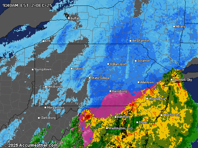
A winter weather advisory remains in effect until 1 p.m. Tuesday for central Pennsylvania as the first widespread snowfall of the season continues through the morning hours. Snow will taper off by late morning in western areas and by early afternoon in eastern parts of the region.
The heaviest snowfall is expected along an axis from Altoona to Selinsgrove to Wilkes-Barre, with the Poconos having the highest potential for accumulations exceeding 6 inches. Most areas will see snowfall rates approaching 1 inch per hour during the peak of the storm between 6 a.m. and 11 a.m. Lancaster County may experience a brief transition to rain after initial snowfall.
Travel conditions will deteriorate Tuesday morning with widespread IFR (Instrument Flight Rules) flying conditions and reduced visibility. Northwest winds will increase to 10-15 mph Tuesday afternoon as the storm system moves eastward, potentially causing blowing snow in some areas.
Following the storm, Wednesday will bring a brief respite with temperatures reaching the 20s to low 30s degrees before an Arctic cold front crosses the region early Thursday. This front will deliver snow showers and possibly squalls along with much colder air.
Friday will be particularly frigid with morning lows in the single digits to teens and afternoon highs only reaching the 20s to low 30s degrees. The cold pattern will persist through the weekend with highs in the 30s and lows in the teens and 20s.
Long-range forecasts suggest this colder-than-normal pattern will continue into next week, with another potential storm system developing this weekend or early next week. The threat of additional winter weather for late week appears to have decreased but has not disappeared entirely.
Current weather radar