
We have added two more Impact Days – Thursday for more light snow and Friday for the potential of a record cold start.Impact Day #1: More light snow Thursday morningThe first of our two upcoming Impact Days is Thursday for a clipper system. This quick passing cold front will drop into the area tomorrow morning bringing light snow showers. This timing is the “impactful” part of the system. The leading edge of snow will arrive before sunrise and clears through mid-morning. Once again, it will be snowing during the morning drive.Unlike Tuesday’s storm, fresh snow accumulations should be less than one inch around western Pennsylvania. Clouds will break and it will turn breezy during the afternoon.Impact Day #2: Record lows possible Friday morningA secondary front will reinforce the cold air. It will be a bitterly cold start to Friday with temperatures in the teens to single digits. Fortunately, the wind will be light so there will not be an added chill factor. Pittsburgh could tie or break our daily record low of 12° set in 1976 on Friday. Temperatures will only return to near freezing Friday afternoon.Not as cold for the weekendTemperatures will warm a bit over the weekend with highs cracking the freezing mark. We will see another flurry chance on Sunday. Light snow will be possible on Tuesday as well. The winter cold will hang on through at least the middle of next week.TODAY: Brisk with sun and clouds. High: 33°.TONIGHT: Increasing clouds with light snow arriving after midnight. Low: 25°.THURSDAY – Impact Day: AM light snow then breezy with sunny breaks. High: 31°, low: 11°.FRIDAY – Impact Day: Frigid start, cold afternoon. More sun than clouds. High: 32°, low: 22°.SATURDAY: Mostly cloudy and brisk. High: 35°, low: 26°.
PITTSBURGH —
We have added two more Impact Days – Thursday for more light snow and Friday for the potential of a record cold start.
Impact Day #1: More light snow Thursday morning
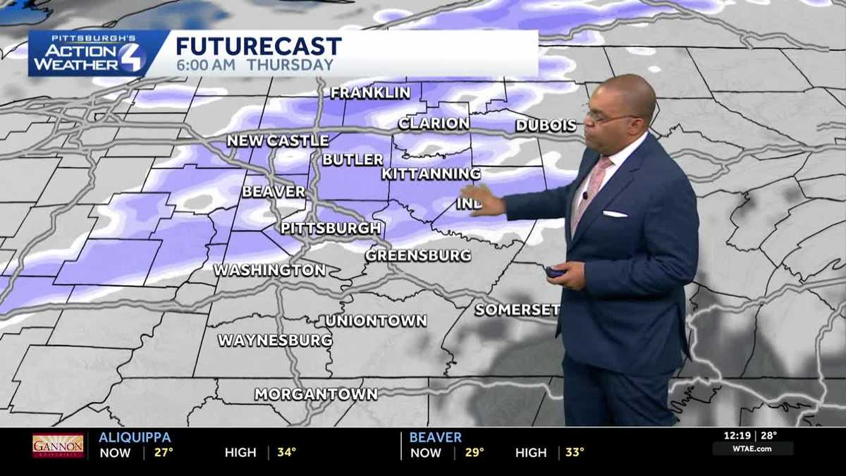
The first of our two upcoming Impact Days is Thursday for a clipper system. This quick passing cold front will drop into the area tomorrow morning bringing light snow showers. This timing is the “impactful” part of the system. The leading edge of snow will arrive before sunrise and clears through mid-morning. Once again, it will be snowing during the morning drive.

Hearst OwnedHearst
Light snow will impact the Thursday morning commute. Amounts will be lower than Tuesday’s storm.
Unlike Tuesday’s storm, fresh snow accumulations should be less than one inch around western Pennsylvania. Clouds will break and it will turn breezy during the afternoon.
Impact Day #2: Record lows possible Friday morning
A secondary front will reinforce the cold air. It will be a bitterly cold start to Friday with temperatures in the teens to single digits. Fortunately, the wind will be light so there will not be an added chill factor. Pittsburgh could tie or break our daily record low of 12° set in 1976 on Friday. Temperatures will only return to near freezing Friday afternoon.

Hearst OwnedHearst
Friday’s Impact Day is for a bitterly cold start, which could tie or break a record in Pittsburgh.
Not as cold for the weekend
Temperatures will warm a bit over the weekend with highs cracking the freezing mark. We will see another flurry chance on Sunday. Light snow will be possible on Tuesday as well. The winter cold will hang on through at least the middle of next week.

Hearst Owned
The best snow chance this next week right now is Thursday, and that only adds up to another inch.
TODAY: Brisk with sun and clouds. High: 33°.
TONIGHT: Increasing clouds with light snow arriving after midnight. Low: 25°.
THURSDAY – Impact Day: AM light snow then breezy with sunny breaks. High: 31°, low: 11°.
FRIDAY – Impact Day: Frigid start, cold afternoon. More sun than clouds. High: 32°, low: 22°.
SATURDAY: Mostly cloudy and brisk. High: 35°, low: 26°.