
Mainly clear this evening & an Arctic front Thursday leads to a frigid Friday across south-central Pennsylvania
Unseasonably cold conditions will persist well into next week. We’re also tracking an Arctic boundary that will come through Thursday, allowing frigid air to settle in Friday. Low temperature records may be challenged come Friday night.
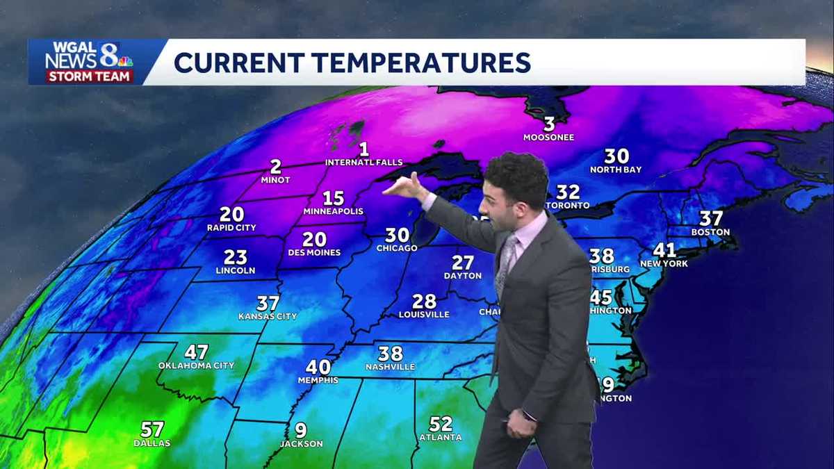
WE’RE TRACKING AN ARCTIC FRONT THAT’S GOING TO COME THROUGH AS WE GET INTO OUR THURSDAY. THEN FOR FRIDAY, THAT COLD ARCTIC AIR BEHIND THAT BOUNDARY IS GOING TO IS GOING TO SETTLE IN RIGHT OVER THE SUSQUEHANNA VALLEY. THAT WILL ALLOW TEMPERATURES TO REACH RECORD CHALLENGING LOWS, COULD SEE SOME SPOTTY SNOW SHOWERS LATE IN THE DAY FOR YOUR FRIDAY. THEN LOOKING AT THE WEEKEND AHEAD, LOOKING AT COLD AND DRY CONDITIONS. SO THE REST OF THIS EVENING, MAINLY CLEAR CONDITIONS, 28 TO 32 DEGREES. LIGHT WINDS OUT OF THE WEST SOUTHWEST AND THAT WILL PERSIST INTO TONIGHT. BUT WE’LL START TO SEE SOME INCREASING CLOUDS LATE. BUT JUST KEEP A NOTE. WE DO. YOU KNOW WE STILL HAVE SOME SNOW LAYING OUT THERE. IF ANY OF THAT MELTS ONTO THE ROADWAYS, THAT COULD ALLOW FOR SOME PATCHY BLACK ICE TO FORM. SO JUST KEEP ON THE WATCH FOR THAT. MAKE SURE YOU JUST STILL DRIVE CAREFULLY AS YOU GO AS YOU TRAVEL FOR TONIGHT. LIGHT TO CALM WINDS WILL PERSIST 24 TO 28 DEGREES. THEN FOR TOMORROW, START WITH SOME MORNING CLOUDS GETTING INTO THE AFTERNOON AND THE EVENING. LOOKING AT SOME MORE SUNSHINE. GOING TO BE BLUSTERY AND COLD THOUGH. COULD SEE A FEW FLURRIES. WE HAVE A WE HAVE A MOISTURE STARVED COLD FRONT THAT’S GOING TO START TO MOVE THROUGH, AND THAT’S THE SAME ARCTIC BOUNDARY THAT’S GOING TO START MOVING THROUGH. THAT’S WHAT’S GOING TO BE THAT’S WHAT COULD TRIGGER A FEW FLURRIES 36 TO 40 DEGREES AS WE GET INTO TOMORROW. ALSO REAL QUICK UPDATE. WE JUST GOT AN UPDATE FROM THE SPACE WEATHER PREDICTION CENTER THAT THERE IS A THERE IS A CHANCE THAT THERE COULD BE A VIEW OF AN AURORA FROM 515 THIS EVENING UP UNTIL 7:00 THIS EVENING. THE BEST VIEWING IS GOING TO BE AWAY FROM CITY LIGHTS, AND YOU’RE GOING TO WANT TO USE A LONG EXPOSURE CAMERA. SO IF YOU IF YOU USE YOUR PHONE, YOU HAVE THE NIGHT MODE, ESPECIALLY ON ON IPHONES. AND I’M PRETTY SURE ANDROID’S ALSO HAVE IT, BUT THERE’S A NIGHT MODE ON THERE THAT YOU CAN USE THAT YOU CAN USE THAT TO, TO VIEW THE AURORA AND THE FORECAST FOR TONIGHT. LOOKING CLEAR, MOSTLY CLEAR ACROSS THE BOARD AS WE GET INTO THE REST OF THIS EVENING. CURRENT TEMPERATURES. THIS IS THE TALKERS WE GET INTO THE NEXT COUPLE OF DAYS HERE. TEMPERATURES ARE INTO THE 30S, STILL BELOW AVERAGE FOR THIS TIME OF THE YEAR. BY THE WAY, ZOOMING OUT, I WANT TO SHOW YOU WHERE THIS ARCTIC AIR MASS IS AT. SEE ALL THIS PINK UP HERE? YOU SEE THAT? YOU SEE THAT STEEP GRADIENT GETTING INTO THE PINK COLORING. THAT IS WHERE THIS ARCTIC AIR, THAT’S WHERE THIS ARCTIC AIR MASS IS GOING TO BE AT. AND THAT’S WHAT’S GOING TO PUSH INTO THE SUSQUEHANNA VALLEY AS WE GET INTO OUR AS WE GET INTO THURSDAY AND FRIDAY, LOOK AT LOOK AS WE GET INTO THURSDAY NIGHT, THURSDAY NIGHT’S LOWS GETTING DOWN TO 12 DEGREES. AND BY THE WAY, 12 DEGREES IN TERMS OF OVERNIGHT LOWS ON DECEMBER 5TH. THAT WAS BACK IN 1926. THAT WAS ALMOST THAT WAS ALMOST 100 YEARS AGO FOLKS. AND LOOK AT THIS. THIS IS WHAT WE’RE FORECASTING AS WE GET INTO FRIDAY MORNING. SO RECORD CHALLENGING TO ALMOST RECORD MATCHING TEMPERATURES AS WE GET INTO THURSDAY NIGHT INTO FRIDAY MORNING. AND WINDS BY THE WAY, THEY WILL BEGIN TO INCREASE AS WE GET OUT OF THE NORTHWEST. AND THAT’S WHAT’S GOING TO CONTRIBUTE TO THE WIND CHILLS OR WHAT’S GOING TO FEEL LIKE MORE LIKE DOWN INTO THE LOWER 20S, INTO THE UPPER TEENS. AS WE GET INTO LATE THURSDAY, YOU CAN SEE BY 4 OR 6, 8:00 IN THE EVENING, 8:00 ESPECIALLY 27, 28 DEGREES, FEELING LIKE THE TEENS AS WE GET INTO THE EVENING. SO STORM TEAM, LIVE RADAR NETWORK. ALL IS QUIET RIGHT NOW THANKS TO HIGH PRESSURE THAT’S BUILT IN OVER THE AREA. HERE COMES THAT WEAK COLD FRONT THAT COULD SPARK SOME SNOW SHOWERS TOWARDS NORTHWESTERN PA. BUT THEN, AS IT MAKES ITS WAY TO THE SOUTHEAST, IT’S VERY MOISTURE STARVED. BY THE TIME IT GETS TO THE SUSQUEHANNA VALLEY, ONLY A FEW FLURRIES. WHAT I EXPECT WITH THAT AND THEN DRY AIR BEHIND IT BECAUSE OF THIS HIGH PRESSURE THAT’S GOING TO START TO SHIFT THROUGH, THAT’S GOING TO START. THAT WILL ALLOW FOR THINGS TO REALLY DRY. BUT THEN HERE’S THAT CHANCE OF SOME FRIDAY, A FRIDAY AFTERNOON, FRIDAY EVENING SNOW CHANCES. YOU CAN SEE THAT’S REFLECTED IN OUR TEN DAY FORECAST SATURDAY AND SUNDAY INTO THE UPPER 30S. WE ARE WATCHING AND TRACKING AN ACTIVE PATTERN AS WE GET INTO TUESDAY THROUGH FRIDAY OF NEXT WEEK. WE’RE GOI
Mainly clear this evening & an Arctic front Thursday leads to a frigid Friday across south-central Pennsylvania
Unseasonably cold conditions will persist well into next week. We’re also tracking an Arctic boundary that will come through Thursday, allowing frigid air to settle in Friday. Low temperature records may be challenged come Friday night.

Updated: 4:53 PM EST Dec 3, 2025
Heading into the evening, clouds will continue to clear out more, leading to mainly clear conditions with light winds out of the northwest, thanks to high pressure building eastward. Temps will reach the lower 30s.Tonight, cloud cover will increase late with light to calm winds persisting. Lows will drop to the mid 20s. Be on the lookout for any patchy black ice that develops from melted snow. Slick conditions may develop once again where snow has melted.Heading into Thursday, an Arctic front is expected to pass through the Valley, leading to a few flurries and much colder weather to end the week. Low temps will approach record-challenging levels, in the upper teens for Thursday night, coming close to the record of 12 degrees set in 1926. Then Friday’s highs might not get out of the 20s in some areas!We’re watching a system that will slide to our south Friday evening through Friday night. It may produce flurries or light snow showers. We’ll keep you updated!Highs will be about 10 degrees below average this weekend, in the upper 30s. Look for partly to mostly cloudy skies.Next week, unseasonably cold weather continues, as highs hover in the 30s. A series of clippers may bring snow showers Tuesday into Wednesday, and a chance of rain/snow showers on Thursday.Have a great rest of your Wednesday evening!~ Ryan
Heading into the evening, clouds will continue to clear out more, leading to mainly clear conditions with light winds out of the northwest, thanks to high pressure building eastward. Temps will reach the lower 30s.
Tonight, cloud cover will increase late with light to calm winds persisting. Lows will drop to the mid 20s. Be on the lookout for any patchy black ice that develops from melted snow. Slick conditions may develop once again where snow has melted.
Heading into Thursday, an Arctic front is expected to pass through the Valley, leading to a few flurries and much colder weather to end the week. Low temps will approach record-challenging levels, in the upper teens for Thursday night, coming close to the record of 12 degrees set in 1926. Then Friday’s highs might not get out of the 20s in some areas!
We’re watching a system that will slide to our south Friday evening through Friday night. It may produce flurries or light snow showers. We’ll keep you updated!
Highs will be about 10 degrees below average this weekend, in the upper 30s. Look for partly to mostly cloudy skies.
Next week, unseasonably cold weather continues, as highs hover in the 30s. A series of clippers may bring snow showers Tuesday into Wednesday, and a chance of rain/snow showers on Thursday.
Have a great rest of your Wednesday evening!
~ Ryan