
The Philadelphia area can expect cold temperatures to close out the week and another chance for snow on Friday.
Planning your Thursday
Thursday will start off chilly with temperatures in the mid-upper 20s. Highs will be in the low 40s, but through the second half of the day, the winds will increase as Arctic air begins to rush into the region. This will make it feel like below freezing through most of the afternoon despite increasing sunshine.

CBS News Philadelphia
What’s NEXT
Colder air will continue to rush into the Philadelphia region Thursday night and drive temperatures even lower, with many spots dropping into the teens by Thursday night.

CBS News Philadelphia
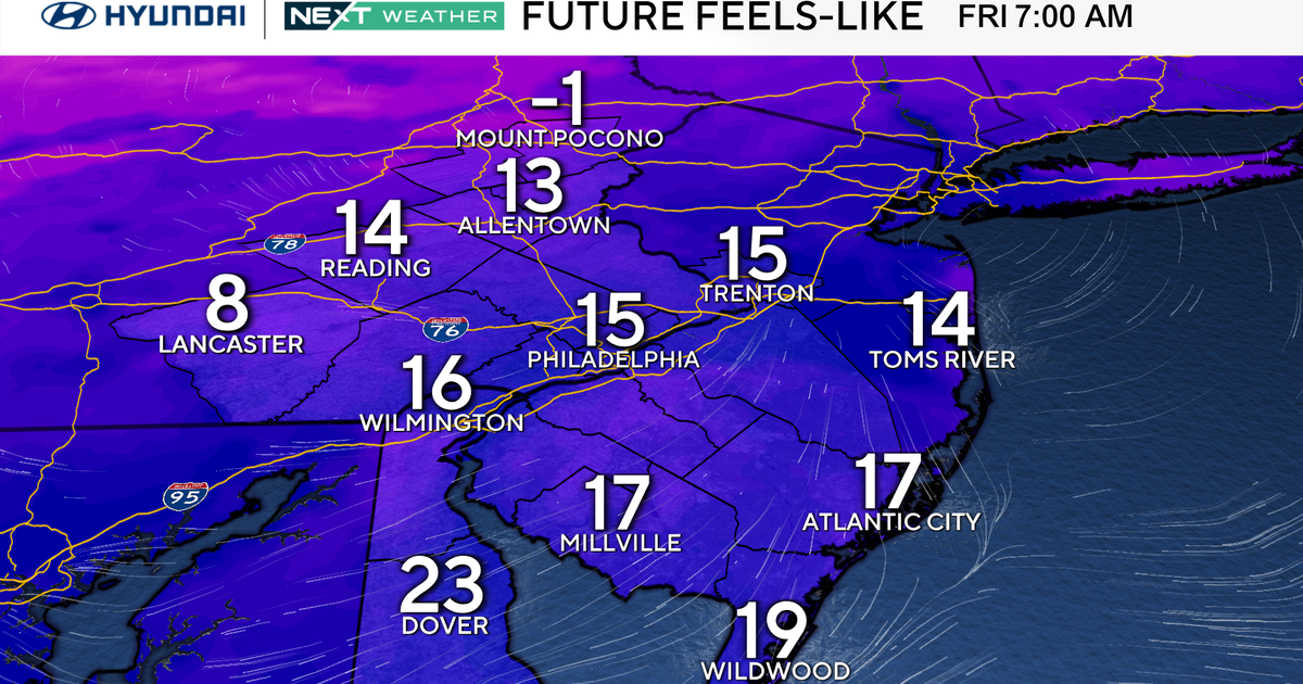
By Friday, that cold air is firmly in place. Highs on Friday around the area may not exceed the freezing mark, and, as a bonus, we’ll have to watch as a new area of low pressure passes to our south. The exact track is still uncertain, but the setup allows for the possibility of snow, especially across South Jersey and the city. Philadelphia could potentially see some snow or snow showers, though any accumulation at this point looks rather light, if any.
The track will need to be watched closely, as a shift slightly further south could mean little or no snow, while a shift north could mean light accumulations across much of the region. If snow does develop, it will likely begin around midday Friday and last until around 6-8 p.m.
A NEXT Weather Alert is in effect on Friday for temperatures barely above freezing and possible snow showers.
Here’s your 7-day forecast:

CBS News Philadelphia
Thursday: Blustery. High 41, Low 29.
Friday: NEXT Weather Alert for cold and snow. High 32, Low 19.
Saturday: Sun, cold. High 40, Low 17.
Sunday: Sun and clouds. High 42, Low 29.
Monday: Very cold. High 33. Low 27.
Tuesday: Very cold. High 35, Low 18.
Wednesday: Partly sunny. High 43, Low 28.
More from CBS News