
A few snow showers will arrive this afternoon and evening, mainly north, with little to no accumulation expected. Some spots could get half an inch.
WEATHER LINKS:
Current Conditions | School Closings & Delays | Submit Your Weather Photos
Highs today finally get above the freezing mark to the upper 30s, so it may even mix at times further south.

Temperatures in Pittsburgh over the next 24 hours
KDKA Weather Center
It’ll be a cold Monday with lows in the low 20s and teens, and with winds 10-15mph, it’ll feel in the single digits. There will be some sunshine, but our highs only make it to the upper 20s. Another cold morning is on tap for Tuesday with lows in the teens and single-digit wind chills once again. Some areas north may even feel below zero.
Our next chance for a few flakes will be on Tuesday. Most of the snow is tracking north of I-80, where some spots could see 1-2″. Places like New Castle and Butler could get .5″-1″ throughout the day.

Rain and snow chances throughout the next six days
KDKA Weather Center
Wednesday will be the warmest day of the week with highs back in the 40s, which is closer to average, and a wintry mix is possible north, while most areas will see rain.
On Thursday, a few snow showers are possible, but timing and how much are still uncertain. It could just end up being some flurries with highs in the upper 30s. After that, our temperatures plummet.
By the end of the week and weekend, our temperatures are still trending WELL below normal with highs in the low 20s and lows in the teens. Snow showers are possible on Saturday as well.
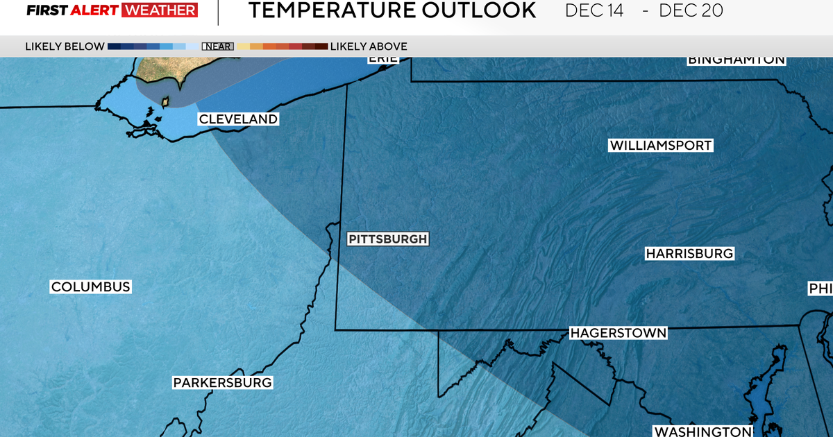
Throughout mid-December, we are seeing the cold stick around, and we are already over 9° below normal for the month so far!

7-day forecast: December 7, 2025
KDKA Weather Center
Stay up to date with the KDKA Mobile App – which you can download here!