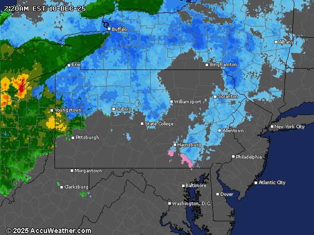
A winter storm is bringing wet snow to northern Pennsylvania today, with snow changing to mixed precipitation or rain across central and southern parts of the state by afternoon.
Winter weather advisories remain in effect for multiple counties north and west of the Harrisburg area.
A hazardous weather outlook for an area that includes Dauphin, Perry, Cumberland and Schuylkill counties calls for a brief period of freezing rain or sleet, possibly mixed with wet snow, before changing to rain. Locally hazardous travel conditions are possible, especially on bridges and overpasses, the weather service says.
Snow began moving into the state early this morning, with the heaviest accumulations expected across the northern mountains, where 2-6 inches of wet snow is forecast. Areas along the I-80 corridor will see a transition to a wintry mix or rain by afternoon as temperatures climb into the mid to upper 30s. The northern tier counties could remain cold enough for all snow throughout the day.
Effects on travel will be most significant through mid-morning, especially north of Interstate 80, where snow rates could reach one inch per hour in some locations.
Road conditions should improve by afternoon in central and southern areas as temperatures rise above freezing, though wet surfaces may refreeze overnight as temperatures drop.
Strong winds will develop tonight into Thursday, with gusts reaching 35-45 mph, particularly across the Laurel Highlands. An additional 2-5 inches of snow is possible in northwestern mountain areas through Thursday night.
The pattern of abnormally cold temperatures will continue through the weekend with additional rounds of light snow possible Friday through Sunday
Current weather radar