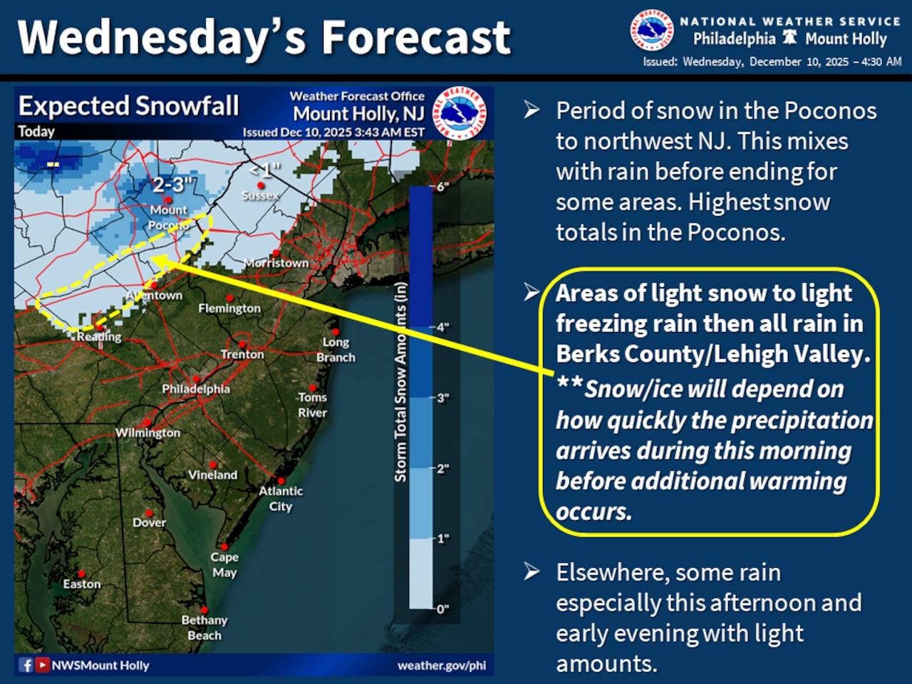
Winter Weather Advisories have been issued for the Lehigh Valley and Pocono Mountains through 6 p.m. Wednesday, with snow and potential freezing rain threatening hazardous travel conditions across the region.
The National Weather Service forecasts precipitation developing later Wednesday morning, starting as snow in the Poconos and rain mixing in with potential snow in the Lehigh Valley.
Carbon and Monroe counties can expect 1 to 3 inches of snow, potentially reaching 4 inches at elevations above 1,000 feet.
Berks, Lehigh and Northampton counties are forecast to receive up to an inch of snow and may experience a brief period of freezing rain, increasing the risk of light icing and slick road surfaces.
Temperatures will range from the upper 30s to low 40s across the region, with westerly winds increasing to 10 to 15 mph and potential gusts up to 25 mph late Wednesday night. Residents should anticipate changing road conditions, allow extra time for travel, reduce speed and maintain increased following distances.
The cold weather pattern continues through the weekend, with another cold front expected Friday night and potentially bringing additional precipitation. Temperatures will remain below average, with wind chills potentially dropping into the teens by Friday morning and single digits in the higher elevations.
An arctic high-pressure system will build into the region early next week, bringing very cold temperatures, particularly on Monday. Residents should prepare for extended periods of below-average temperatures and potential additional snow or mixed precipitation events.
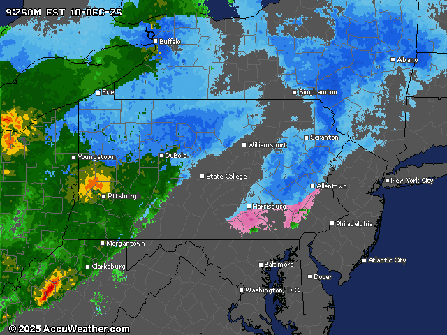
Current weather radar