
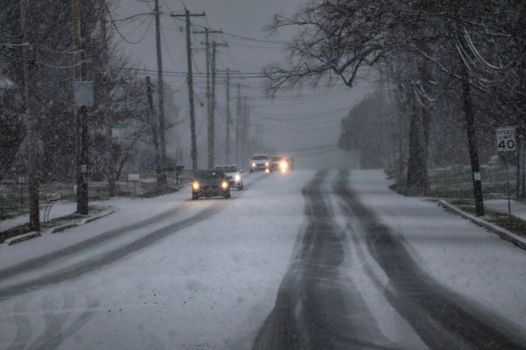
Get the shovels and snowblowers ready: The Lehigh Valley is set to get several inches of snow from the latest winter storm to impact the region.
The National Weather Service has issued a winter weather advisory for Lehigh, Northampton and Berks counties for 2 to 4 inches of snow from 7 p.m. Saturday until 7 a.m. Sunday. Expected snowfall amounts are up slightly from earlier forecasts, prompting the advisory, according to the weather service.
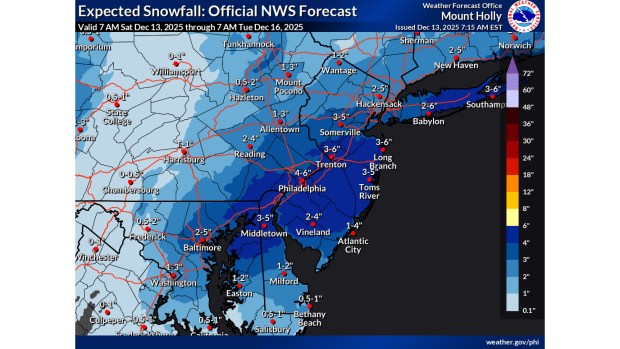 Snowfall projections from the National Weather Service’s Mount Holly, N.J., forecast office. (NWS)
Snow should begin across the region by 8 p.m., according to the weather service’s storm briefing issued Saturday morning. However, the heaviest snowfall is expected after midnight.
The weather service said it has moderate confidence in its snow forecast totals, with around an 80% chance of at least 1 inch of snow or more falling across the Lehigh Valley. Snowfall amounts are expected to increase as you head south and east of the Lehigh Valley, with Philadelphia in the 3-5 inch range.
Snow will lead to slippery road conditions during the storm, and motorists should use caution, according to the advisory.
The brunt of the snow should wrap up by daybreak Sunday, however, snow showers could linger through the morning.
After the snow moves out, bitter cold is expected to move in, with wind chills Sunday night dropping into the low single digits in the Lehigh Valley and below zero in the Poconos. During the day, winds could gust up to 30 miles per hour, according to the weather service.
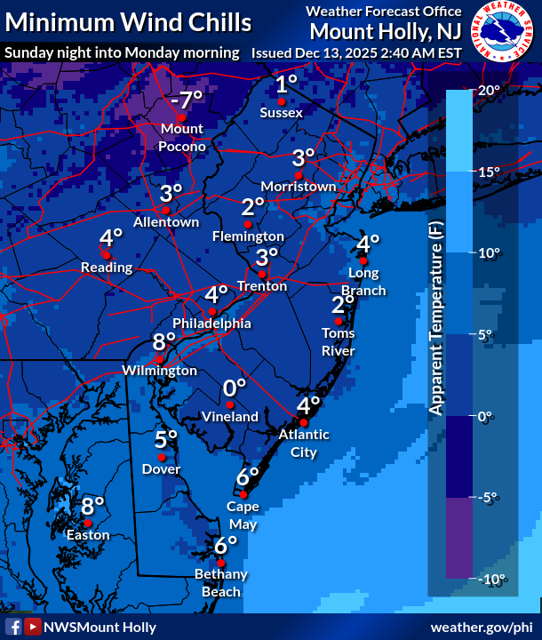 Wind chills are expected to drop into the low single digits in the Lehigh Valley and below zero in the Poconos Sunday night into Monday morning, Dec. 14-15, 2025. (NWS)
While the week will start out cold, a warmup is expected, with a high temperature near 50 expected by Thursday. No additional snow is in the immediate forecast.
Here is the extended forecast from the National Weather Service.
Sunday: Snow likely before 7am, then a chance of snow showers between 7am and noon. Mostly cloudy, with a high near 28. Northwest wind 10 to 15 mph, with gusts as high as 30 mph. Chance of precipitation is 60%. New snow accumulation of less than a half inch possible.
Sunday Night: Partly cloudy, with a low around 15. Northwest wind 10 to 15 mph.
Monday: Partly sunny, with a high near 30. Northwest wind around 10 mph, with gusts as high as 20 mph.
Monday Night: Mostly cloudy, with a low around 18.
Tuesday: Mostly sunny, with a high near 32.
Tuesday Night: Mostly cloudy, with a low around 22.
Wednesday: Partly sunny, with a high near 43.
Wednesday Night: Mostly cloudy, with a low around 28.
Thursday: A chance of rain. Mostly cloudy, with a high near 49. Chance of precipitation is 30%.
Thursday Night: Rain likely. Mostly cloudy, with a low around 34. Chance of precipitation is 60%.