
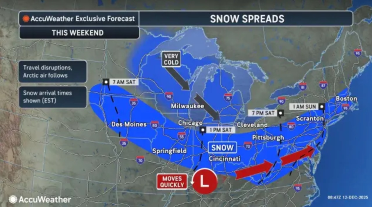
A winter storm is set to deliver snow and dangerously cold temperatures to the Lehigh Valley and Poconos this weekend, with snowfall expected Saturday night and arctic air plunging temperatures into the teens.
The National Weather Service forecasts 1-3 inches of snow across the region, with some areas potentially seeing up to 4 inches, primarily along the Interstate 95 corridor.
Snow is most likely to fall between late Saturday evening and early Sunday morning, accompanied by gusty winds that will create blowing snow conditions and potentially treacherous travel.
Sunday will be brutally cold, with temperatures struggling to rise and potentially falling during the afternoon.
Wind chills are expected to drop into single digits, with some areas near the Poconos experiencing below-zero temperatures.
The extreme cold will persist into Monday, with high temperatures remaining below freezing across nearly the entire area. Winds will remain strong, further enhancing the bitter cold feeling.
Residents are advised to take precautions against the cold, including dressing in layers, protecting exposed skin, and limiting time outdoors.
A significant warmup is expected by Thursday, with temperatures potentially reaching the 50s as a surge of milder air moves into the region.
This dramatic temperature swing could bring a rapid transition from winter-like conditions to spring-like temperatures in just a few days.