
Mostly cloudy skies are in store this afternoon, with a few peeks of sun. Southerly winds will warm temperatures to the mid-40s, then a dry cold front will pass late this afternoon. A light breeze will develop by evening.Tonight, lows will fall to the low 20s under partly cloudy skies.A warm front will lift north Thursday, leading to the mildest day of the week. Highs will reach the upper 40s late in the evening, with rain developing ahead of a cold front. The rain could be moderate to heavy at times Thursday night and it will also be windy. Rain totals will range between 0.50″ and 1″ through Friday morning.By sunrise Friday, rain will taper, and temperatures will hover in the low 40s. By afternoon, temperatures will fall to the mid-30s. It will be windy, with gusts to 35-40 mph from the northwest. A rain/snow shower is possible later in the day.Saturday will be brisk to start, then building high pressure will ease the wind. Highs will be seasonable near 40 degrees.Milder highs in the mid-40s return Sunday and winds increase late, as a dry cold front passes.Monday will feature cooler highs in the upper 30s, then temperatures will remain close to average Tuesday and Christmas Eve.A fast-moving system will bring mainly rain showers on Christmas Day. Highs will stay in the low 40s, with lows around freezing. We’ll keep you posted on any changes!Have a great day!~ Ryan
Mostly cloudy skies are in store this afternoon, with a few peeks of sun. Southerly winds will warm temperatures to the mid-40s, then a dry cold front will pass late this afternoon. A light breeze will develop by evening.
Tonight, lows will fall to the low 20s under partly cloudy skies.
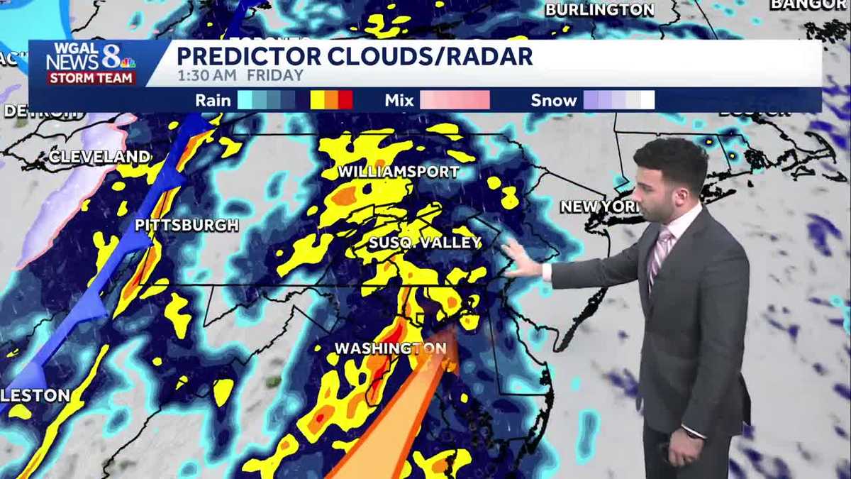
A warm front will lift north Thursday, leading to the mildest day of the week. Highs will reach the upper 40s late in the evening, with rain developing ahead of a cold front. The rain could be moderate to heavy at times Thursday night and it will also be windy. Rain totals will range between 0.50″ and 1″ through Friday morning.
By sunrise Friday, rain will taper, and temperatures will hover in the low 40s. By afternoon, temperatures will fall to the mid-30s. It will be windy, with gusts to 35-40 mph from the northwest. A rain/snow shower is possible later in the day.
Saturday will be brisk to start, then building high pressure will ease the wind. Highs will be seasonable near 40 degrees.
Milder highs in the mid-40s return Sunday and winds increase late, as a dry cold front passes.
Monday will feature cooler highs in the upper 30s, then temperatures will remain close to average Tuesday and Christmas Eve.
A fast-moving system will bring mainly rain showers on Christmas Day. Highs will stay in the low 40s, with lows around freezing. We’ll keep you posted on any changes!
Have a great day!
~ Ryan