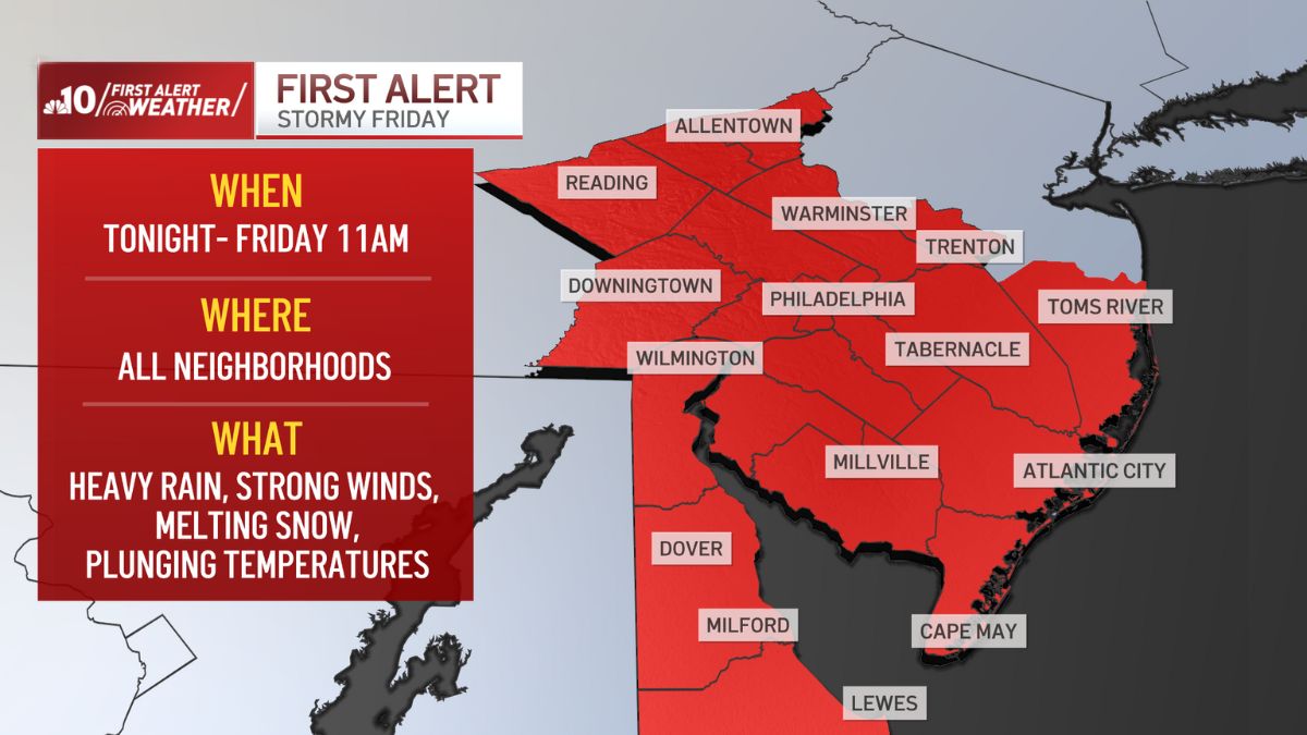
The NBC10 First Alert Weather Team is issuing a First Alert at 11 p.m. Thursday that will remain in effect until Friday morning at 11 a.m.

A powerful storm will impact our region tomorrow with gusty winds, heavy rain and tumbling temperatures.
Rain is starting to move into Berks and Lehigh counties and will turn widespread and heavy overnight.
Wind speeds will start to pick up by 1 a.m. Friday and gusts up to 50 m.p.h. are expected until 1 a.m. Saturday.
Expect rounds of rain and storms with drenching downpours at times for Friday morning.
Some ponding on roadways is possible along with reduced visibility during the heaviest rain Friday morning. Fortunately, the flood threat with this system is low.
Then only a stray rain shower or snow flurry will remain for the afternoon.
Temperatures will fall from the upper 50s or low 60s Friday morning to wind chills in the teens and 20s for Friday evening under a partly cloudy sky.
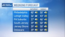
The weekend looks much quieter.
Saturday will be chilly with partly sunny skies and highs near 40.
Sunday turns milder with sunshine and a light breeze pushing temperatures back toward 50 during the afternoon.