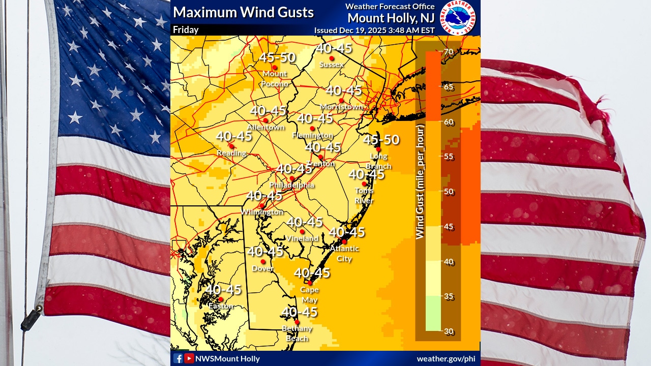
A powerful cold front is bringing potentially damaging winds and heavy rainfall to the Lehigh Valley on Friday morning, with gusts potentially reaching 40 to 45 mph and rainfall totals up to 2 inches in some areas.
The National Weather Service issued a Wind Advisory for an area that includes Lehigh, Northampton and Warren counties until 1 a.m. Saturday.
Winds will initially blow from the south at 20 to 30 mph, with gusts up to 45 mph, before shifting to the west and northwest later in the day. The most intense wind conditions are expected between 8 and 11 a.m., when a low-topped convective line could produce wind gusts over 50 mph.
The wet, windy weather was causing thousands of power outages Friday morning across Lehigh and Northampton counties in eastern Pennsylvania and into northwestern New Jersey’s Warren County.
Rainfall will be heaviest during the morning commute, with total precipitation around an inch for most areas and up to 2 inches possible in the Poconos. While flooding concerns are minimal, urban and poor drainage areas may experience some water accumulation.
For the Lehigh Valley, the weather service forecasts rain and possibly a thunderstorm before 1 p.m. Friday, followed by a slight chance of rain until about 4 p.m.
Temperatures that reached near 60 degrees shortly before dawn are forecast to quickly drop to the upper 30s and low 40s after the front passes.
The weekend forecast calls for improving conditions, with high pressure moving in Saturday and temperatures remaining below normal. Saturday’s highs will range from the upper 30s in the northwest to low 40s elsewhere. Sunday will see slightly warmer temperatures, with highs from the low 40s to near 50 degrees.
Looking ahead, the forecast for early next week suggests continued dry conditions Monday, followed by increasing cloud cover and potential snow overnight into Tuesday and possibly through the morning with a 40% chance of precipitation.
Current weather radar