
After a quiet weather day for Christmas, get ready for a messy wintry mix to develop later Friday into Friday night. Because much of our area will see a light mix of snow, sleet, and a little freezing rain, accumulations will be limited to only a few inches of snow and sleet along with a glaze of ice for many.
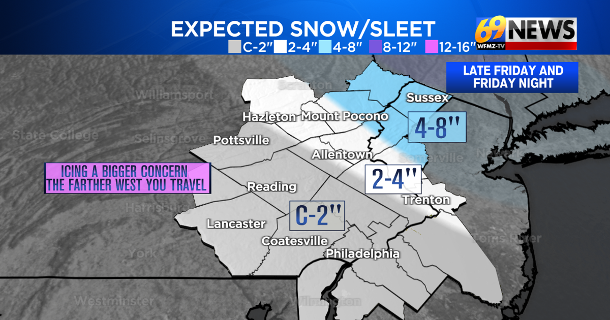
However, areas in far northeastern Pennsylvania as well as North Jersey, including Monroe, Pike, Wayne, Sussex, and Warren counties, a steadier shot of snow with more limited mixing is still expected. These areas are under winter storm warnings, and still primed for a possible 4 to 8″ of snow and a little sleet.
For the Lehigh Valley, a brief period of snow later Friday afternoon will mix and change to sleet and a little freezing rain or drizzle. Because of the lighter and more varied precipitation, lighter accumulations are expected, with anywhere from around 1″ on the lower end to 2-4″ on the higher end expected. Amounts will be higher the farther north and east you travel, so the Slate Belt will likely see the highest totals, while western Lehigh County sees the lower totals.
Farther south and west from the Lehigh Valley, even less snow is expected, with primarily sleet and freezing rain expected. Only a coating to 1″ of snow and sleet is forecast, with perhaps a little more in the way of freezing rain and icing causing the bigger issue. Up to a tenth of an inch of ice accumulation is possible.
The main timing for this event is for it to develop later Friday afternoon, peak Friday evening, and then continue overnight but slowly taper off towards Saturday morning.
Expect slick travel to be possible from mid to late afternoon on Friday and then all of Friday night. The farther north and east you travel, the slick travel will be due to steadier snow and higher snow accumulations. The farther south and east you travel, there will be notably less snow, but light sleet and freezing rain accumulations can cause slick surfaces and slippery travel.
Saturday should be drier, albeit still cloudy and cold, with just some early morning flurries or freezing drizzle lingering in a few spots.
TRACK THE WEATHER:
LINKS: HOUR BY HOUR | RADAR | TRAFFIC