
A significant winter storm is expected to impact the Lehigh Valley Friday evening through Saturday morning, with widespread travel disruptions and a mix of snow, sleet, and potential icing creating dangerous conditions for residents.
The National Weather Service has issued a winter weather advisory for Carbon, Monroe, Northampton and Lehigh counties from 3 p.m. Friday to 10 a.m. Saturday.
A winter storm watch that had previously been issued for the region is no longer in effect.
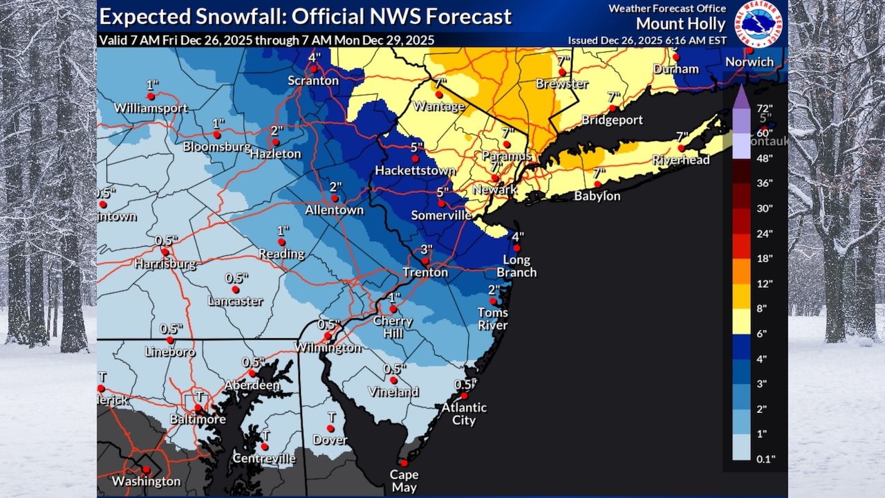
Precipitation is forecast to begin as snow in the afternoon, transitioning to a mix of snow and sleet, with potential accumulations of one to five inches and a possible glaze of ice in the Allentown area.
The storm’s most challenging period will be during the evening rush hour, with snowfall rates potentially reaching one to two inches per hour.
Areas north of Interstate 78 are expected to see mostly snow, while regions closer to and south of the highway will experience a mix of precipitation types.
Temperatures will struggle to rise above the mid-30s on Saturday, and road conditions are likely to remain treacherous throughout the day.
Looking ahead, temperatures will remain cold through the weekend, with Saturday night’s lows dropping into the low 20s.
A brief warmup is expected Sunday, with highs reaching the upper 30s to low 40s, followed by another cold front that will bring gusty winds and significantly colder temperatures early next week.
Residents are advised to monitor local weather updates, prepare for potential travel delays, and exercise extreme caution if driving during the winter storm. Keep emergency supplies in vehicles and stay informed about changing road conditions.