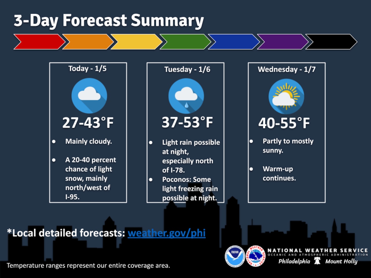
A warming trend will bring temperatures into the 30s and 40s to start this week, with a slight chance of light snow Monday morning and potential rain overnight Tuesday into Wednesday.
Residents should expect increasing cloud cover and gradually milder conditions, according to the National Weather Service forecast.
A warm front moving through the region Monday morning could produce brief, light snow, particularly in the Poconos, with minimal accumulation expected. Temperatures will range from the 20s in the Poconos to upper 30s in the Lehigh Valley and low 40s along coastal areas.
By Tuesday and Wednesday, temperatures will climb into the 40s and potentially low 50s across the region, with increasing cloud cover. The Lehigh Valley could see light rain, with the potential for freezing rain in higher elevations, after 1 a.m. Wednesday. A cold front will move through Wednesday, dropping temperatures back into the upper 20s and low 30s Wednesday night.
The latter part of the week will see continued mild conditions, with scattered showers and southerly winds likely Friday. Temperatures could reach near 60 degrees on Saturday before a strong cold front brings much cooler temperatures and blustery conditions by Sunday.
Residents should be prepared for rapidly changing weather conditions, with temperatures fluctuating significantly and potential precipitation in various forms throughout the week.
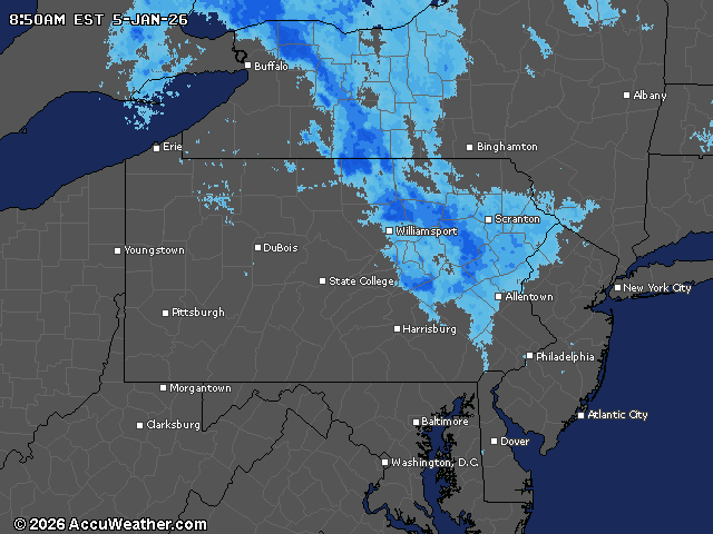
Current weather radar