
Today is a First Alert Weather Day with highs again in the mid-70s. It’ll also be windy with gusts around 30-40 mph, so make sure you secure those loose outdoor Halloween decorations and cover up anything that you don’t want to get wet.
WEATHER LINKS:
Current Conditions | School Closings & Delays | Submit Your Weather Photos
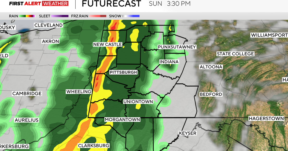
There will be scattered showers and possible thunderstorms starting around 1-2 p.m.

When we could see rain and storms in our region – Sunday, October 19, 2025
KDKA Weather Center
There’s a marginal risk for severe weather across the region (1 out of 5) for isolated strong to severe storms. We have a squall line moving through shortly after that into the evening, which will be the cold front. With the warm, humid air and increasing wind shear, this provides enough instability for a few storms to form, where an isolated, brief/weak tornado can’t be ruled out.

Chances for severe weather in our region – October 19, 2025
KDKA Weather Center
Most locations will just see rain with .50-1″ estimated totals. The rain will be beneficial to our drought situation, but we still need over 1″ to catch up to our deficit for the month.
Monday, we will have a few early showers, and high temperatures will be back to normal in the low 60s with partly cloudy skies. A few showers are possible Tuesday, Wednesday, and Thursday, and then the chill takes over for the rest of the week with highs only in the 50s.

7-day forecast: October 19, 2025
KDKA Weather Center
Stay up to date with the KDKA Mobile App – which you can download here!