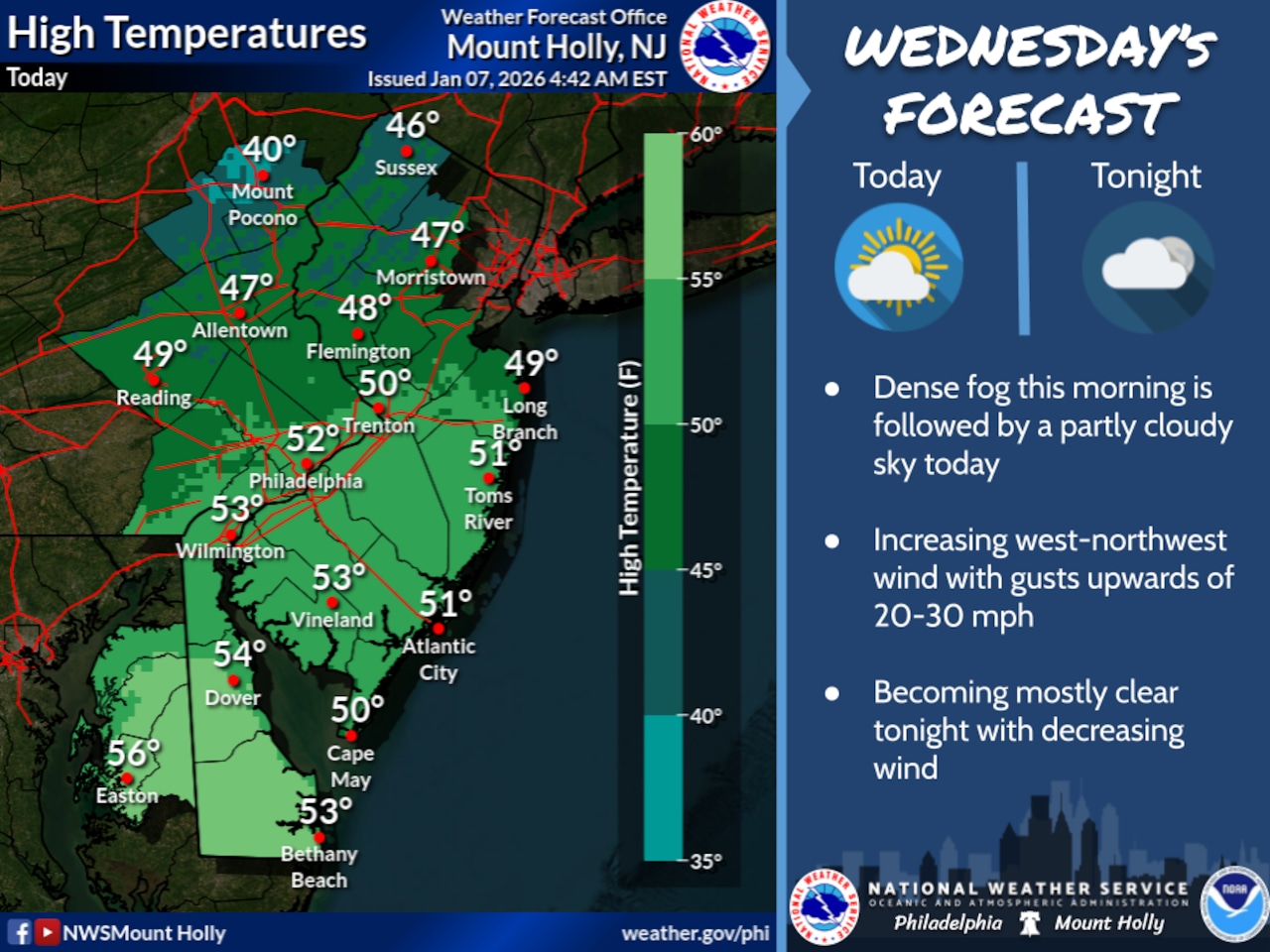
A widespread dense fog advisory is in effect for the Lehigh Valley region until 10 a.m., creating potentially hazardous travel conditions during the morning rush hour. Visibility will be significantly reduced across the region, requiring drivers to exercise extreme caution.
The National Weather Service warns that dense fog will make travel challenging early Wednesday morning, with low visibility persisting through the beginning of the rush hour period. Fog is expected to rapidly dissipate after sunrise, with conditions clearing by mid-morning as warmer air moves into the region.
Highs are forecast in the upper 40s Wednesday and Thursday, with west winds 10 to 15 mph becoming calm. Skies are forecast to start out mostly cloudy Wednesday before clearing for a mostly sunny Thursday.
Looking ahead, temperatures will continue to trend warmer over the next few days, with Friday and Saturday expected to be 10 to 15 degrees above normal for this time of year.
Scattered showers are anticipated Friday, beginning in the afternoon and becoming more widespread on Saturday as a cold front approaches. While severe weather is not likely, wind gusts could potentially reach damaging levels during the shower activity.
The weekend will bring increasing winds, particularly on Sunday and Monday, before conditions return to near-normal temperatures early next week. Residents should prepare for changing conditions and potential light precipitation during the upcoming days.
Current weather radar