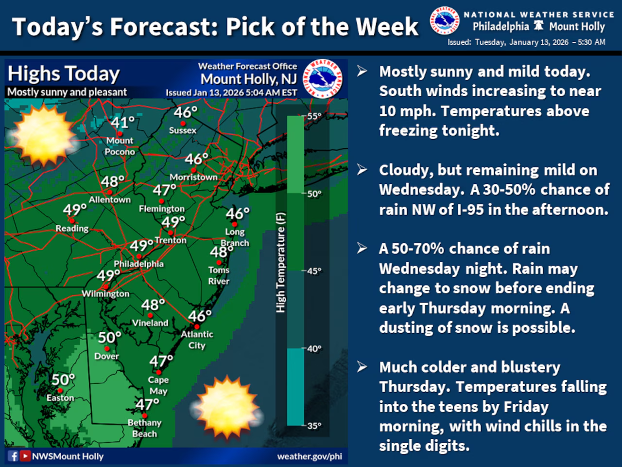
A sharp cold front will sweep through the Lehigh Valley on Wednesday and Thursday, bringing significantly colder temperatures and the possibility of light wintry precipitation.
Residents should prepare for a dramatic temperature drop, with daytime highs falling from close to 50 degrees Tuesday and Wednesday to around 30 Thursday and Friday. Wind chills could potentially drop into the single digits in the region.
Tuesday is shaping up as a pleasant day for January, with temperatures above seasonal averages and mostly sunny skies.
The National Weather Service forecasts light rain possibly mixing with snow Wednesday afternoon through early Thursday morning, with minimal accumulations expected. Winds will increase during this timeframe to around 15 mph with gusts up to 30 mph, creating dangerous wind chill conditions. The southern Poconos may see up to one inch of snow, with a light dusting possible for the Lehigh Valley.
Temperatures will plummet Thursday night, with overnight lows dropping into the teens and potentially reaching below zero in the Poconos. Wind chills will be particularly harsh, remaining in the single digits across the region. Friday will continue the cold trend, with highs struggling to reach the mid-30s and persistent westerly winds maintaining the bitter conditions.
The weekend outlook suggests continued cold temperatures with a slight chance of light wintry precipitation. Forecasters indicate a 20% chance of light snow or flurries Saturday and Sunday, with temperatures remaining below normal. Residents should be prepared with winter weather gear and take precautions against the cold, including protecting pipes and limiting outdoor exposure.
Long-term models suggest the cold pattern will persist into early next week, with temperatures remaining below seasonal averages and the potential for additional light winter precipitation.
Current weather radar