
Light Rain Today, Wind Chills In The Teens Thursday In South Central Pennsylvania
Highs will reach the upper 40s today, then fall to the upper 20s on Thursday, with wind chills in the teens.
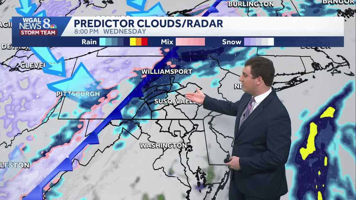
COMPLEX IN HARRISBURG. I’M GABRIELLE THOMAS, WGAL, NEWS EIGHT. NOW, THE WGAL NEWS EIGHT STORM TEAM FORECAST WITH METEOROLOGIST MIKE SUSKO. GOOD AFTERNOON. GOOD DAY TO GO TO THE FARM SHOW BECAUSE WE ARE SEEING RAIN ACROSS PARTS OF THE SUSQUEHANNA VALLEY FROM CARLISLE TO EPHRATA TO GETTYSBURG, AS WELL AS HERSHEY. EVERYONE AT THIS POINT STARTING TO SEE A LITTLE BIT OF THAT RAIN. IF IT HASN’T STARTED FOR YOU YET, IT WILL LATER ON. HERE’S A LOOK AT STORM TEAM LIVE RADAR NETWORK. WE ARE SEEING THAT RAIN NOW. EXPAND TO NORTHWEST HERE. SO PARTS OF PERRY COUNTY WHERE IT HAS BEEN DRY MOST OF THE MORNING. WE’RE STARTING TO SEE SOME OF THAT LIGHT RAIN MOVE IN. BUT LANCASTER, YORK CITY AND POINTS TO THE SOUTHEAST. IT’S GOING TO TAKE A LITTLE LONGER FOR YOU TO GET A LITTLE BIT OF THAT RAIN. BUT WE DO HAVE RAIN IN PARTS OF LEBANON COUNTY, LEBANON. THE SCHAEFFERSTOWN, MYERSTOWN ALL THE WAY TO PALMYRA. THERE IN HERSHEY, HARRISBURG, GETTING A LITTLE BIT OF THAT LIGHT RAIN. SAME THING IN DILLSBURG, SHIPPENSBURG, CHAMBERSBURG FOR FRANKLIN COUNTY AND ALSO IN GETTYSBURG AND ADAMS COUNTY. SEEING SOME OF THAT LIGHT RAIN. LEWISTOWN. WE ARE SEEING SOME SHOWERS AT THE MOMENT. SAME THING. GAP AND PORT ROYAL, A LITTLE BIT OF THAT FILLING IN THOUGH. NOW, LIKE I SAID, IN PARTS OF PERRY COUNTY, AND THIS IS GOING TO CONTINUE AS WE ALL WATCH ALL THIS MOISTURE PASS OVER PENNSYLVANIA OVER THE NEXT 12 HOURS OR SO. SO LET’S TIME THIS OUT FOR YOU. WE CONTINUE TO SEE THE SHOWERS AS WE GO THROUGH THE AFTERNOON AND EVENING. THE COLD FRONT IN BLUE THERE WILL START TO MOVE THROUGH AFTER SUNSET. THAT’S WHEN WE’RE GOING TO SEE MOST OF THAT WIDESPREAD RAIN PUSH ACROSS THE SUSQUEHANNA VALLEY AND INTO EVERYWHERE, SO EVERYONE WILL GET RAIN BY MIDNIGHT. IT’S JUST A MATTER OF LOCATION. DEPENDS IF YOU GET IT NOW OR IF IT’S GOING TO TAKE A LITTLE BIT FOR YOU. THEN WE CLEAR OUT. BUT WE ARE WINDY. WE SEE THE WINDS PICK UP TOMORROW AND IT’S GOING TO BE QUITE A BLUSTERY DAY. IT’S GOING TO FEEL MORE LIKE JANUARY TOMORROW HERE. AND AS WE HEAD INTO TOMORROW NIGHT AND FRIDAY MORNING, IT’S REALLY GOING TO FEEL LIKE JANUARY WITH THOSE WIND CHILLS IN THE SINGLE DIGITS BY FRIDAY MORNING HERE. BUT IT DOES LOOK DRY FOR TOMORROW AND FRIDAY AS WELL. SO THE FORECAST FOR THE REST OF THE DAY, WE STILL HAVE THOSE SHOWERS ON AND OFF WITH TEMPERATURES IN THE 40S. ENJOY IT WHILE YOU CAN BECAUSE ONCE THOSE TEMPERATURES DROP BELOW FREEZING, THEY WILL STAY THERE. AND WE’RE GOING TO BE DOING THAT TONIGHT WITH THE UPPER 20S RAIN ENDING AS WE HEAD TOWARDS THE MIDNIGHT HOUR. SOME OF THOSE SNOWFLAKES MAY MIX IN AT TIMES, BUT I’M NOT EXPECTING ANY ACCUMULATION WITH THIS AT ALL. IT’S GOING TO BE VERY LIGHT AND VERY BRIEF. TOMORROW. MOSTLY CLOUDY. THOSE HIGHS ACTUALLY OCCUR IN THE MORNING. THEY WILL DROP A LITTLE BIT AS WE GO THROUGHOUT THE DAY TOMORROW, AND THE WINDS GUSTS UP TO 35MPH MAKE IT FEEL MORE LIKE THE TEENS THROUGHOUT YOUR THURSDAY HERE. IN FACT, WHEN WE LOOK AT THE WINDS, YOU CAN SEE HOW THEY REMAIN ELEVATED ALL DAY. THERE’S REALLY NO CHANCE OR POINT WHERE THEY DROP THROUGHOUT YOUR THURSDAY HERE. SO IT WILL BE BREEZY ALL DAY. AND AGAIN, THAT HAS AN EFFECT WITH THE TEMPERATURE MAKING IT FEEL LIKE THE TEENS IN THE MORNING THROUGH THE AFTERNOON. IN FACT, BY THE EVENING, FEELING LIKE THE SINGLE DIGITS THERE. AND THAT CONTINUES AS WE GO INTO YOUR FRIDAY HERE, THE WIND CHILL FORECAST FOR FRIDAY WILL BE IN THE TEENS AND 20S DURING THE AFTERNOON, BUT FRIDAY MORNING YOU’RE LOOKING AT THOSE SINGLE DIGITS. IT GETS A LITTLE BIT BETTER THOUGH ON SATURDAY. SO HERE’S A LOOK AT THE TEN DAY FORECAST. ONE MORE DAY ABOVE AVERAGE TODAY. THEN WE DROP DOWN TO 28 TOMORROW. AGAIN THAT HIGH IN THE MORNING WE’LL GO TO 32 ON FRIDAY 38 WITH A FEW SNOW SHOWERS. SATURDAY A BIT COLDER SUNDAY WITH A HIGH OF 30 AND THEN 28 BY MARTIN
Light Rain Today, Wind Chills In The Teens Thursday In South Central Pennsylvania
Highs will reach the upper 40s today, then fall to the upper 20s on Thursday, with wind chills in the teens.

Updated: 12:56 PM EST Jan 14, 2026
Good afternoon,Areas of light rain will be around throughout the afternoon and evening. The rain is currently located mainly along I-81 and southeast of the highway. However, it will shift mainly north and west of Harrisburg later this afternoon. Expect rain to return later this evening through early tonight, ahead of a cold front. Highs will reach the mid-to-upper 40s.Tonight, rain will end after midnight, and a few snowflakes may mix in. No accumulation is expected. It will turn windy overnight, and temperatures will fall to the upper 20s by sunrise.After several mild days, temperatures will hover in the mid-to-upper 20s all day Thursday. Isolated afternoon snow showers are possible. The bigger story is the wind, which will increase to 15-25 mph, with gusts to 35 mph. This will make it feel like the teens all day, and single digits by evening!Blustery and cold conditions continue Friday, as highs hover in the low 30s. The blustery wind will make it feel like the 20s.We’re watching a clipper that will bring a few snow showers Saturday and Sunday. Highs will reach the mid-to-upper 30s Saturday, and the low 30s Sunday.Blustery and colder weather is in store for Martin Luther King Jr. Day, with highs only reaching the upper 20s. Lows will fall to the teens. Wind chill values will be much lower, with single-digit and sub-zero values likely in the morning early next week.Below-average temperatures and breezy conditions continue through the end of next week, with highs slowly climbing from the upper 20s on Tuesday to the mid-30s on Friday. Generally, dry weather is in store under partly to mostly cloudy skies.Have a great day!
Good afternoon,
Areas of light rain will be around throughout the afternoon and evening. The rain is currently located mainly along I-81 and southeast of the highway. However, it will shift mainly north and west of Harrisburg later this afternoon. Expect rain to return later this evening through early tonight, ahead of a cold front. Highs will reach the mid-to-upper 40s.
Tonight, rain will end after midnight, and a few snowflakes may mix in. No accumulation is expected. It will turn windy overnight, and temperatures will fall to the upper 20s by sunrise.
After several mild days, temperatures will hover in the mid-to-upper 20s all day Thursday. Isolated afternoon snow showers are possible. The bigger story is the wind, which will increase to 15-25 mph, with gusts to 35 mph. This will make it feel like the teens all day, and single digits by evening!
Blustery and cold conditions continue Friday, as highs hover in the low 30s. The blustery wind will make it feel like the 20s.
We’re watching a clipper that will bring a few snow showers Saturday and Sunday. Highs will reach the mid-to-upper 30s Saturday, and the low 30s Sunday.
Blustery and colder weather is in store for Martin Luther King Jr. Day, with highs only reaching the upper 20s. Lows will fall to the teens. Wind chill values will be much lower, with single-digit and sub-zero values likely in the morning early next week.
Below-average temperatures and breezy conditions continue through the end of next week, with highs slowly climbing from the upper 20s on Tuesday to the mid-30s on Friday. Generally, dry weather is in store under partly to mostly cloudy skies.
Have a great day!