
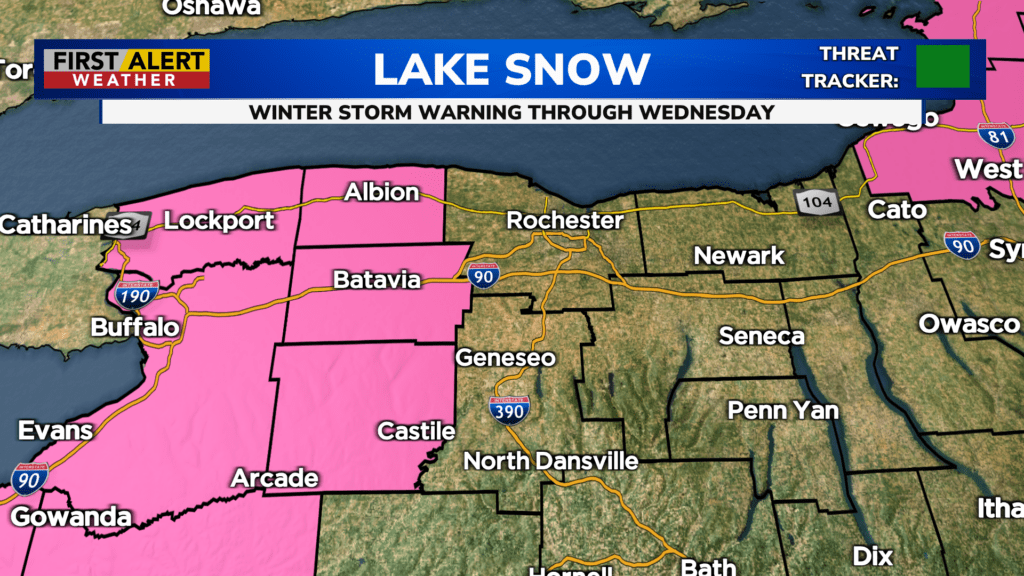
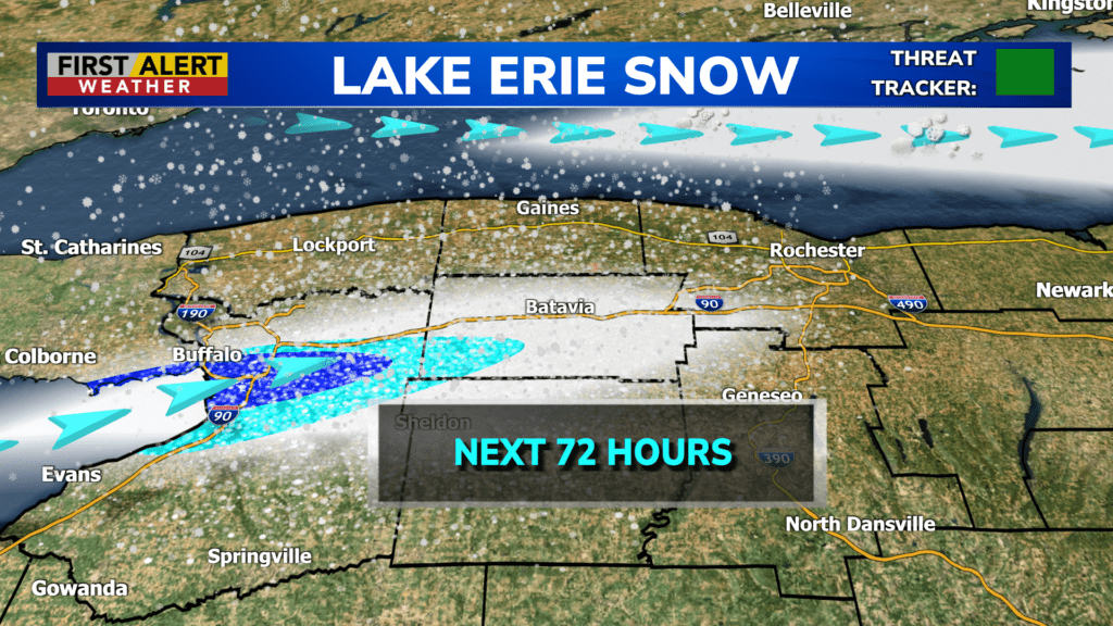
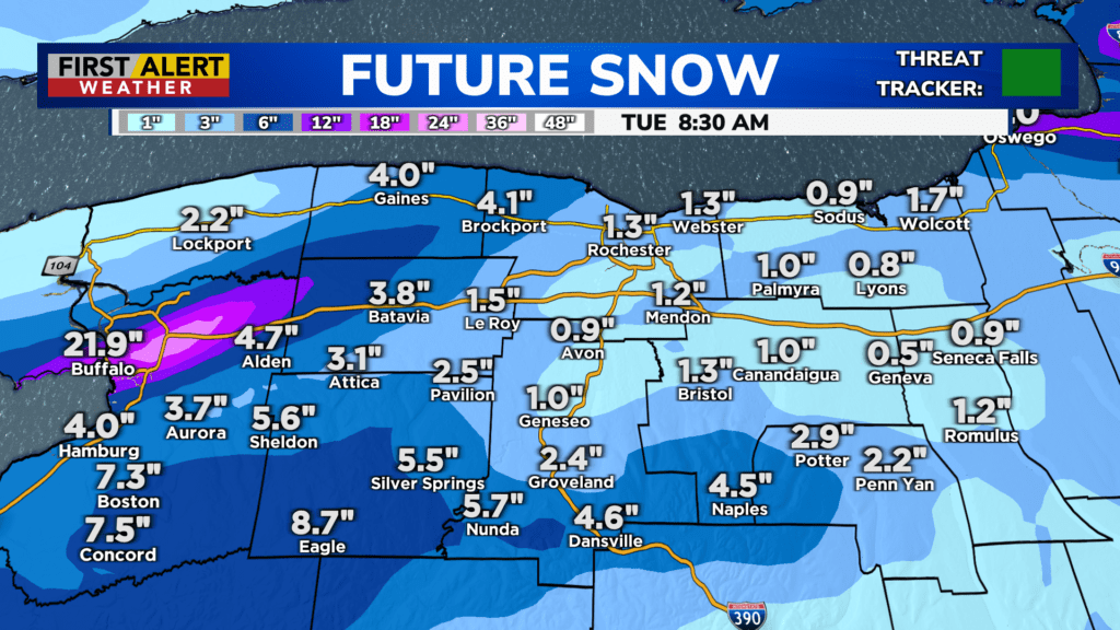
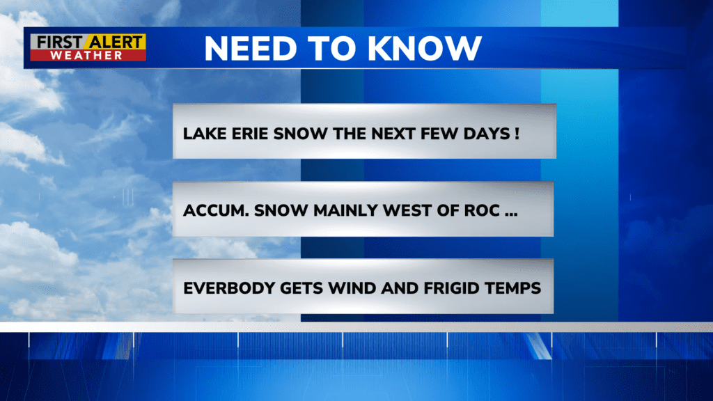
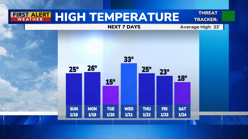
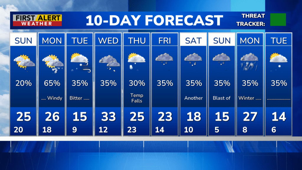
ROCHESTER, N.Y. – An Arctic airmass will be overspreading the Great Lakes during the first half of the week. This is the perfect receipt for lake effect snow and with a primarily westerly wind, it will be Lake Erie squalls to be watching. The main focus is poor visibility, and accumulating snow which will be found west of Rochester. The immediate Rochester area will see small amounts of snow, but starting with the western suburbs, snowfall will begin to increase. It is likely that communities from Batavia to Buffalo will experience whiteout conditions at times, and this will take place from Sunday night through Wednesday morning. Extensive blowing and drifting in the open areas with the most persistent snow bands bringing accumulations in the range of 10 to 20 inches. Winter storm warnings are in effect for Orleans, Genesee and Wyoming Counties. Needless to say, travel will be very difficult in these areas. The immediate Rochester area will likely see much lighter amounts of snow with accumulations running at only one to three inches.
However, even if you do not see the heavy snow, everyone will get the windy and bitter cold weather. Monday and Tuesday the wind chill will be near zero and could reach sub-zero at times. The weather will moderate somewhat later Wednesday, but another blast of arctic air is likely later Thursday and continuing into the weekend.
![]()
Stay tuned to News10NBC First Alert weather for updates on the forecast.
For Related Stories: Bitter Cold Lake Erie Squalls First Alert Weather