
An extreme cold warning and winter storm warning are in place for the Lehigh Valley, with dangerous wind chills and a significant snowstorm expected through the weekend.
Residents should prepare for life-threatening cold temperatures and potentially hazardous winter conditions.
Wind chills will drop below zero degrees early Saturday morning, potentially reaching -10 degrees in most areas and -20 degrees in the Poconos. Saturday will remain bitterly cold, with high temperatures struggling to reach the low 20s and single-digit temperatures in mountainous regions.
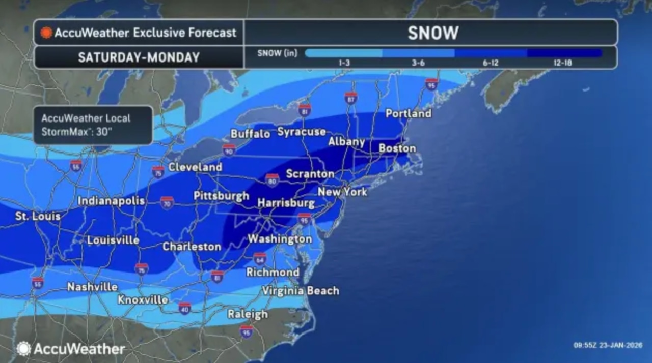
A winter storm is forecast to develop Saturday night and continue through Sunday, bringing 12 to 18 inches of snow to the Lehigh Valley and northern New Jersey. The storm will include mixed precipitation, with potential for sleet and freezing rain, creating dangerous travel conditions. The National Weather Service recommends avoiding unnecessary travel and preparing for potential power outages.
Arctic air will persist through next week, with temperatures remaining below freezing into Friday. Monday may be the “warmest” day, with highs reaching the upper 20s to low 30s. Tuesday will see continued cold with highs in the teens and potentially dangerous wind chills as low as 10 degrees below zero.
The prolonged cold means the new snowpack is not expected to melt, and residents should continue to take precautions against extreme winter conditions. Continued monitoring of local weather updates is advised as the winter storm develops.