
Power outages are possible across Pennsylvania as a powerful winter snow storm is poised to move through the region. Bookmark this link for live updates as the outages are reported.West Penn Power and Duquesne Light said they may not be expecting widespread outages, but they say they are prepared just in case.”Based on this afternoon, based on the weather forecasts we have right now, we’re not expecting power interruptions across our territory,” Duquesne Light spokesperson Matt Neistein said.West Penn Power expects minimal power outages because the snowfall in the upcoming storm is not expected to put a strain on trees to rip down power lines.Both utility companies will still be ready with extra staff in the event of outages and advise residents to do their part to be ready. They recommend not using stoves or ovens as heat sources, keeping generators away from windows, and having flashlights and car chargers handy.Live-updating map Winter storm warning: Significant snow on SundaySunday is a Severe Weather Alert Day for snow. The storm will approach from the south with the snow starting Saturday night.Models are in agreement that the brunt of the storm will be during the day on Sunday. Snow could pile up at rates of 1 to 2 inches per hour.Your Full Sunday Forecast: How much snow you’ll see The heaviest snow will taper off Sunday evening, and the storm will finally end Monday morning.Significant snow is anticipated across the Pittsburgh region. The forecast holds with 8-12 inches of snow to fall by the end of Sunday for most of Western Pennsylvania. We could tack on an additional 1-3 inches through Monday morning. The question remains whether enough warm air will make it north into our area to allow for a period of sleet and/or freezing rain south of Interstate 70 and into the Laurel Highlands. If it does, this will limit snow totals here but add icing concerns.Related coverage: PHNjcmlwdCB0eXBlPSJ0ZXh0L2phdmFzY3JpcHQiPiFmdW5jdGlvbigpeyJ1c2Ugc3RyaWN0Ijt3aW5kb3cuYWRkRXZlbnRMaXN0ZW5lcigibWVzc2FnZSIsKGZ1bmN0aW9uKGUpe2lmKHZvaWQgMCE9PWUuZGF0YVsiZGF0YXdyYXBwZXItaGVpZ2h0Il0pe3ZhciB0PWRvY3VtZW50LnF1ZXJ5U2VsZWN0b3JBbGwoImlmcmFtZSIpO2Zvcih2YXIgYSBpbiBlLmRhdGFbImRhdGF3cmFwcGVyLWhlaWdodCJdKWZvcih2YXIgcj0wO3I8dC5sZW5ndGg7cisrKXtpZih0W3JdLmNvbnRlbnRXaW5kb3c9PT1lLnNvdXJjZSl0W3JdLnN0eWxlLmhlaWdodD1lLmRhdGFbImRhdGF3cmFwcGVyLWhlaWdodCJdW2FdKyJweCJ9fX0pKX0oKTs8L3NjcmlwdD4=
PITTSBURGH —
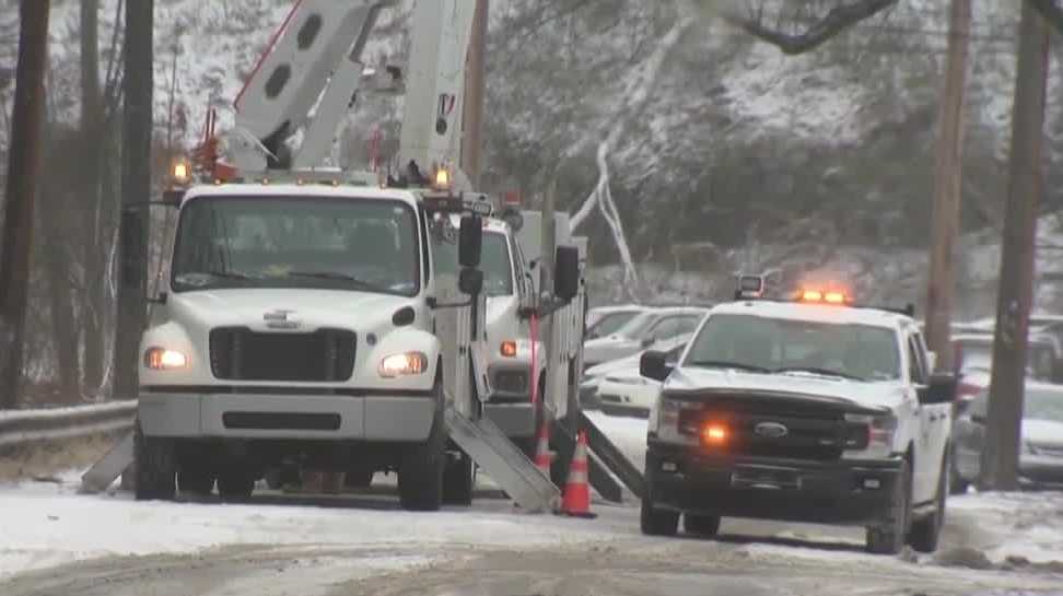
Power outages are possible across Pennsylvania as a powerful winter snow storm is poised to move through the region. Bookmark this link for live updates as the outages are reported.
West Penn Power and Duquesne Light said they may not be expecting widespread outages, but they say they are prepared just in case.
“Based on this afternoon, based on the weather forecasts we have right now, we’re not expecting power interruptions across our territory,” Duquesne Light spokesperson Matt Neistein said.
West Penn Power expects minimal power outages because the snowfall in the upcoming storm is not expected to put a strain on trees to rip down power lines.
Both utility companies will still be ready with extra staff in the event of outages and advise residents to do their part to be ready. They recommend not using stoves or ovens as heat sources, keeping generators away from windows, and having flashlights and car chargers handy.
Live-updating map
Winter storm warning: Significant snow on Sunday
Sunday is a Severe Weather Alert Day for snow. The storm will approach from the south with the snow starting Saturday night.
Models are in agreement that the brunt of the storm will be during the day on Sunday. Snow could pile up at rates of 1 to 2 inches per hour.
Your Full Sunday Forecast: How much snow you’ll see
The heaviest snow will taper off Sunday evening, and the storm will finally end Monday morning.
Significant snow is anticipated across the Pittsburgh region. The forecast holds with 8-12 inches of snow to fall by the end of Sunday for most of Western Pennsylvania. We could tack on an additional 1-3 inches through Monday morning.
The question remains whether enough warm air will make it north into our area to allow for a period of sleet and/or freezing rain south of Interstate 70 and into the Laurel Highlands. If it does, this will limit snow totals here but add icing concerns.