
First came the heavy snow the first half of today, which delivered the brunt of the snow accumulations. This afternoon and evening, there’s still some snow, but it’s been a sleet-fest for many, those ice pellets that ping and sting. That stinging is even more brutal when temperatures hover in the single digits and wind chills remain below zero. This won’t be one of the biggest snowstorms in terms of snow accumulations, but it sure is one of the coldest snowstorms on record.

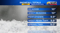
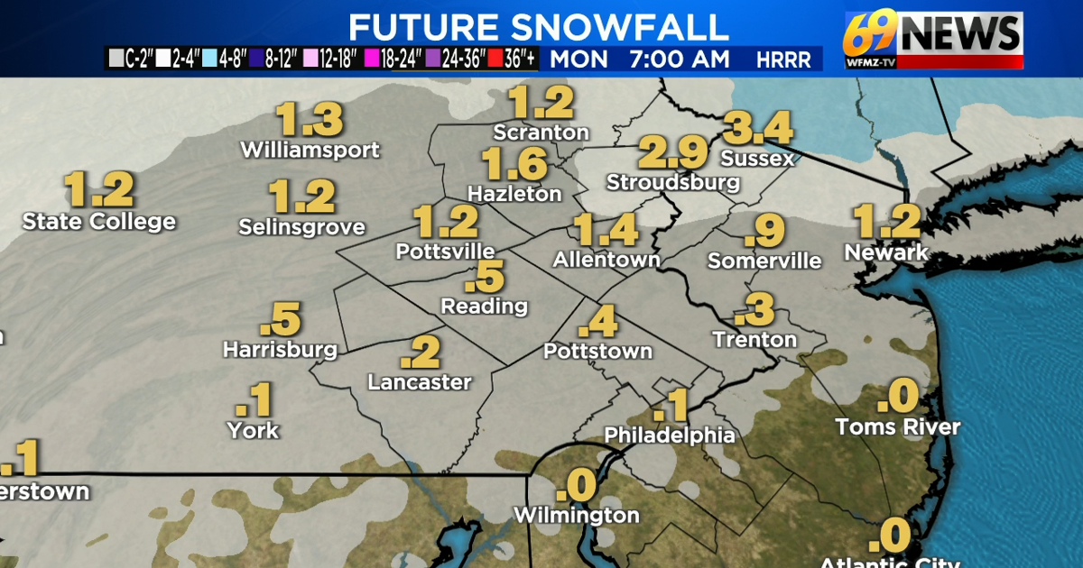
Much of the area saw anywhere from 8 to 14″ of snow and sleet as of 5pm Sunday evening, with additional accumulations of up to a coating to 1 inch of sleet for areas south of the I-78 corridor, around 1 inch of snow and sleet along the I-78 corridor, and up to 2-4 inches of mostly snow (little to no sleet) in the Poconos through the first part of the overnight hours.
Snow and sleet will continue into the evening hours, though become lighter and more scattered as we move further into the night. With well below freezing temperatures remaining in place overnight, and much of the week ahead for that matter, expect slick roads to persist but slowly improve as the storm departs by Monday morning. Temperatures aren’t expected to get above freezing through the end of January next weekend, so expect little to no melting through early February of whatever snow and sleet is on the ground.