
One More Warm Day
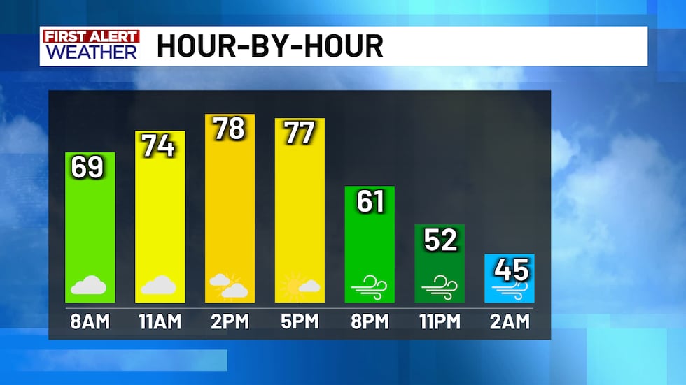
We’re starting Sunday on a warm and cloudy note with low clouds that will likely hang around through midday before breaking up later this afternoon. Even with the clouds, we’re squeezing out one more near-record warm day, with highs in the upper 70s to low 80s. This all changes tonight though as a powerful cold front barrels south and arrives by late afternoon/early evening.
 Powerful cold front brings significant temperature drop and damaging winds as it blows through Central Texas.(KWTX)Strong Cold Front Arrives this Afternoon/Evening
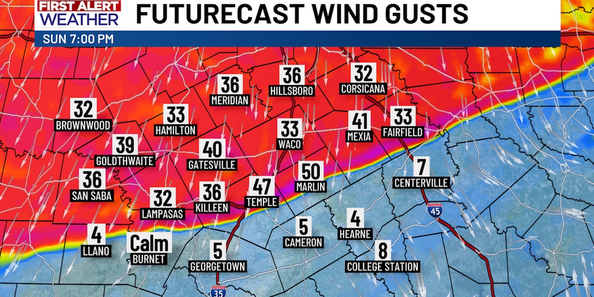
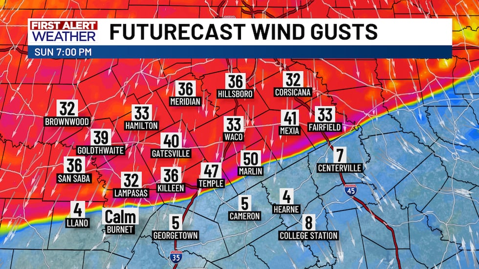
We set or tied several records for the warmth over the last week. This stretch of warmth comes to a sharp end later today. A powerful cold front will charge south this afternoon, reaching Central Texas by early evening. As the front moves through, winds will quickly strengthen. North winds are expected to gust between 40 and 50 mph for several hours, especially along the leading edge. Even behind that, winds 30-40+ mph stick around tonight. This has prompted a Wind Advisory from 3pm this afternoon through early Monday. Winds gradually back down late Monday.
 Powerful cold front brings significant temperature drop and damaging winds as it blows through Central Texas.(KWTX)
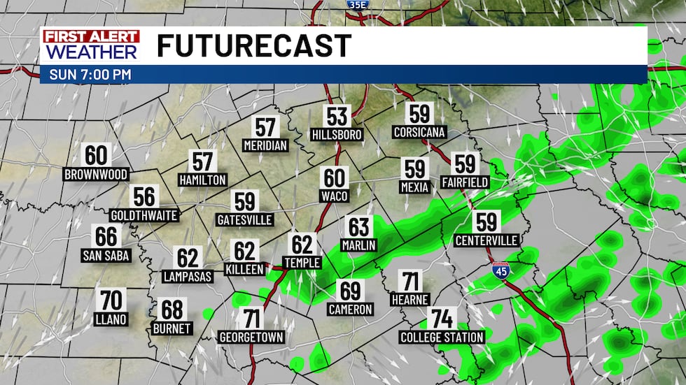
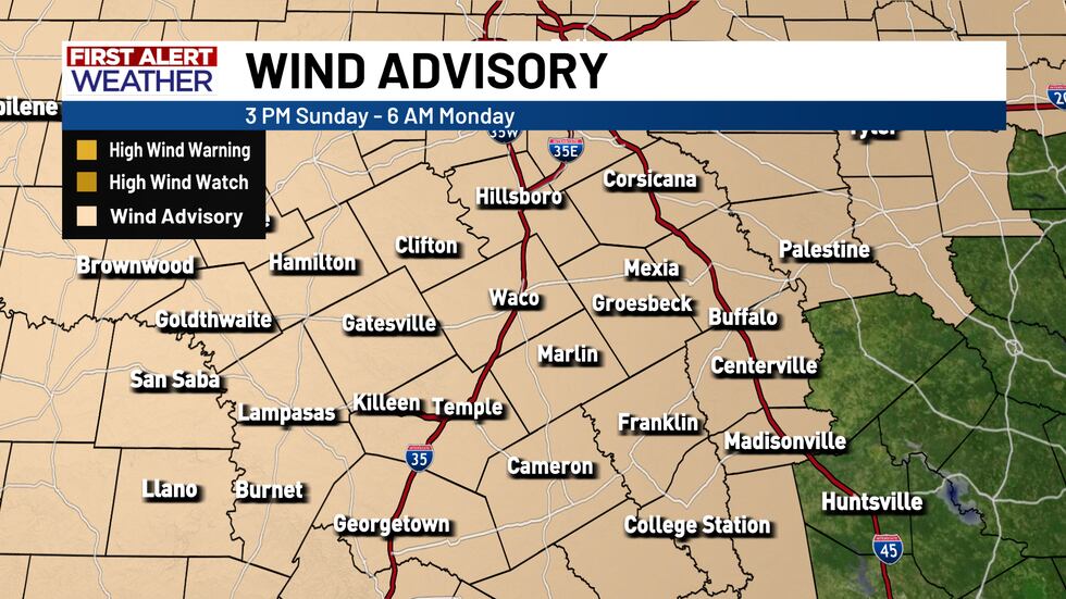 Powerful cold front brings significant temperature drop and damaging winds as it blows through Central Texas.(KWTX)Spotty Showers Along the Front
A few spots of rain may bubble up right along the front (mainly in our eastern zones) late this afternoon into early evening. Rain coverage will be spotty at best.
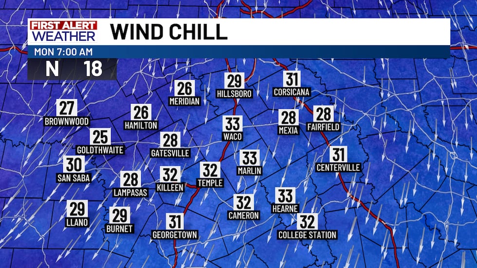
 Powerful cold front brings significant temperature drop and damaging winds as it blows through Central Texas(KWTX)Temperatures Plunge, Then a Gradual Warm-Up
Once the front passes, temperatures will fall fast. We’re talking a 40 to 50-degree drop from Sunday afternoon to Monday morning, with lows in the 30s and wind chills below freezing. Monday stays cold and blustery, with highs only in the 40s and wind chills in the 30s for the afternoon.
 Powerful cold front brings significant temperature drop and damaging winds as it blows through Central Texas.(KWTX)
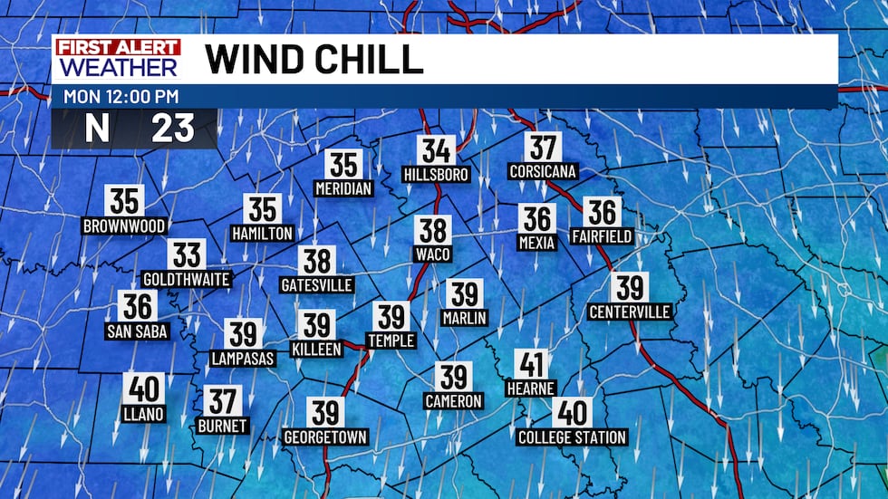 Powerful cold front brings significant temperature drop and damaging winds as it blows through Central Texas.(KWTX)
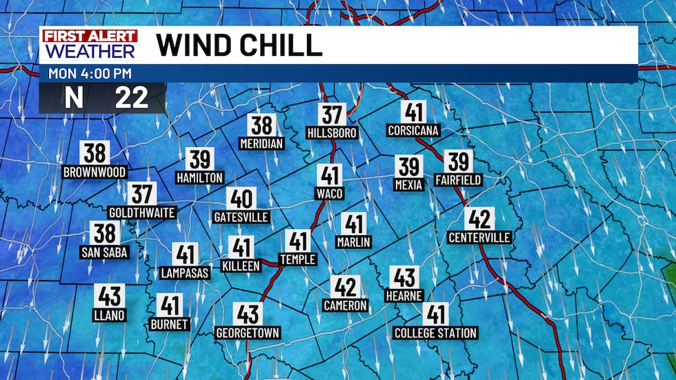 Powerful cold front brings significant temperature drop and damaging winds as it blows through Central Texas.(KWTX)
Tuesday morning will be the coldest of the week, dipping into the upper 20s. The cold snap doesn’t last forever because by midweek we start a steady warm-up. We will see highs return to the 60s by midweek and are even looking at 70s for high for the first few days of 2026!
Copyright 2025 KWTX. All rights reserved.