
LUBBOCK, Texas (KCBD) – An arctic cold front swept across the South Plains on Sunday morning, ushering in the coldest temperatures in several weeks and gusty winds that will persist through the evening.
Winds gusted up to 45 mph this afternoon, especially across the Caprock region, as the strong cold front moved through. Conditions have gradually calmed since sunset, with wind speeds dropping to less than 15 mph by Monday morning.
 KCBD(KCBD)
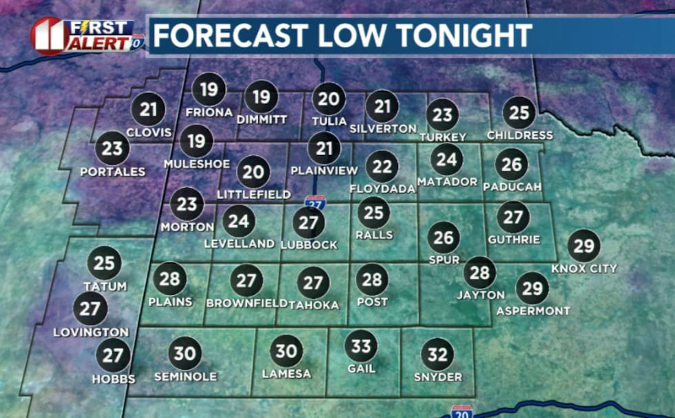
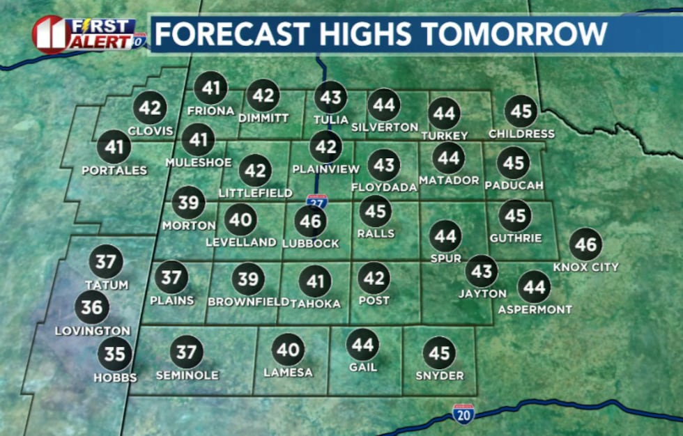
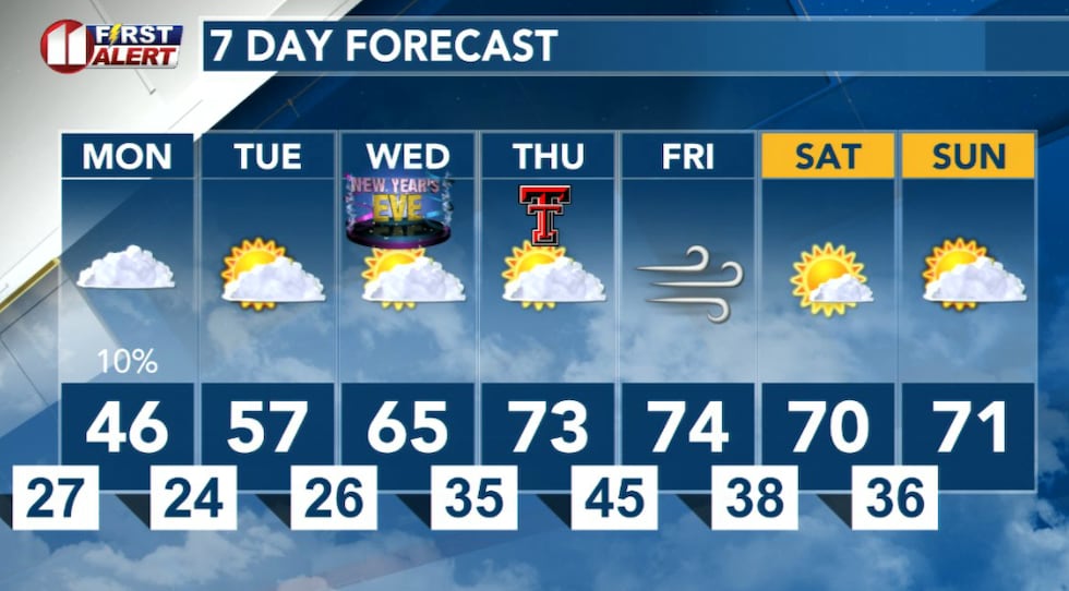
The real story, however, is the dramatic temperature drop. Lows tonight are expected to be the coldest seen in several weeks, with temperatures dipping into the upper teens to mid-20s early Monday morning. Highs on Monday will struggle to climb out of the upper 30s to low 40s under cloudy skies.
 KCBD(KCBD)Light Snow Possible Monday
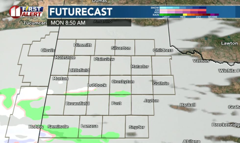 KCBD(KCBD)
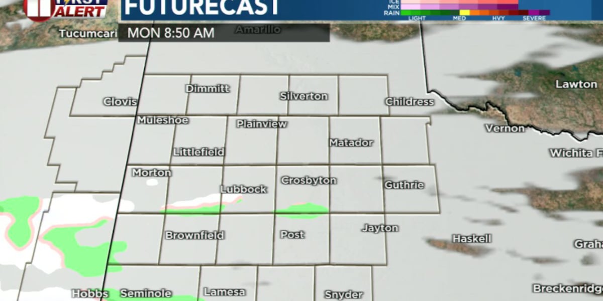
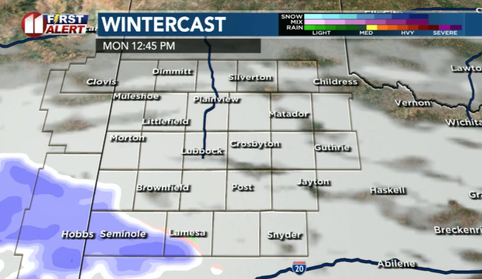
A 30-40% chance of light snow exists for southwestern portions of the South Plains on Monday, though impacts are expected to be minimal. Most locations will see only flurries, but parts of Yoakum and Terry Counties could receive up to about a half inch of accumulation.
 KCBD(KCBD)
The combination of plentiful moisture aloft and strong low level jet will create the conditions for snow, but an extremely dry air mass near the surface will limit accumulation potential. Most of the heavier snow is expected to remain south of the forecast area in New Mexico and adjacent portions of West Texas.
Warming Trend Ahead
The cold snap will be short-lived. A gradual warming trend is expected throughout the week, with well above average temperatures in the 70s returning by New Year’s Day. Dry conditions will continue through the remainder of the week.
 KCBD(KCBD)
Copyright 2025 KCBD. All rights reserved.