

HOUSTON – If you don’t get any rain Saturday night, don’t expect any until the end of the new week.
Spotty showers, storms this evening
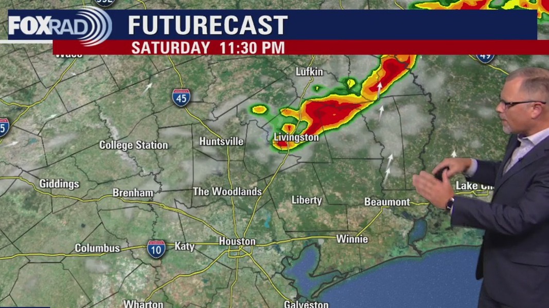
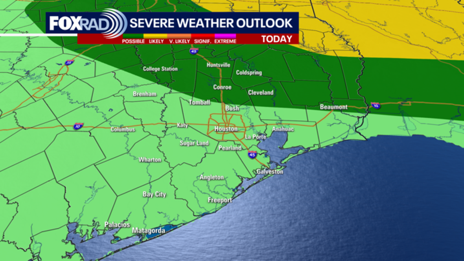
A front pushes through southeast Texas Saturday evening. A few storms could be strong and severe, especially north and east of the Houston area.
Another thing to watch will be the chance that a lightning strike could start a fire in the driest, most vulnerable areas.
Areas north and east of Houston are in a level 1 risk of severe weather. Isolated small hail and strong winds are possible with storms in these areas.
 Some changes Sunday
The cold front is expected to sweep through early Sunday morning. Once it clears the area, the afternoon will feature sunny skies, comfortable temperatures, but also a huge drop in humidity.
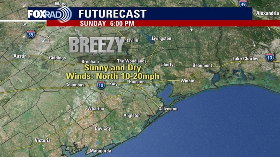
Very dry air along with northern breezes on Sunday mean a higher risk for fires across our area and much of Texas.
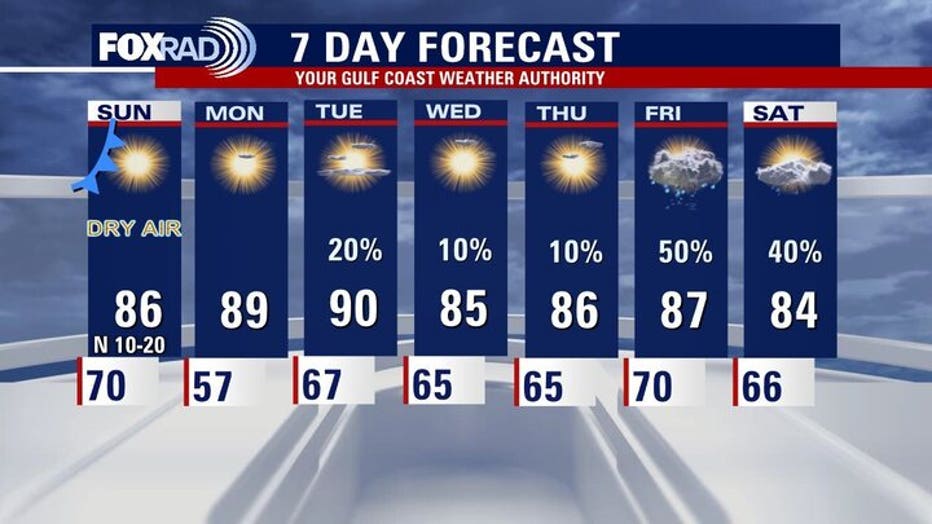
Monday morning should be the coolest of next week with upper 50s across the region.
 Tropics
 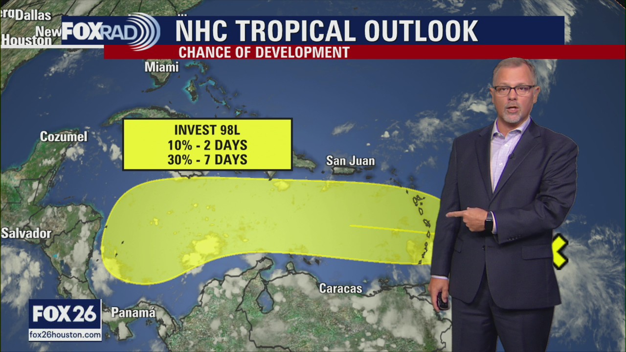 Tropical Weather Update – October 18, 2025
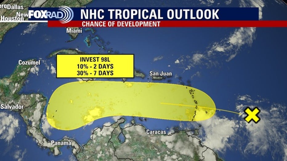
The National Hurricane Center is monitoring 2 areas in the Atlantic Ocean. An area of low pressure in the Northern waters has a very low chance to development into a tropical cyclone. A tropical wave moving towards the Caribbean Sea has been labeled Invest 98L and will be the system everyone is watching over the next several days.
The National Hurricane Center is still monitoring a tropical wave in the central Atlantic. This tropical wave has been labeled Invest 98L and is expected to continue moving west and eventually into the Caribbean Sea. It has a low chance to develop into a tropical cyclone over the next 7 days.
Another weak area of low pressure in the northern Atlantic has a very low chance of turning into a brief tropical or subtropical system before moving into cooler waters.
Nothing appears to be a threat to Texas at this time, but keep in mind hurricane season runs through November.
The Source: Your Gulf Coast Weather Authority