

HOUSTON – Drought conditions still persist across the area and with not much rain falling with this front, they will continue to worsen.
Some changes Sunday
A cold front swept through early this morning.
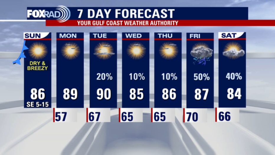
The afternoon will feature sunny skies, comfortable temperatures, but also a huge drop in humidity.
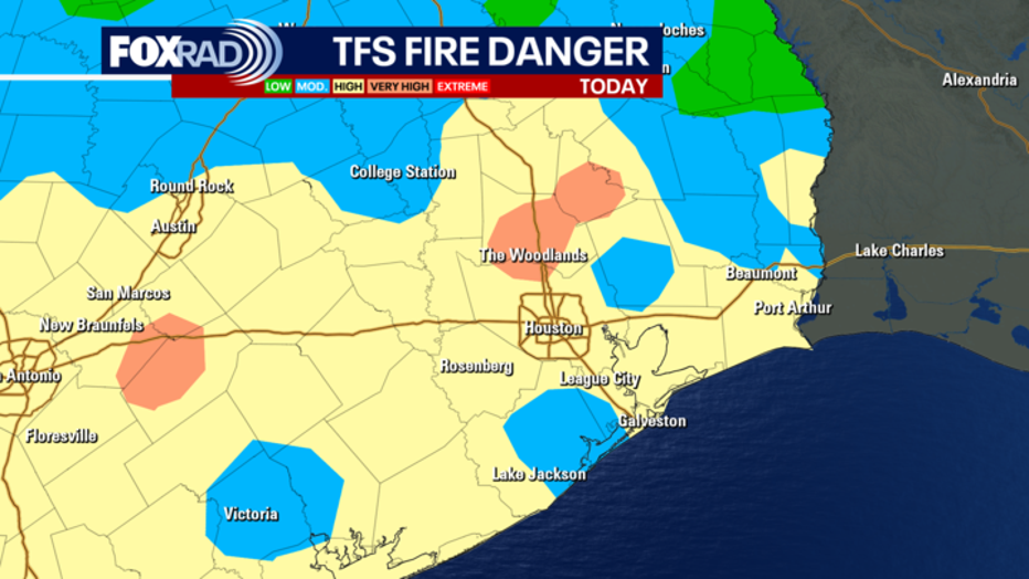
Very dry air along with north breezes on Sunday mean a higher risk for fires across our area and much of Texas.
Monday morning should be the coolest of next week, with upper 50s across the region.
 Dry drought
Drought conditions still persist across the area and with not much rain falling with this front, they will continue to worsen.
Moderate drought conditions for parts of Harris. Chambers, Liberty Counties, among others. Burn Bans also in effect for over 150 counties across Texas.
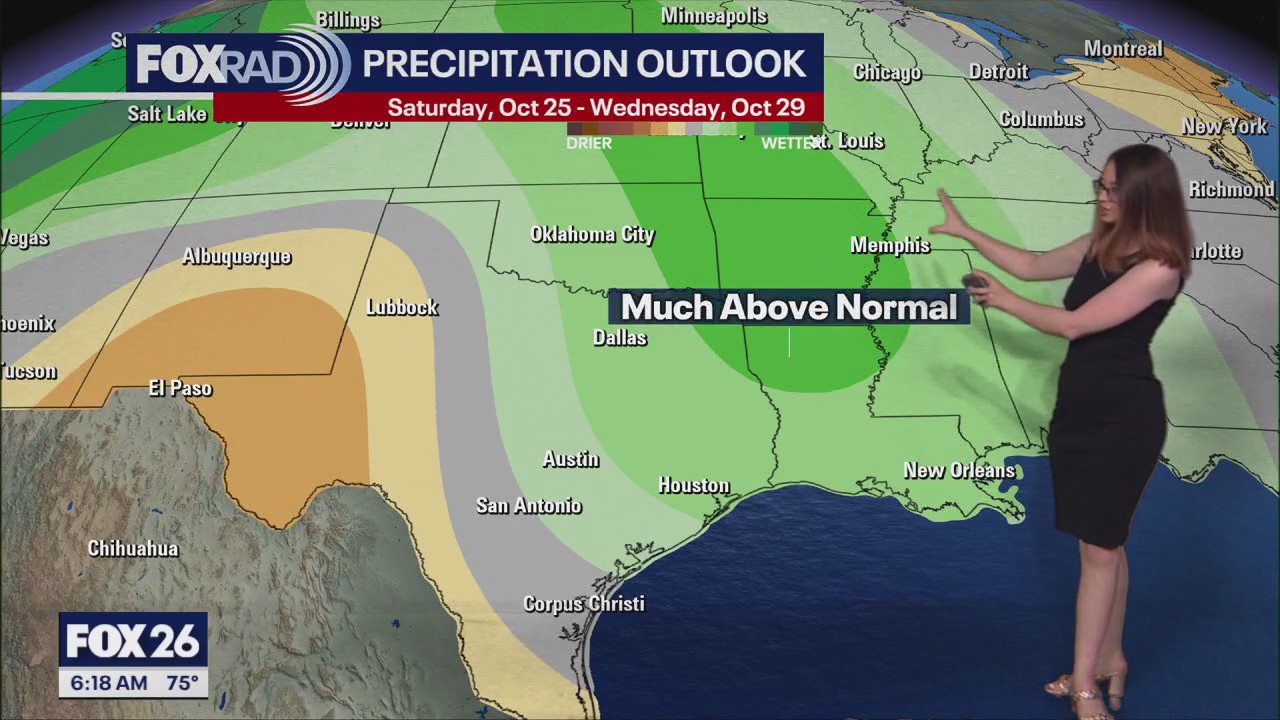
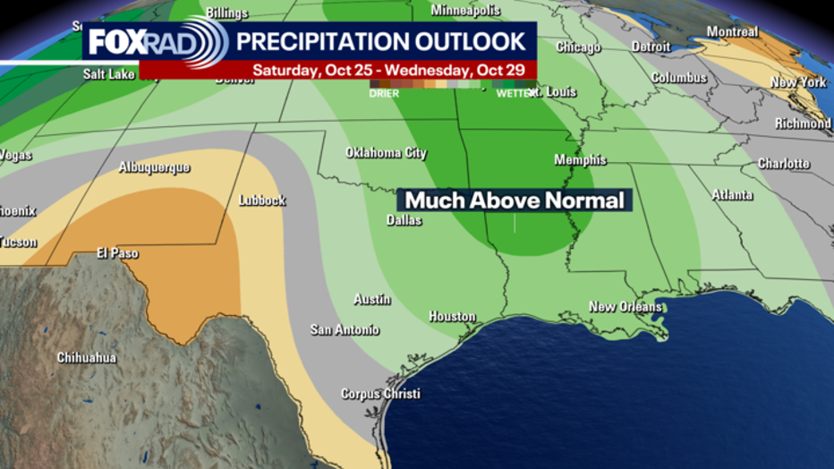
Model trends show an increase in moisture as we end the month, which should bring some relief.
 Tropics
The National Hurricane Center is still monitoring a tropical wave in the central Atlantic.
This tropical wave has been labeled Invest 98L and is expected to continue moving west and eventually into the Caribbean Sea. It has a medium chance to develop into a tropical cyclone over the next 7 days.
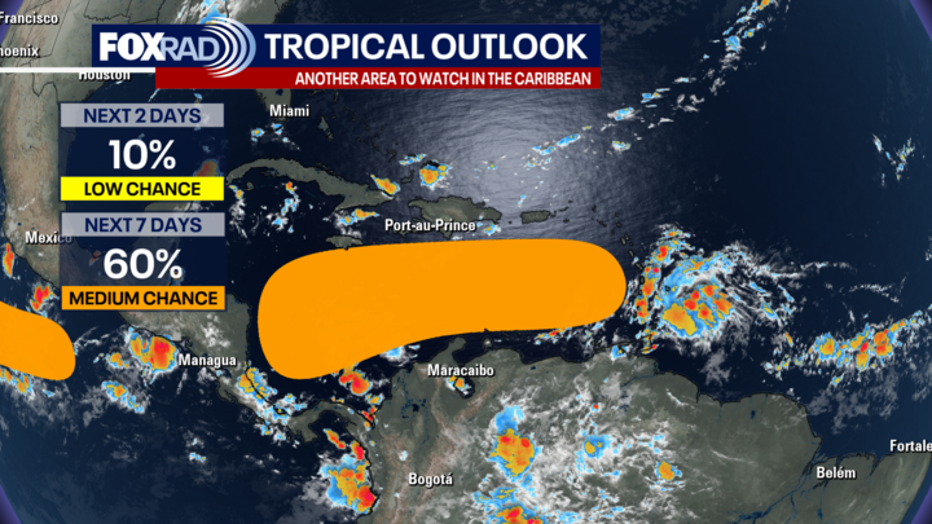
Nothing appears to be a threat to Texas at this time, but keep in mind hurricane season runs through November.
The Source: Your Gulf Coast Weather Authority