In brief: Houston will experience its chilliest night of the season on Sunday, with much of the area dropping into the 50s. But alas, it will not last.
Cold front arrives
Good morning everyone. Just a quick note on a Sunday to say that front pushing into Houston right now is bringing a nice dose of cooler air. Today will be sunny and pleasant, with highs generally in the mid-80s, only marred by occasionally gusty winds from the north. With drier air arriving, we’re going to have a very pleasant evening.
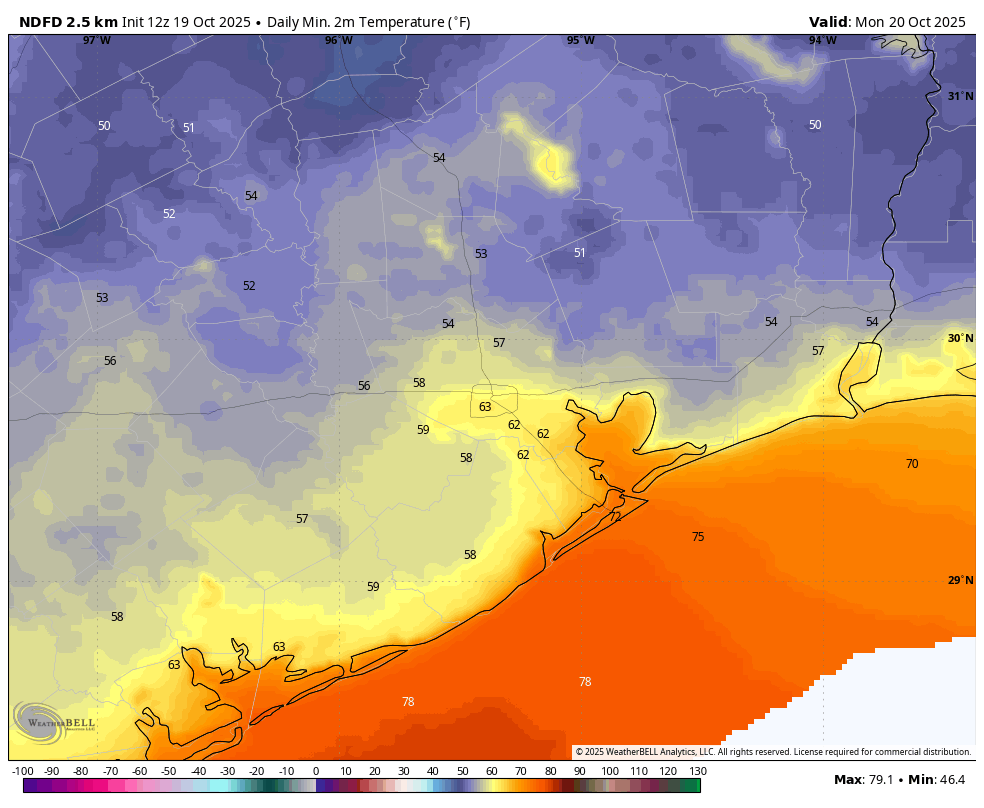
Most of the region has yet to see a night in the 50s so far this season, (our coolest night came on October 11, with 61 degrees at Bush Intercontinental Airport) but that is in the cards on Sunday night. Areas outside of Houston’s urban core, and away from the immediate coast, should drop into the mid-50s tonight as drier air descends into the region today.
However a southeasterly flow resumes on Monday morning, with the return of muggier air. Another (weaker) front arrives on Tuesday and this will bring us a couple of slightly cooler nights. However we still probably are going to have to wait until next week for the arrival of a truly fall-like cold front. Our confidence in that is increasing, but I’m not ready to sign off on it yet.
Anyway, have a great Sunday, everyone. Just wanted to say if you’ve been looking for fall, it will make a brief appearance tonight!