
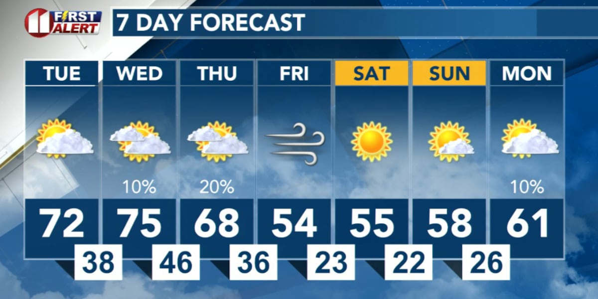
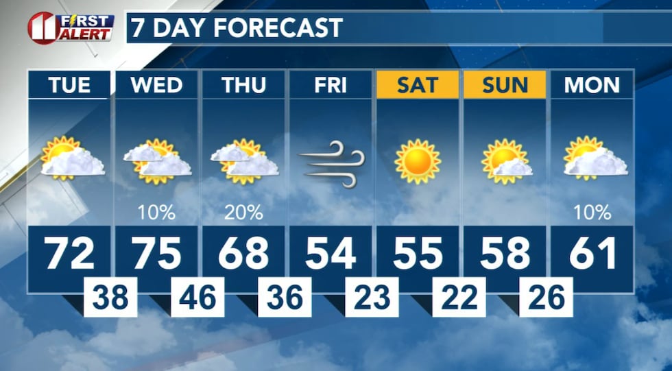
LUBBOCK, Texas (KCBD) – Temperatures remain seasonably mild at the beginning of this week. There is, however, a significant drop in temperature by the end of the week.
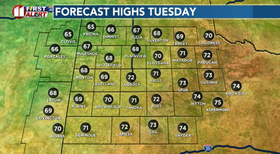
Enjoy the mild temperatures weather while they last. Temperatures climb into the low 70s Tuesday, then mid-70s Wednesday. A moderately strong cold front will bring temperatures down to near seasonal averages Friday.
What to Expect This Week
Tonight through Tuesday conditions remain more Spring-like, with partly to mostly cloudy skies and temperatures ranging from lows in the 30s to highs in the 70s. Winds will be breezy this evening, but will be light Tuesday afternoon.
 A pleasant afternoon with a light wind and temperatures well-above average for early January.(KCBD First Alert)
Wednesday becomes breezy, helping to push afternoon temperatures into the 70s, but clouds will thicken throughout the afternoon. There’s a slight chance of light rain showers Wednesday night, with amounts generally around a few hundredths of an inch. Winds will pick up Wednesday, becoming gusty from the southwest.
Thursday there also is a slight chance of light rain showers — possibly mixed with light snow in the northwestern viewing area — in the morning. No significant impacts are expected at this time.
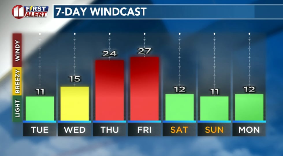 Forecast peak sustained winds are shown in this graph. Peak gusts will exceed the values shown here.(KCBD First Alert)
Afternoon clearing will bring breezy to windy conditions and noticeably cooler temperatures, with high still 10 to 15 degrees above average for the date.
The Big Friday Cooldown
Friday marks the arrival of a moderate cold front and much cooler air. The high will only reach 56 degrees — roughly 20 degrees below Wednesday’s forecast high – and near the average for early January. Gusty winds will make it feel even colder.
 Warm start, much cooler end, to this week. A 20-degree temperature drop ahead.(KCBD First Alert)
A slight chance of light rain or snow showers is possible early in the day, but no significant impacts are expected.
Weekend Outlook
Saturday and Sunday generally will be sunny but cool – even chilly. Low temperatures are forecast in the low 20s with highs in the mid- to upper 50s.
On This Date
On this date in 1988, a major winter storm seriously hampered travel in the Northwest Texas area. Beginning on the morning of the 5th, freezing drizzle slickened roads and sidewalks so seriously that driving and simply walking became extremely hazardous. More than 60 motor vehicle wrecks were reported in Lubbock during the morning rush hour, three of which involved school buses. Fortunately, no serious injuries resulted. In the three days that followed, snow accumulated to depths up to seven inches in Paducah, four inches at Spur, and three at Brownfield.
(National Weather Service Lubbock)
Copyright 2026 KCBD. All rights reserved.