
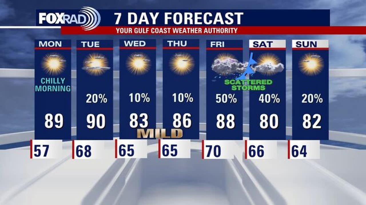
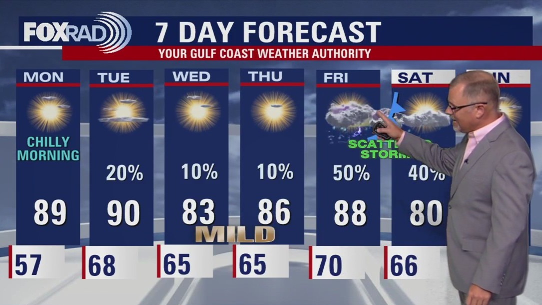
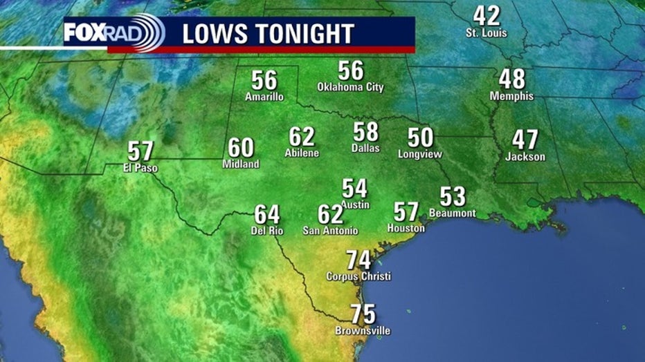
HOUSTON – Monday morning should be the coolest of next week, with upper 50s across the region.
Some changes Sunday
A cold front swept through southeast Texas on Sunday. It took until the late afternoon for comfortable temperatures, but also a huge drop in humidity.
Very dry air along with northern breezes keep a high risk of fires across our area and much of Texas.
Short taste of fall
By Monday afternoon the winds return from the south. The Gulf breezes bring warmer and more humid conditions back across the region.
Tuesday morning will be around ten degrees warmer than Monday morning.
A very week front Tuesday brings isolated rain to the forecast but leaves the middle of the week with quiet and mild temperatures.
Dry drought
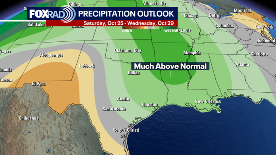
Drought conditions still persist across the area and with not much rain falling recently.
Moderate drought conditions for parts of Harris. Chambers, Liberty Counties, among others. Burn Bans are also in effect for over 150 counties across Texas.
Model trends show an increase in moisture as we end the month, which should bring some relief.
 Rain returns Friday
An end of the week front should bring more rain to the forecast and cooler temperatures for the weekend.
The timing is not certain yet, but right now it looks to move into Houston Friday evening or perhaps overnight into early Saturday morning.
 Tropics
 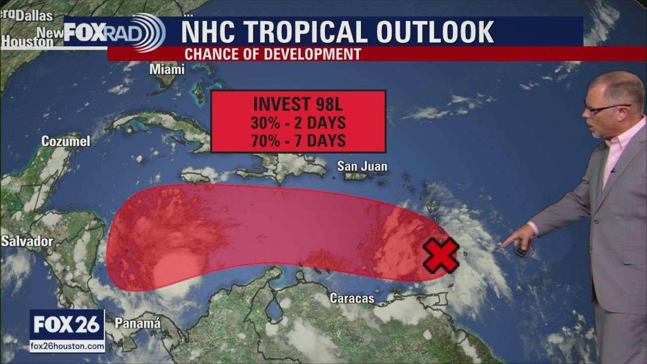 Tropical Weather Update – October 19, 2025
Near the Windward Islands and the Caribbean Sea (AL98): Recent satellite wind data and surface observations indicate the tropical wave (Invest 98L) currently crossing the Windward Islands still lacks a closed circulation. However both radar and satellite images indicate the associated shower and thunderstorm activity is starting to show signs of organization. The system is still moving quickly westward at 20 to 25 mph and environmental conditions are forecast to become more favorable as it slows down in the central Caribbean Sea by the middle of this week. A tropical depression is likely to form by the middle to latter portion of this week in the central Caribbean Sea.
The National Hurricane Center is still monitoring a tropical wave moving into the Caribbean. This tropical wave has been labeled Invest 98L and is expected to continue moving west until it slows down in the middle of the week. Conditions are favorable for it to become the next named storm over the next 7 days.
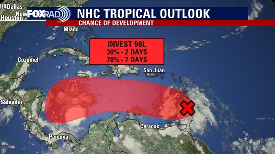
Nothing appears to be a threat to Texas at this time, but keep in mind hurricane season runs through November.
The Source: Your Gulf Coast Weather Authority