
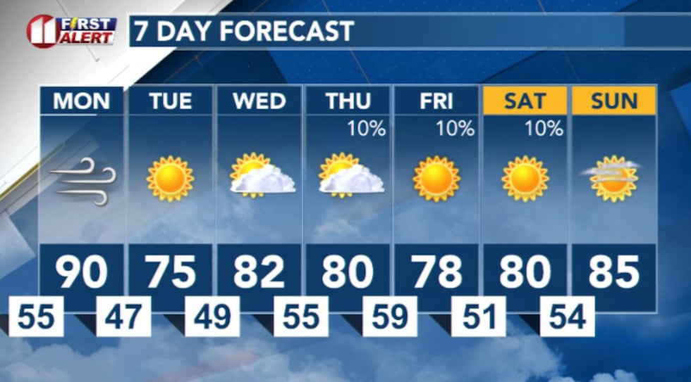
LUBBOCK, Texas (KCBD) – A quick pattern change is on the way. The week will start warm, dry, and windy before a cold front slide through cooling things down for Tuesday. A small chance for rain returns by Thursday, but for much of the region, the next few days will stay quiet.
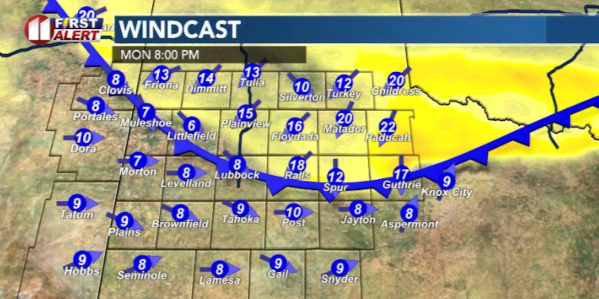
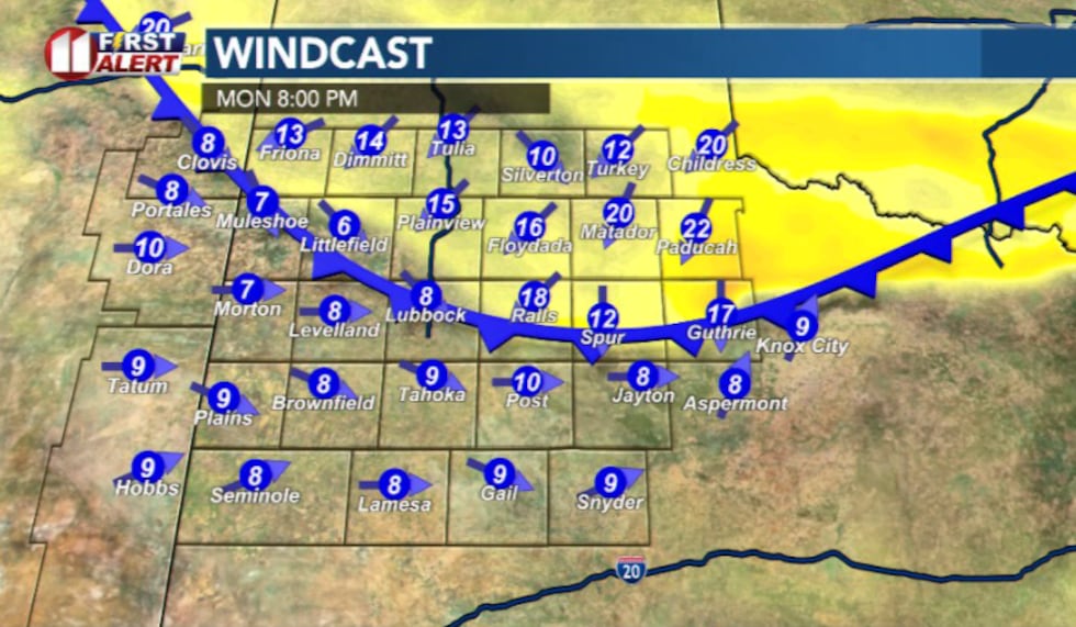
On Monday, strong westerly winds will kick up across the South Plains, driven by a developing low-pressure system over the Rockies.
 Highs tomorrow(KCBD)
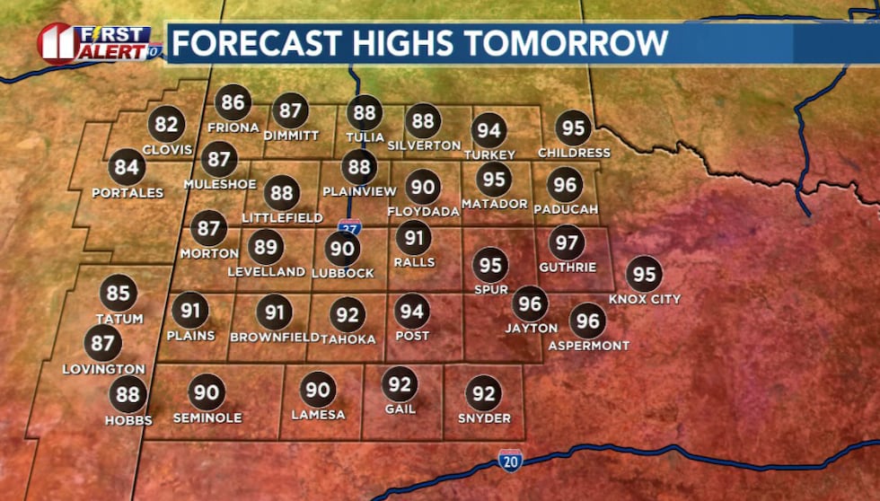
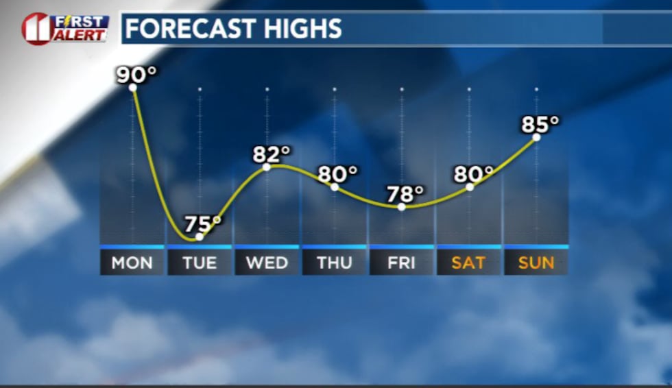
As winds blow downslope from higher terrain, the air compresses and warms. That’s why temperatures will surge well above average, reaching the low to mid-90s, especially off the Caprock.
 Windy conditions return Monday(KCBD)
Those same downslope winds will dry the air out. Humidity will drop to near 10% in some locations, which means elevated fire weather conditions for much of the area.
 Front moving in Monday(KCBD)
By Monday evening, winds shift to the northeast as a cold front moves in, bringing a change in both air mass and feel.
After the cold front sweeps across the region, winds will turn breezy from the northeast before calming Monday night. Cooler air settles in quickly. Early Tuesday morning, temperatures will dip into the 30s and 40s across the area.
 Temperature trend(KCBD)
Tuesday afternoon will feel much more seasonable with highs in the low to mid 70s.
Winds will shift back around to the south by Wednesday, pulling in more mild air. Temperatures rebound back into the 80s and skies remain mostly sunny.
Moisture will slowly filter its way back into the area by Thursday along with small rain chances, mainly off the Caprock.
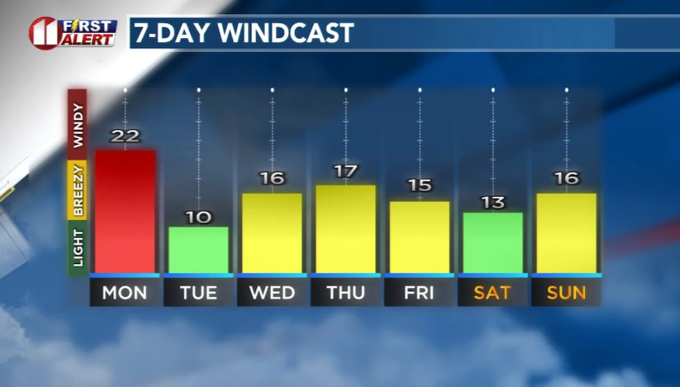
 7 Day Forecast(KCBD)
Copyright 2025 KCBD. All rights reserved.