
LUBBOCK, Texas (KCBD) – Gusty winds and a sunny sky will help temperatures soar to near records for the date this afternoon. The heat will quickly be followed by a cold front, dropping temperatures to near average for late October.
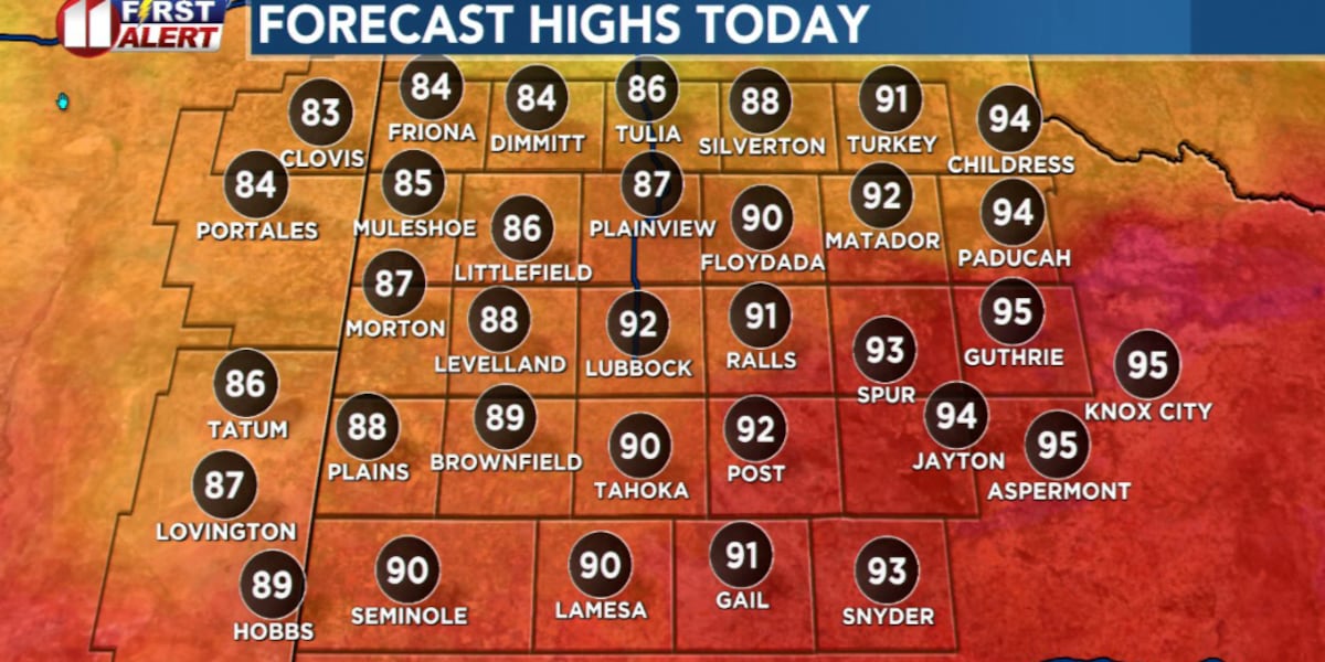
Highs today will range from about 15 to 20 degrees above average, near record levels for October 20. Lubbock’s average high for the date is 74°. The record is 93°, set on this date in 2012.
 Near record high temperatures this afternoon!(KCBD First Alert)
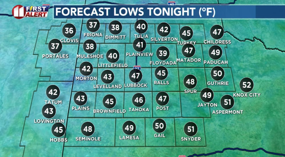
Winds will be sustained from about 15 to 25 mph, with gusts from about 25 to 35 mph.
With the wind, sun, heat, low humidity, and dry vegetation, there will be an elevated grassland fire risk. Be cautious if you will be involved in outdoor activities which may involve open flames, generate extreme heat, or create sparks.
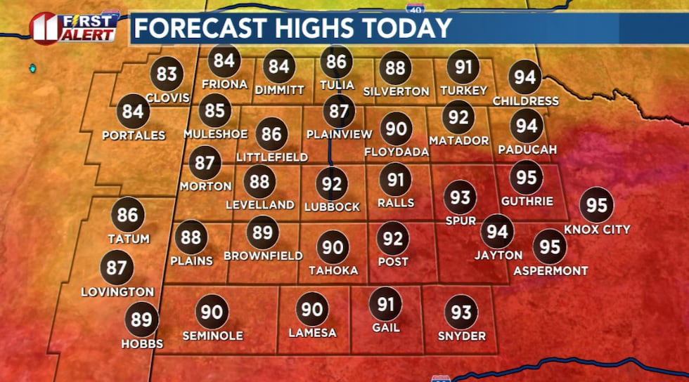
The first, and strongest, of two cold fronts this week will sweep across the viewing area late today. The front, moving from northeast to southwest, will be through the viewing area by the end of this evening.
 A chilly start to Tuesday!(KCBD First Alert)
Behind the front, under a clear sky, temperatures will drop into the 30s in the northwest viewing area and the 40s elsewhere.
 Quite breezy to somewhat windy today, the windiest day this week.(KCBD First Alert)
The front is a “dry front”, that is, no rain is expected. The main impact will be a significant drop in temperatures across West Texas and eastern New Mexico.
The next front, however, may bring rain to our area. On the other hand, the drop in temperature following the front will not be as significant (as with the front late today).
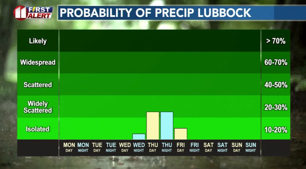 The KCBD viewing area’s next chance of rain is Thursday.(KCBD First Alert)
Copyright 2025 KCBD. All rights reserved.