
LUBBOCK, Texas (KCBD) – After a dramatic cold front brought dangerous wind gusts near 65 mph and a massive dust storm through the region early Friday morning, conditions are rapidly improving.
 KCBD(KCBD)
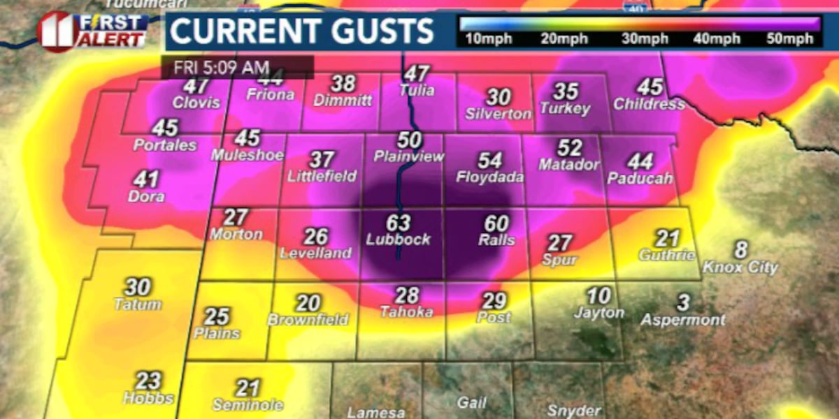
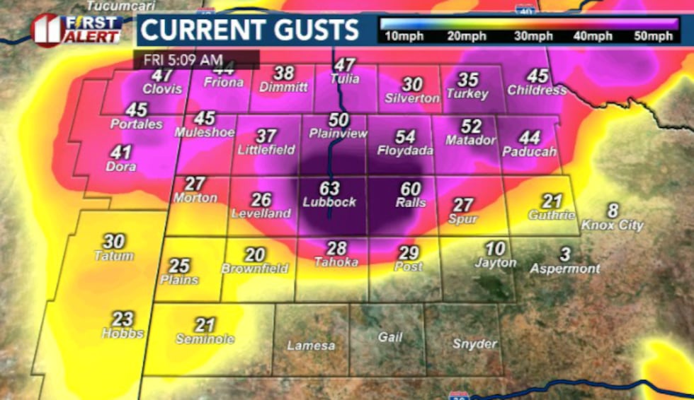
Multiple mesonet sites recorded sustained wind speeds between 30 and 40 mph, with gusts reaching nearly 60 mph as the cold front moved through the area this morning. The Lubbock Airport reported a peak wind gust of 63 mph around 4:47 a.m. A haboob — a thick wall of blowing dust — accompanied the system, reducing visibility to as low as one mile in some locations.
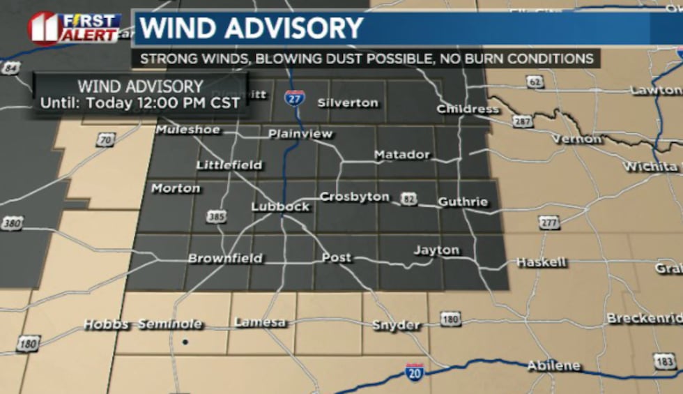
The initial Wind Advisory was upgraded to a High Wind Warning around 4 a.m. as conditions intensified but this was downgraded again to A Wind Advisory once again and was allowed to expire for the South Plains at 8 a.m.
 KCBD(KCBD)
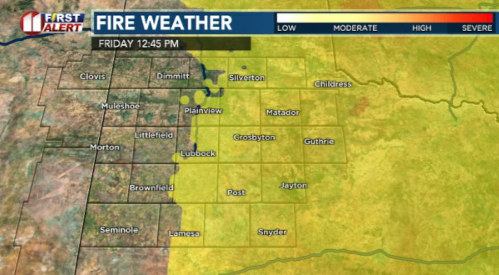
What to expect Friday:
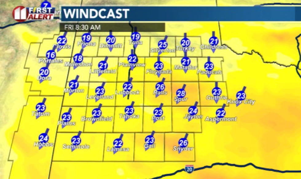
Northerly winds will continue through the morning, ranging from 20 to 30 mph and gradually easing during the afternoon. A few spots east of the Caprock may still approach low-end advisory wind levels until early afternoon, but the system has already shifted south and east of the region.
 KCBD(KCBD)
Elevated fire danger will persist for areas along and east of the I-27 corridor, where dry conditions remain a concern.
 KCBD(KCBD)
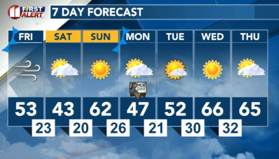
Weekend and beyond:
Saturday will bring colder temperatures with the slimmest chance of light snow flurries. Conditions are expected to turn mostly mild and dry through next week as high pressure settles into the region.
 KCBD(KCBD)
Copyright 2026 KCBD. All rights reserved.