
LUBBOCK, Texas (KCBD) – Saturday wraps up cold, cloudy, and quiet before we’re buckled into a temperature roller coaster.
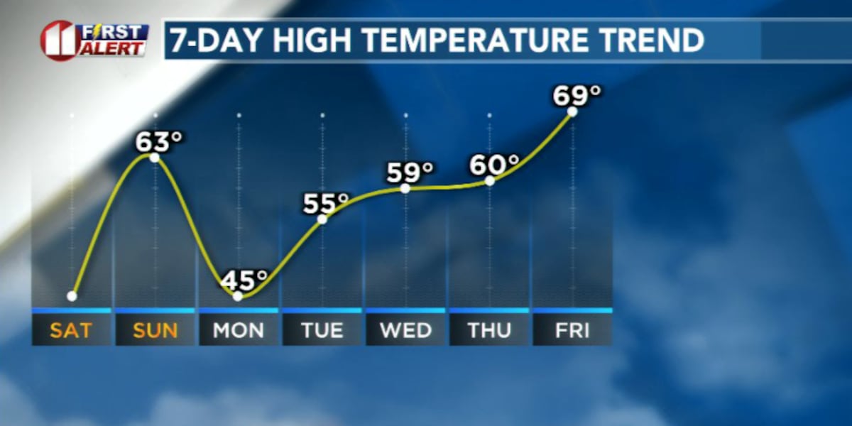
 Temperatures this week(KCBD)
Temperatures struggled to get out of the 30s across most of the area after on Saturday, after coming off a cold front that left behind cold, dense air near the ground.
Some areas to our north were lucky enough to see a few snowflakes this morning but there’s not enough lift or moisture for anything to stick.
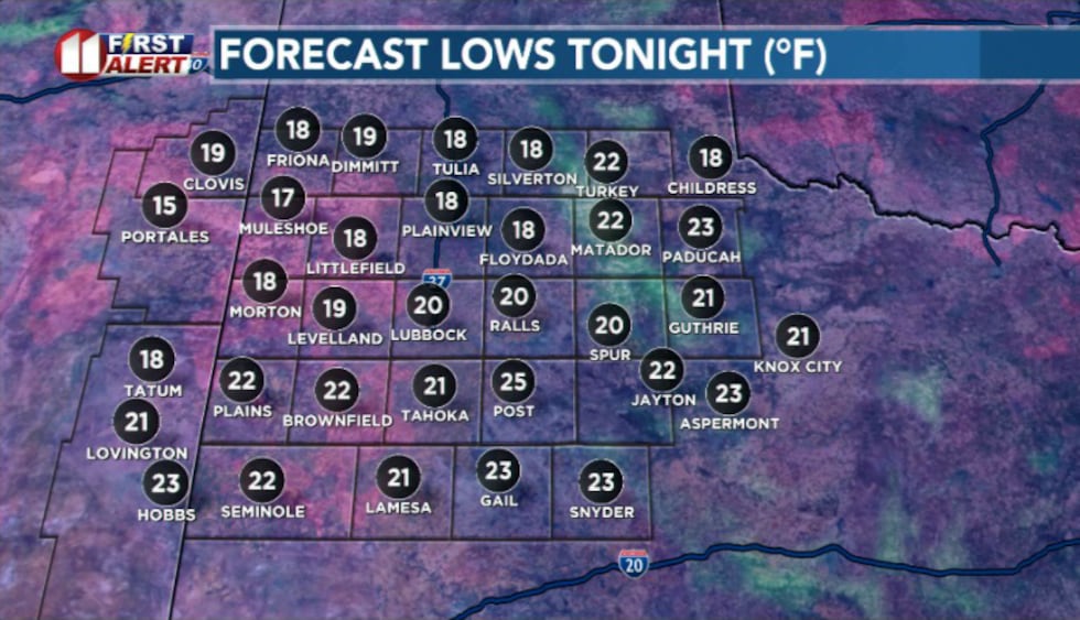 Lows tonight(KCBD)
Tonight, skies will continue to clear and winds go light as high pressure settles overhead. Overnight lows will fall into the teens. If you have pets, plants, or exposed pipes, tonight is one you’ll want to plan for.
Sunday looks like a complete flip of the switch. As that high pressure slides off to our south and east, winds turn southwesterly and warmer air rushes back in.
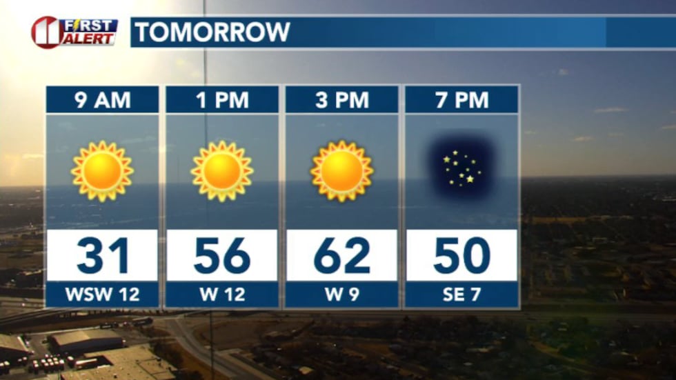 Forecast tomorrow(KCBD)
With sunshine returning, temperatures rebound into the 60s.
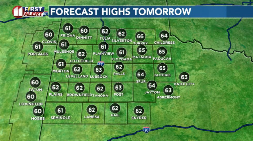 Highs tomorrow(KCBD)
Another cold front arrives late Sunday and early Monday, knocking temperatures back down into the 40s for Martin Luther King Jr. Day.
From there we’ll settle into a familiar pattern: fronts moving through every few days, temperatures swinging up and down, but with very little moisture to work with.
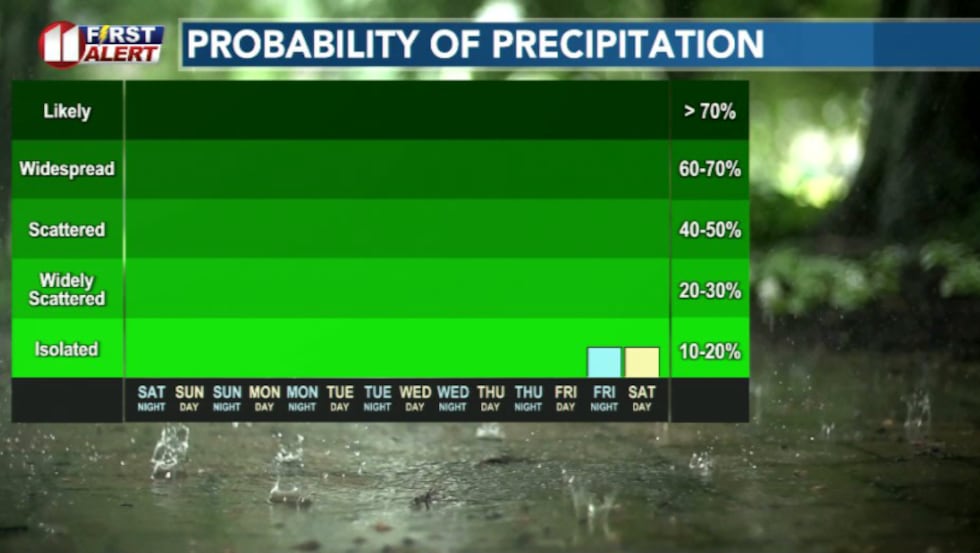 Rain chances this week(KCBD)
The jet stream keeps steering storms systems away from us, so these fronts are mostly dry. That means no meaningful rain or snow to help ease the dry conditions across the region.
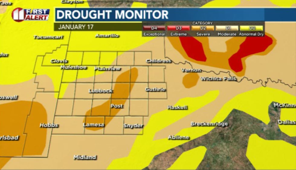 Drought conditions as of 1/17/26(KCBD)
Which is why fire danger is something to look out for even in colder weather, particularly when the winds kick up.
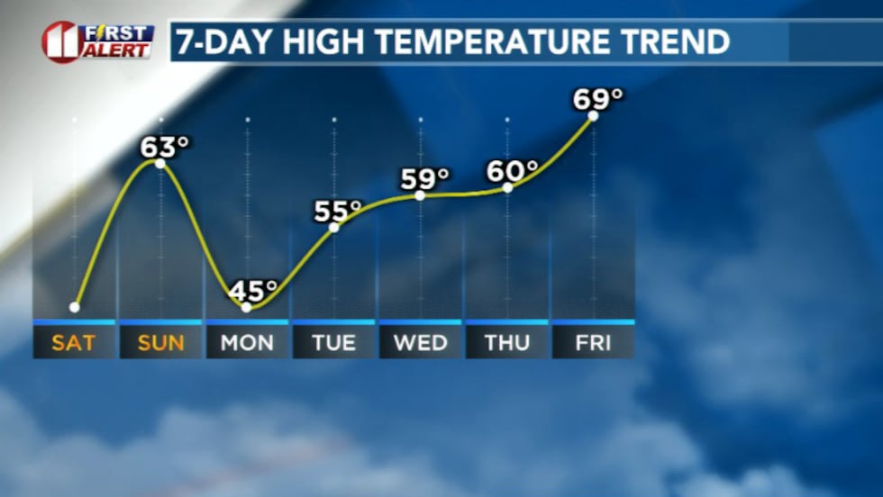
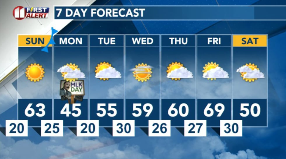 7 Day Forecast(KCBD)
Copyright 2026 KCBD. All rights reserved.