
Central Texas woke up to a widespread freeze Sunday morning, marking just the second freeze of the season for Austin’s main weather station at Camp Mabry. On average, Austin records about a dozen freezing mornings each winter, putting this season well below normal so far.
However, with arctic air outbreaks still possible through February, the number of freeze days could climb quickly, something many Texans remember all too well from the historic February 2021 freeze five years ago.
After the brief morning freeze, temperatures on Sunday will nudge up slightly as winds shift and come out of the south and southwest. The afternoon will top out in the upper 50s to low 60s, which is near normal for mid-January.
The Martin Luther King Jr. holiday will begin with clear skies, south winds and temperatures above freezing, with most predawn readings in the mid-30s. Clouds will increase throughout Monday in response to another cold front traveling across the state. Temperatures will climb into the lower to mid-60s.
Monday’s front will initially come through dry, but it will enhance our next weather maker coming midweek. That system will bring our best rain coverage and rain chances we’ve had since before Thanksgiving.
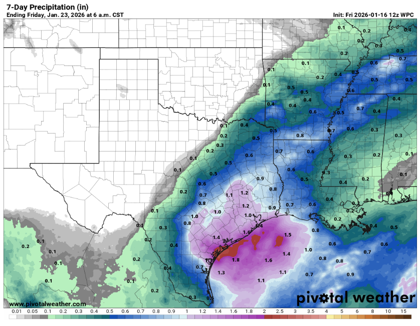
The next storm system is expected to move in from the Pacific Ocean, and track through Mexico before arriving in Texas. Spotty showers could develop as early as Tuesday morning near Del Rio and across parts of the Hill Country. They could gradually spread east and northeast into the Interstate 35 corridor by Wednesday morning.
“For now, it appears the best opportunity for rain will occur Wednesday afternoon and evening over the Coastal Plains region where moisture levels and stronger warm air advection will align,” meteorologists from the National Weather Service wrote in their forecast discussion. “Rain chances will largely shift east of the region Thursday, with expected total rainfall amounts ranging from near 0.25 inch along I-35 to near 1 inch in the coastal plains.”
Temperatures initially behind the front will be cooler than normal on Tuesday with the morning starting out in the 30s and the afternoon in the 50s. Then once the rain begins, temperatures will quickly climb with highs nearing 70 degrees by Thursday and Friday.