
AUSTIN, Texas – Early indications from long range computer weather models are hinting at a wintry mix threat for the weekend.
What we know:
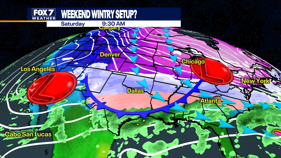
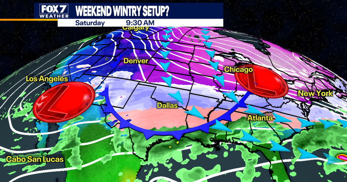
An Arctic front is scheduled to arrive on Friday.
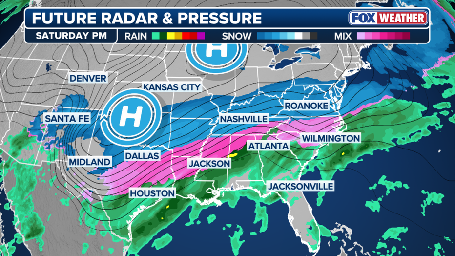
At the same time, a Western Low will pump in moisture from the Pacific and push it above the cold air. This interaction will create clouds and more precipitation.
If it is cold enough, the cold rain could transition into freezing rain in the middle of the weekend.
What we don’t know:
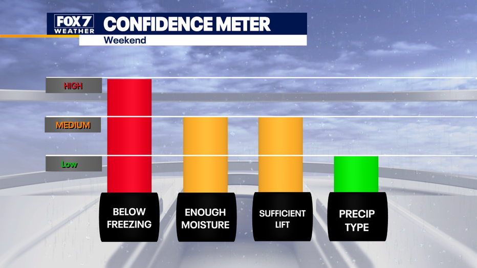
The forecast is not set in stone yet since it is six days away.
Confidence is high we will have freezing weather and precipitation but low confidence on timing and type of precipitation.
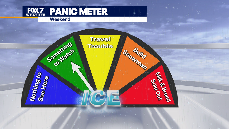
The panic meter is on something to watch.
We have plenty of time to fine tune the forecast and iron out the details.
Dig deeper:
 Across Texas
Anyone who has travel plans in Texas this week should pay close attention to the forecast as the winter storm impacts could be widespread.
While specifics on rain, snow, sleet and freezing rain are limited at this time, the dramatic drop in temperatures is much more certain.
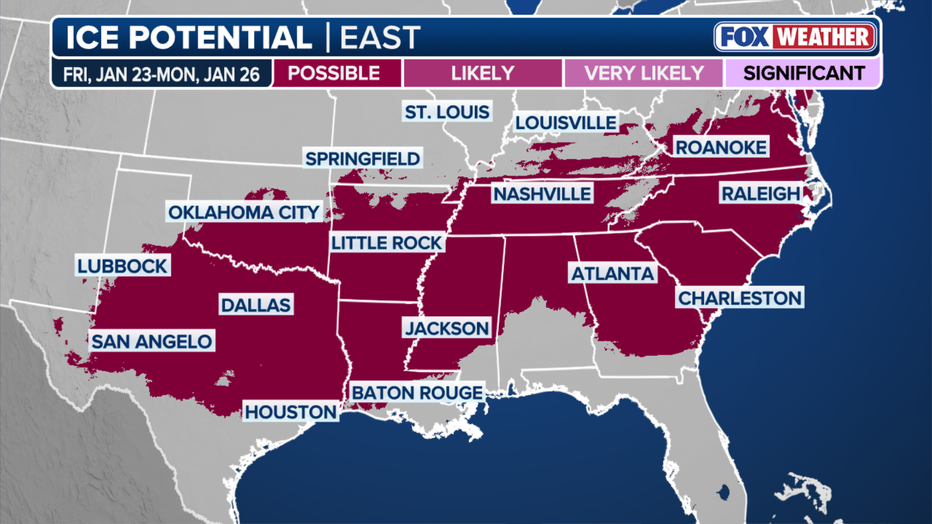
Wintry weather could be seen across a large swath of Texas, as temperatures go from about 15 degrees above average for some places to as much as 30 degrees below average in the span of a day.
Bottom line for Texans, keep tabs on the weather forecast as details come into focus.
What you can do:
Track your local forecast for the Austin area quickly with the free FOX 7 WAPP.
The design gives you radar, hourly, and 7-day weather information just by scrolling.
Our weather alerts will warn you early and help you stay safe.
The Source: Information from meteorologist Zack Shields, FOX Weather and Aaron Barker.