Dallas Fort-Worth and surrounding area could see a mixed bag of winter weather precipitation in the coming days. Let’s talk about the “why” behind the forecast.
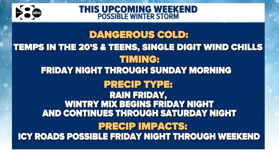
DALLAS — The first winter storm of the season is expected to hit North Texas this coming weekend.
It’s still several days out, so the details aren’t firm and very well could change.
But here’s what we know: An arctic cold front will sweep through early on Friday. It’s a true arctic front, too, and it will send temperatures across the region tumbling down throughout the day before settling in for the weekend.
Temperatures will drop to around freezing Friday night, and they may not rise above 32 degrees again until sometime Sunday afternoon. But they could drop again after that; it’s possible we won’t see stable, above-freezing temperatures around here until midday Monday.

Keep in mind, the timing of this could all change.
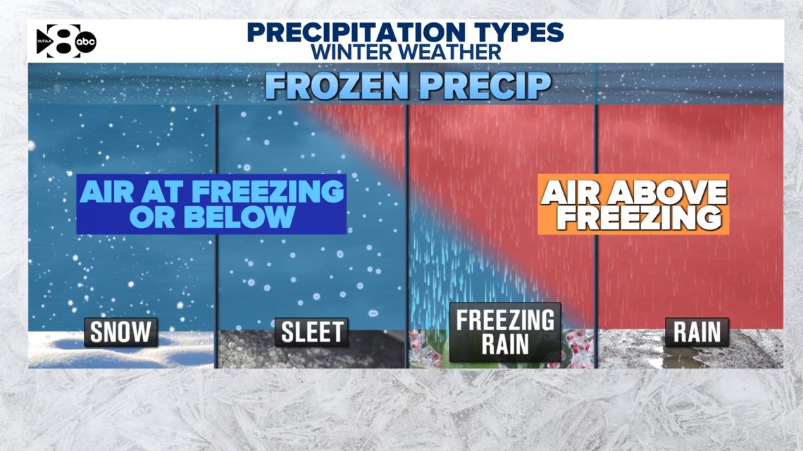
But the timing also plays an important role in the types of precipitation we could see, each of which is unique from the others.

Rain will start things off
Temperatures will begin in the 40s early Friday morning. As things look now, the arctic cold front will first arrive in the area sometime Friday morning, with temperatures staying above freezing until closer to midnight Friday night. With temperatures comfortably above 32 degrees for most of the day, any precipitation that we get on Friday will be just a plain cold rain.
Freezing rain then follows
As the colder air filters in on Friday night into Saturday morning, we will see the transition from rain to freezing rain as the different levels of the atmosphere cool from top to bottom.
Sleet could then slide in
During the day Saturday, the precipitation falling may still be fighting through a shallow layer of warm air aloft. This precipitation would fall as a wintry mix that could include freezing rain and sleet.
Settling into snow (maybe)
Once all layers of the atmosphere become cold enough, the precipitation will then transition over to snow. Because we have been so relatively warm lately, the window of opportunity for us to see freezing rain and sleet on Saturday may last longer than our chance of snow by Saturday evening. Keep in mind, too, that ground temperatures are still well above freezing, so that could at least initially keep roads from becoming slick too fast.
Ice to end things off?
A flurry or two will be possible early Sunday morning, but the forecast for most of the day looks dry for the time being. Really, at this point, Sunday looks to be all about the cold. Temperatures will still struggle to make it to freezing in the afternoon. So: If roads do become slick on Saturday, we could still see slick spots on Sunday — and staying that way until the temperatures rise.