
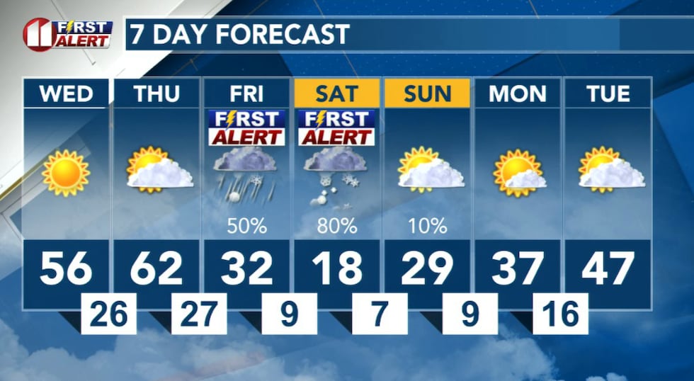
LUBBOCK, Texas (KCBD) – A potent winter storm is set to impact the entire forecast area this weekend, bringing significant snow and ice accumulations along with dangerously cold temperatures. But before that system arrives, the region will experience two relatively quiet days.
Wednesday and Thursday: Calm Before the Storm
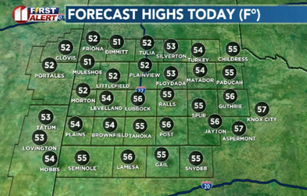
Wednesday will remain mild and quiet with typical winter conditions. A cold front has moved through with breezy winds behind it, but temperatures will remain manageable. Winds will decrease to 10 mph or less by midday, then shift to the south after sunset.
 KCBD(KCBD)
Thursday continues the mild pattern with quiet conditions expected throughout the day. This will be the last day of relatively comfortable weather before the arctic front arrives early Friday morning with the winter storm system.
 KCBD(KCBD)Friday Through Sunday: Winter Storm Impacts
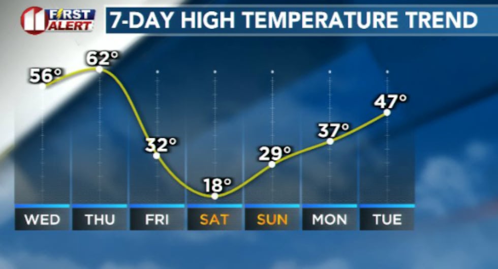
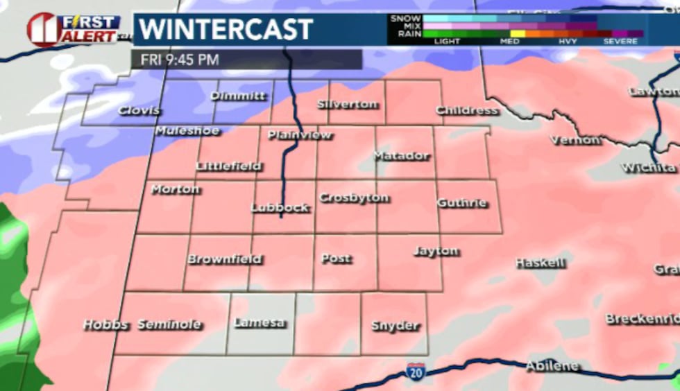
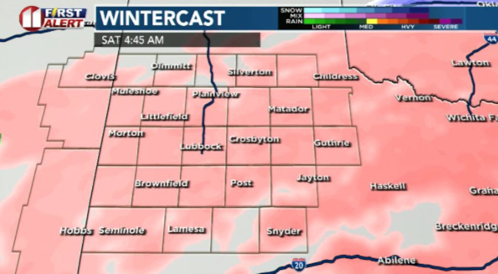
A potent winter storm will impact the entire forecast area from late Friday through early Sunday morning. The KCBD/Fox34 First Alert Weather Team has designated Friday and Saturday as First Alert Weather Days.
 KCBD(KCBD)
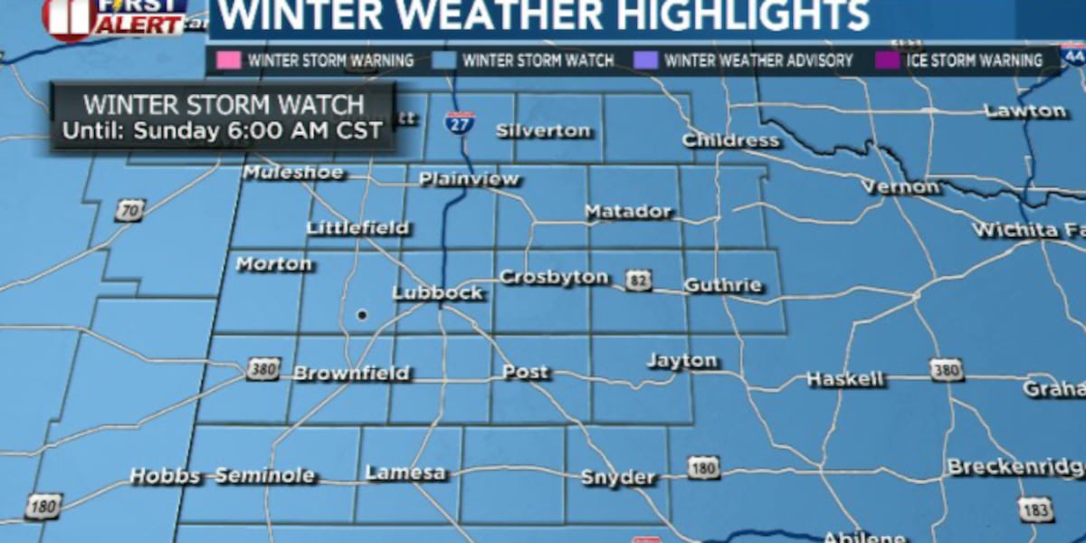
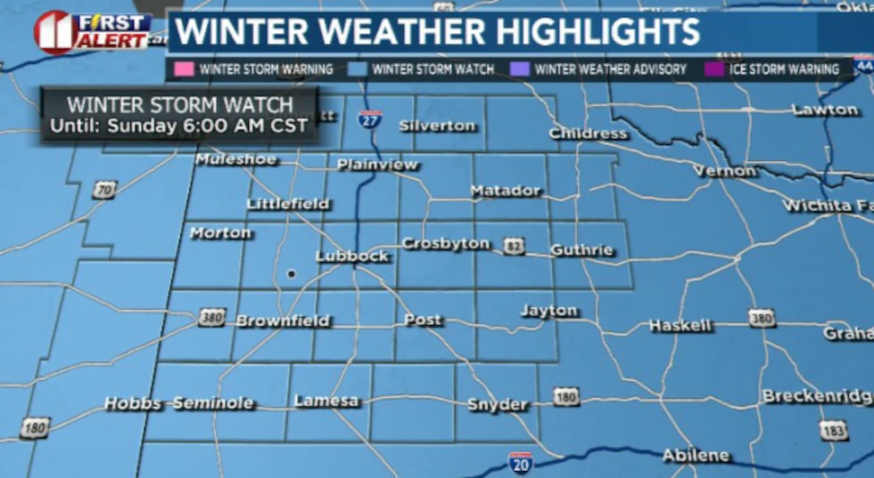
The National Weather Service has issued a Winter Storm Watch for the entire region during this timeframe.
Accumulating snow and freezing rain are expected throughout the period, though exact amounts remain uncertain as forecasters work to pinpoint where and when precipitation transitions from freezing rain to snow.
 KCBD(KCBD)
Travel will likely become very difficult from late Friday through early Sunday. There is a high chance of more than an inch of snow across the region, and a medium to high chance of accumulating ice from freezing rain.
 KCBD(KCBD)Extreme Cold This Weekend
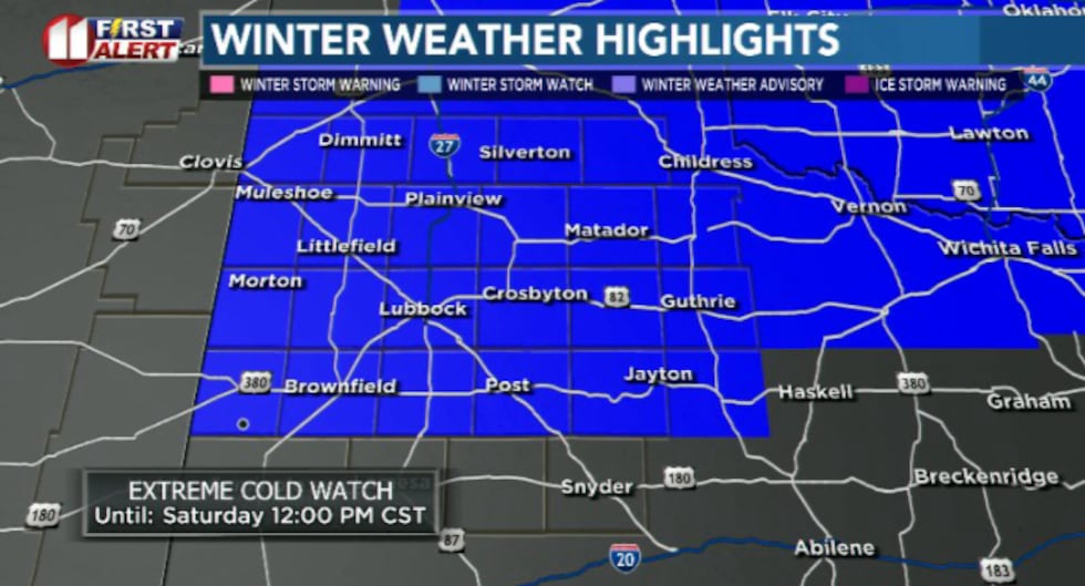 KCBD(KCBD)
The weekend won’t just bring snow and ice—dangerously cold temperatures will accompany the storm. An Extreme Cold Watch is in effect for the entire area from midnight to noon Saturday.
 KCBD(KCBD)
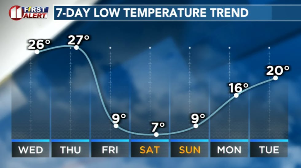
Wind chills are expected to plunge as low as 15 degrees below zero Friday night into Saturday morning, making it the coldest wind chills of the winter season so far. Morning lows will dip into the single digits Saturday and Sunday.
We will continue to update you with specific information about snow and ice accumulation amounts in the coming forecast cycles.
 KCBD(KCBD)
Copyright 2026 KCBD. All rights reserved.