
Current watches and warnings | Submit your weather photos and videos | Closings and delays | TXDOT driving conditions
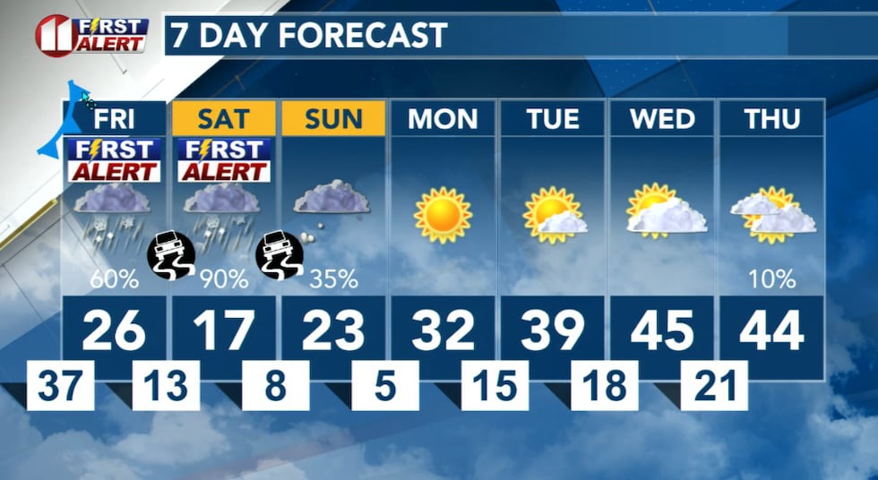
LUBBOCK, Texas (KCBD) – Friday and Saturday are First Alert Weather Days due to anticipated significant cold as well as ice and snow.
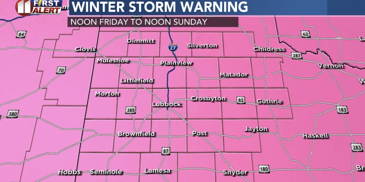
Winter Storm Warning
The National Weather Service has issued a winter storm warning for Lubbock and the South Plains, in effect from Noon Friday to Noon Sunday. The warning here is for total sleet and snow accumulations of more than four inches, along with some icing.
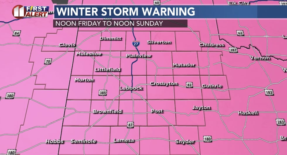 Winter storm warning for Lubbock and the South Plains Friday through Sunday.(KCBD)
Roads will become slick and hazardous, and travel may be extremely difficult if not dangerous. The hazardous conditions could impact the Friday evening commute.
Power outages and tree damage are possible.
Showing how widespread winter weather will be, warnings as of Thursday evening extend from near Albuquerque to San Angelo, Dallas-Fort Wort, Oklahoma City, Wichita, Memphis TN and points eastward.
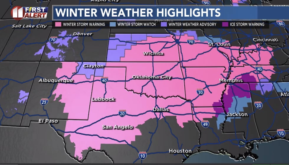 Alerts as of Thursday afternoon(KCBD)The Timing
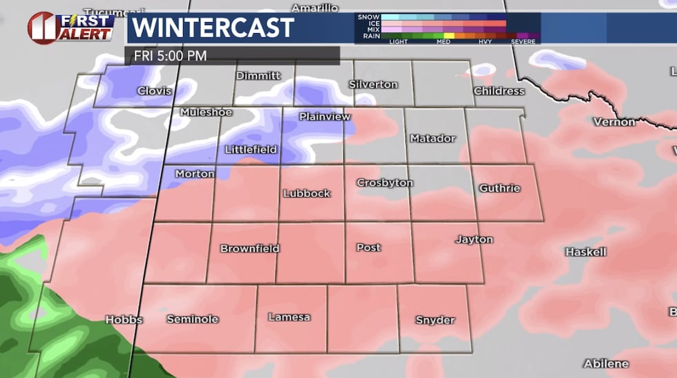
Some drizzle or light rain is possible mid-day Friday. The temperature will be dropping through the day, from upper 30s early to mid 20s by the afternoon, with a gusty northeast wind. Below is just one computer model’s projection. We are reviewing all the data this afternoon, refining the forecast as new data arrives.
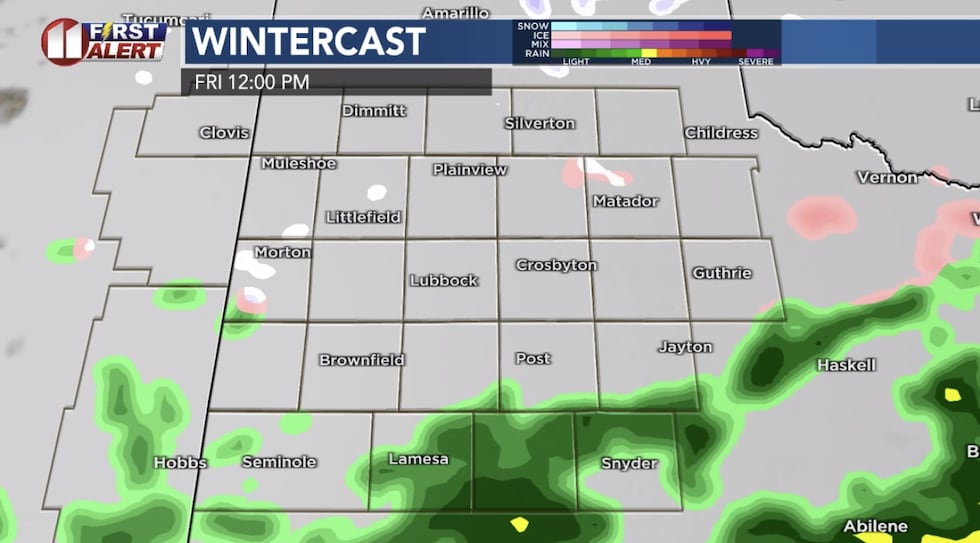 Computer model projection Friday mid-day(KCBD)
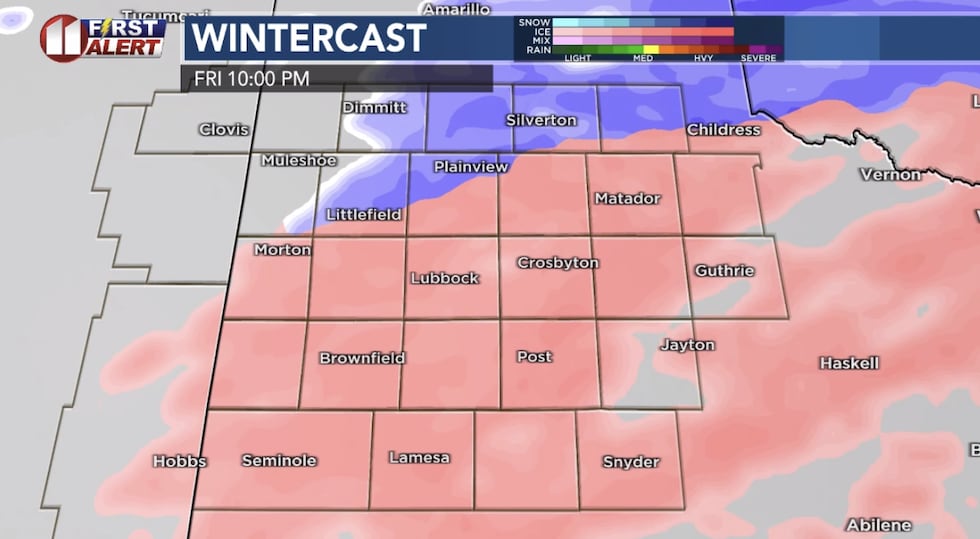
As it gets colder, some of the rain may begin to freeze on surfaces. That’s depicted by the pink coloring on the map below.
 Computer model projection Friday evening(KCBD)
It won’t instantly freeze on surfaces, but icing becomes more likely later Friday night.
 Computer model projection Friday night(KCBD)
Saturday morning there will likely be a break in the showers, followed by a change to snow during the day Saturday.
Type and Amounts
Significant ice accumulations, perhaps around a quarter inch or more in some locations, are possible. This of course would make driving or even walking outside treacherous.
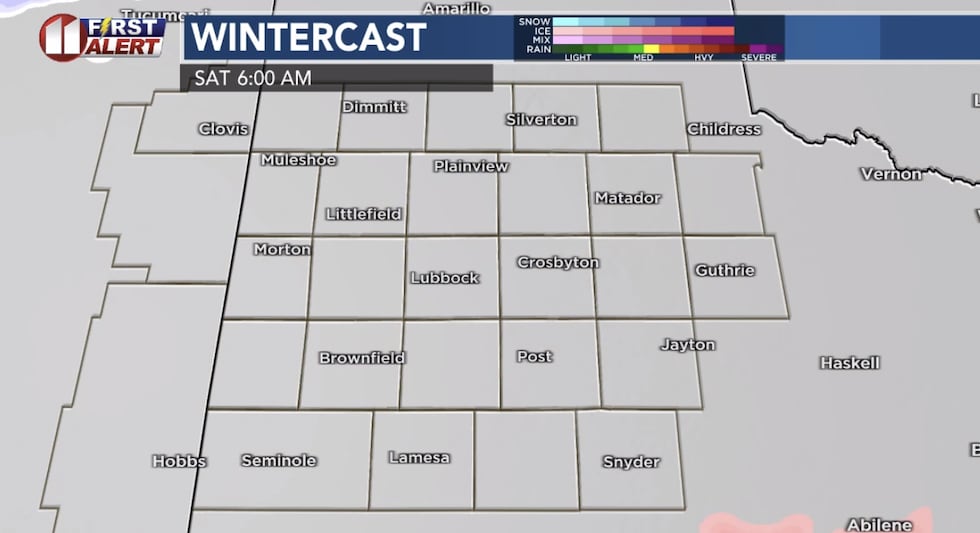 Computer model projection Saturday morning(KCBD)
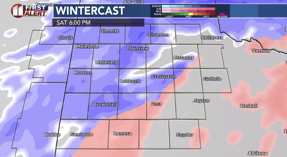
A change over to snow is expected during the day Saturday, from northwest to southeast.
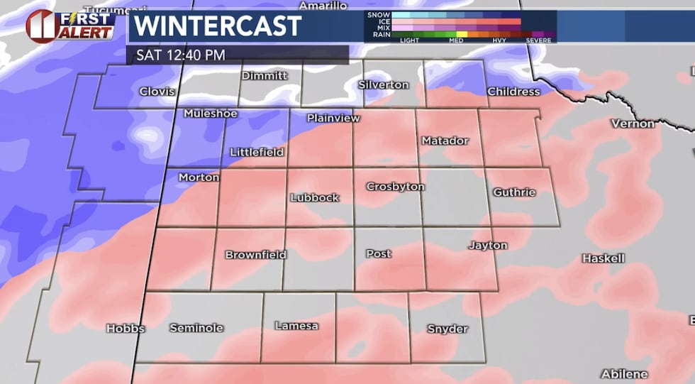 Computer model projection mid-day Saturday(KCBD)
An earlier change over to snow would result in snow falling longer and and therefore greater amounts. A later change over would mean a shorter time frame for snow to accumulate.
 Computer model projection Saturday evening(KCBD)
By late Saturday, through early Sunday morning, the snow may become heavy at times.
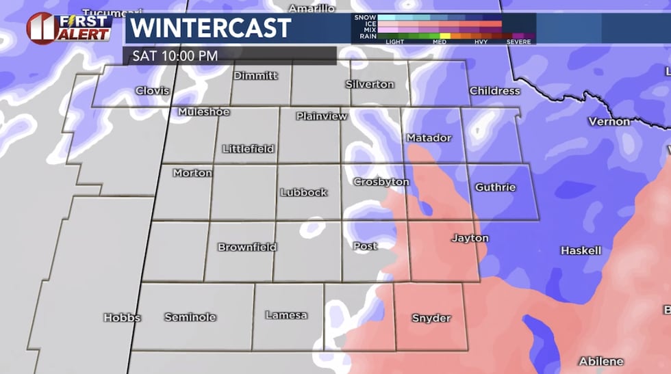 Computer model projection Saturday night(KCBD)
Depending on when the changeover occurs, significant snow totals may occur.
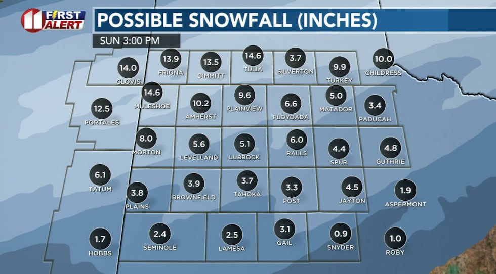 These totals are only estimates and serve as a rough guide.(KCBD First Alert)
Amounts may range from 1 to 3 inches in the southeastern viewing area to as much as 10 or more inches in the northwestern viewing area. At this point, 4 to 6 inches continues to look possible in central areas, including Lubbock.
 Computer model projection early Sunday morning(KCBD)
Travel is being discouraged in the viewing area and across the region this weekend.
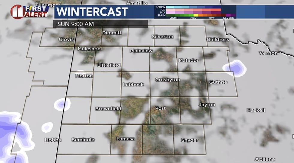 Computer model projection Sunday morning(KCBD)
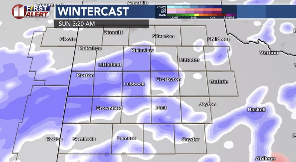
The snow showers will end by around midday Sunday.
Dangerous cold
Extremely cold temperatures are expected over the weekend with morning lows in the single-digits and teens Saturday morning and single digits Sunday morning. Wind chills as low as 15 below zero are possible each morning.
Preparing for Extreme Cold
This will be the first time we experience sub-zero wind chills this season. Plan to reduce time outdoors and take proper precautions to avoid frostbite and hypothermia if you do need to be outside. Dress in layers with a waterproof outer layer, cover exposed skin, and limit outdoor exposure.
What You Can Do
Hopefully, you’ve prepared for the weekend weather. Time is running out to prepare your home and vehicles. Make sure you have your essentials, such as medications and groceries before Friday afternoon.
Charge all devices and have flashlights and batteries ready. Check on elderly neighbors and family members throughout the weekend.
Avoid travel this weekend if possible because conditions will be dangerous. Ensure heating systems are working properly. Bring pets indoors and protect outdoor animals.
Looking Ahead
Dry weather returns early next week, but temperatures will remain below normal.
 Extreme cold and significant wintry showers this weekend!(KCBD First Alert)
As this system approaches, we’ll continue to monitor the timing and intensity of the winter storm and provide detailed forecasts throughout the week.
Copyright 2026 KCBD. All rights reserved.