
LUBBOCK, Texas (KCBD) – Current Watches and Warnings | Submit your weather photos | Closings and delays| TXDOT Driving Conditions | Lubbock Airport Flights | City of Lubbock updated links
See live radar and road conditions here: WATCH LIVE: Radar and live feed of road conditions in Lubbock
This morning at 6 a.m., temperatures ranged from 5 degrees in Swisher County to 14 degrees in Gaines County.
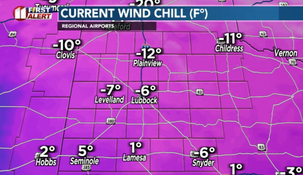
Even more concerning are the current wind chills, which range from minus 5 to minus 15 degrees. At these levels, frostbite can occur in as little as 30 minutes on any exposed skin while outside.
 KCBD(KCBD)Today’s Conditions
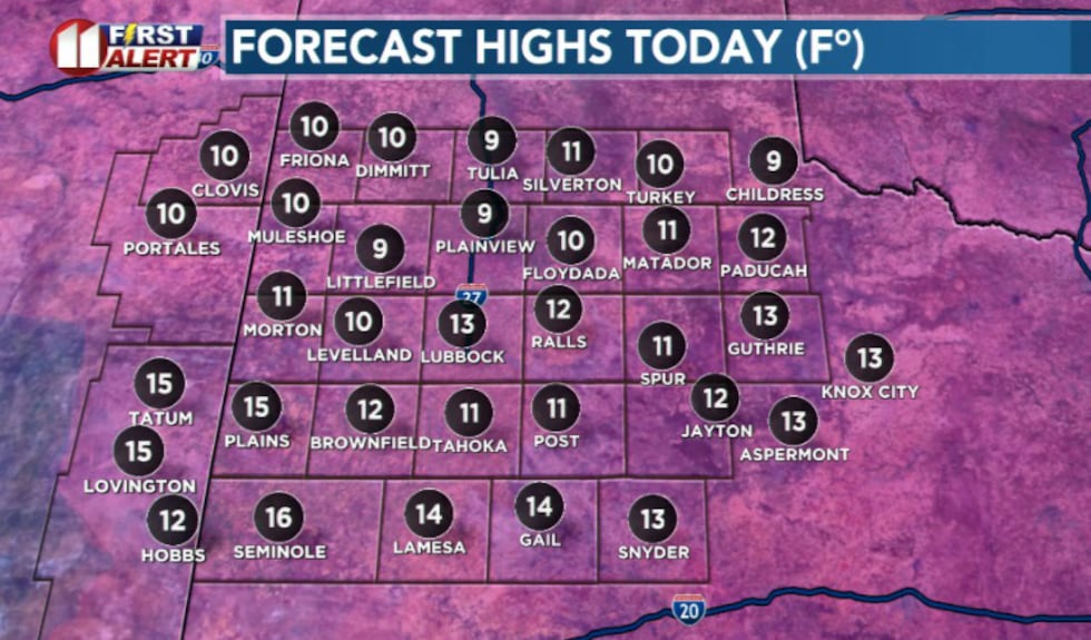
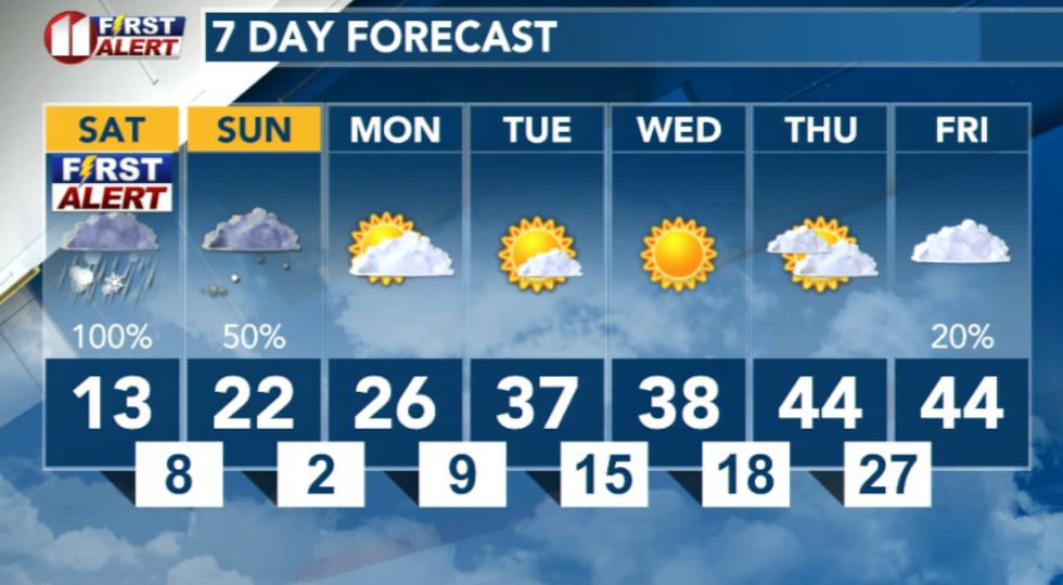
With overcast skies and continued northeast winds, temperatures will not warm much at all through the rest of the day. Highs this afternoon are forecast to range from the upper single digits in northern zones to the mid teens in southern zones.
 KCBD(KCBD)
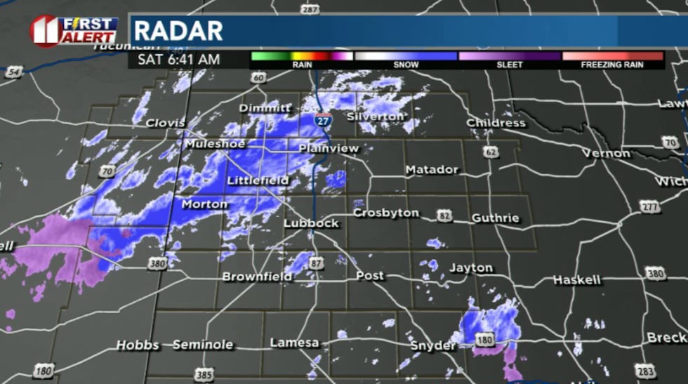
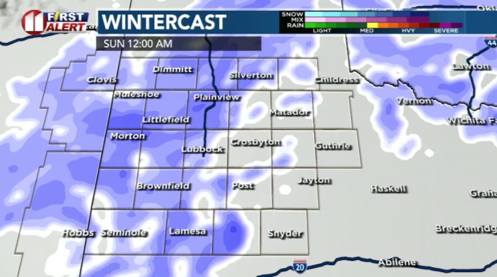
Light snow will continue on-and-off through the morning, with a brief break in precipitation expected around midday before snow resumes this afternoon.
 KCBD(KCBD)Tonight Into Sunday Morning
Any lingering mixed precipitation will become all snow this evening, with periods of heavy snow expected tonight through early Sunday morning.
 KCBD(KCBD)
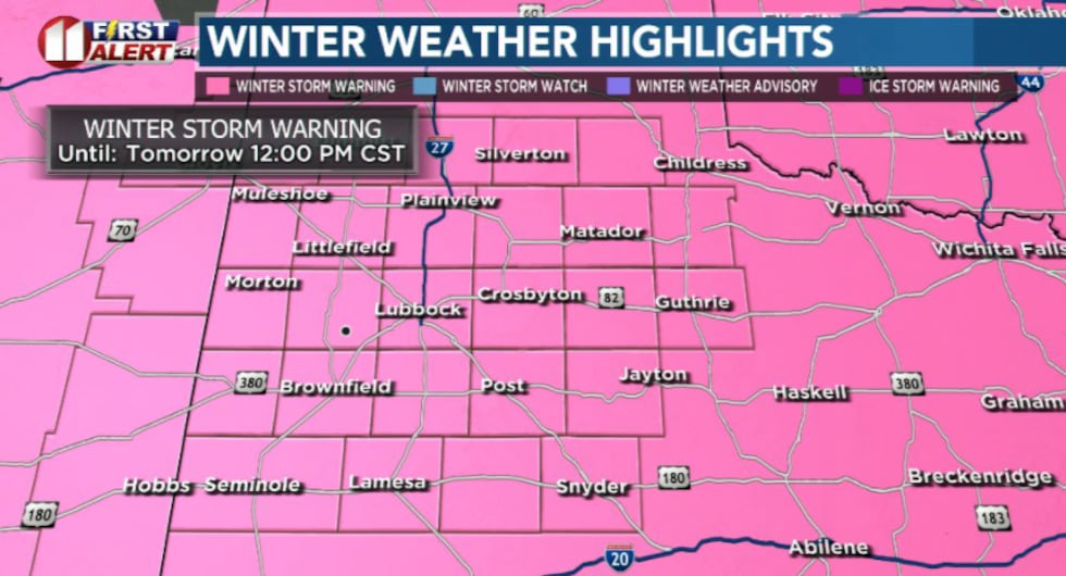
Heavy snow is expected across much of the region. Accumulations of 4 to 8 inches will be most common, with some locations seeing up to 12 inches. A Winter Storm Warning is in effect for the entire area until noon Sunday.
 KCBD(KCBD)
Travel conditions will be very dangerous through the rest of this weekend across the region, and travel is strongly discouraged.
The Extreme Cold Threat
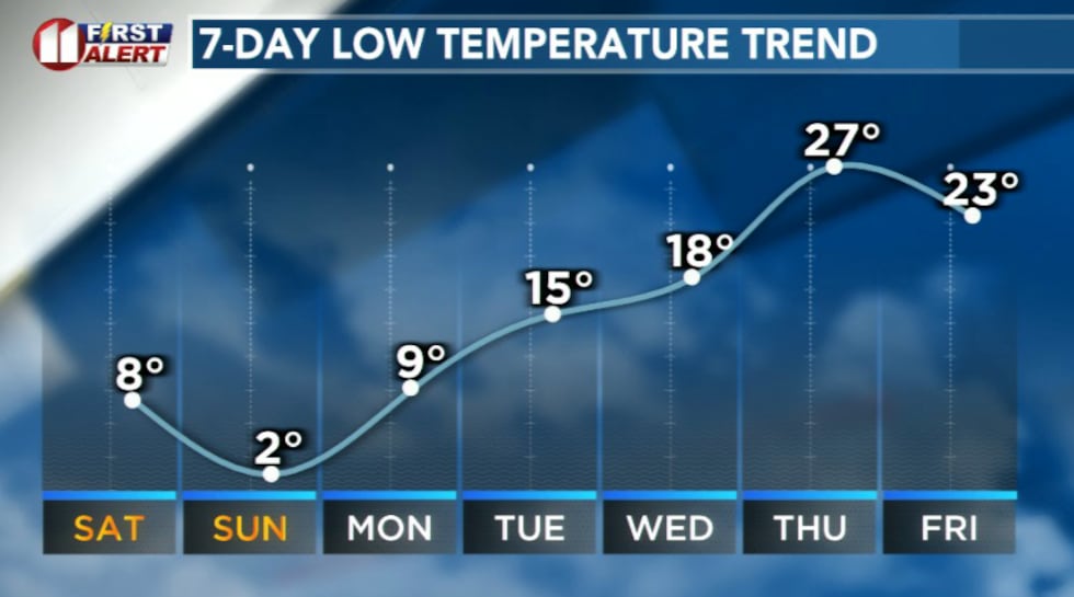
Very cold temperatures are expected this weekend with wind chills as low as 15 below zero today through Sunday morning. Conditions will worsen further on Monday morning, when wind chills could drop as low as 20 degrees below zero. An Extreme Cold Warning is in effect for the entire area through Monday morning.
 KCBD(KCBD)
At these dangerous wind chill levels, frostbite and hypothermia are serious threats. Reduce time outdoors, and take the proper precautions to avoid frostbite and hypothermia if you do need to be outside.
What You Should Do Now
Avoid unnecessary travel, especially overnight Saturday into Sunday morning when snow will be heaviest and roads will be most dangerous. If you must be outside, limit your time and wear multiple layers of warm clothing, including a hat, gloves, and face protection to prevent frostbite. Bring pets indoors and ensure livestock have adequate shelter and water. The combination of heavy snow and life-threatening wind chills makes this a serious weather event.
 KCBD(KCBD)
Copyright 2026 KCBD. All rights reserved.