
Current watches and warnings | Submit your weather photos and videos | Closings and delays | TXDOT driving conditions | Lubbock Airport Flights | City of Lubbock updated links
LUBBOCK, Texas (KCBD) – Winter Storm Warning in effect until noon Sunday
Extreme Cold Warning in effect until noon Monday
This winter storm is continuing to unfold across the region.
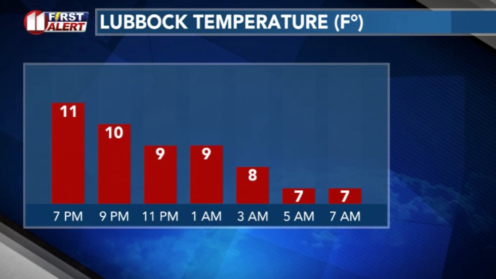
Right now, very cold Arctic air is locked in at the surface keeping temperatures in the single digits and roads slick across much of the area.
 Hourly(KCBD)
Light sleet and snow continues at times, and even when precipitation lets up, conditions don’t improve because it’s simply too cold.
Most of the region is facing sub-zero wind chills and will continue to do so through Sunday morning. With values ranging anywhere from -5 to -15 across the South Plains.
TONIGHT: as the main storm system moves closer overhead conditions deteriorate.
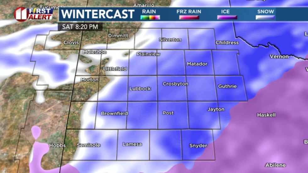 Wide spread snow and sleet(KCBD)
Precipitation becomes more widespread and transitions to mostly snow. Once that change happens, accumulation increases much faster, and visibility drops quickly during heavier snow bands.
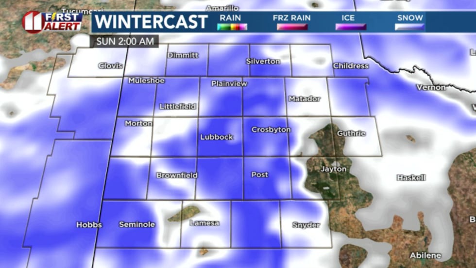 Heavy snowfall overnight(KCBD)
Snowfall rates could briefly reach 1 to 2 inches per hour overnight and visibility may be reduced to near zero at times. This will make travel difficult and, in some cases, impractical.
Sunday: By Sunday morning, many locations will have picked up several inches of snow. Some areas south and west could see higher totals, while areas farther east may see slightly less.
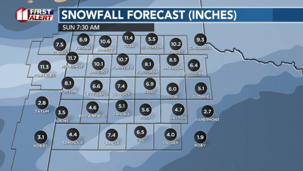 Potential snow totals across the region Sunday morning(KCBD)
Accumulations of 4 to 6” will be most common. But don’t be surprised if there are heavier accumulations closer to 10” locally.
Whether sleet or snow dominates early on, travel impacts remain significant. Sleet tends to compact into a hard, slick surface, while snow accumulates faster and reduces visibility. Either scenario will lead to dangerous driving conditions.
 Snow tapers off(KCBD)
Snow gradually tapes off Sunday afternoon, but dangerously cold temperatures remain. Overnight lows Sunday will fall into the single digits or below zero by Monday morning.
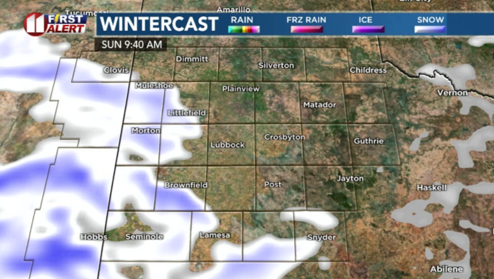
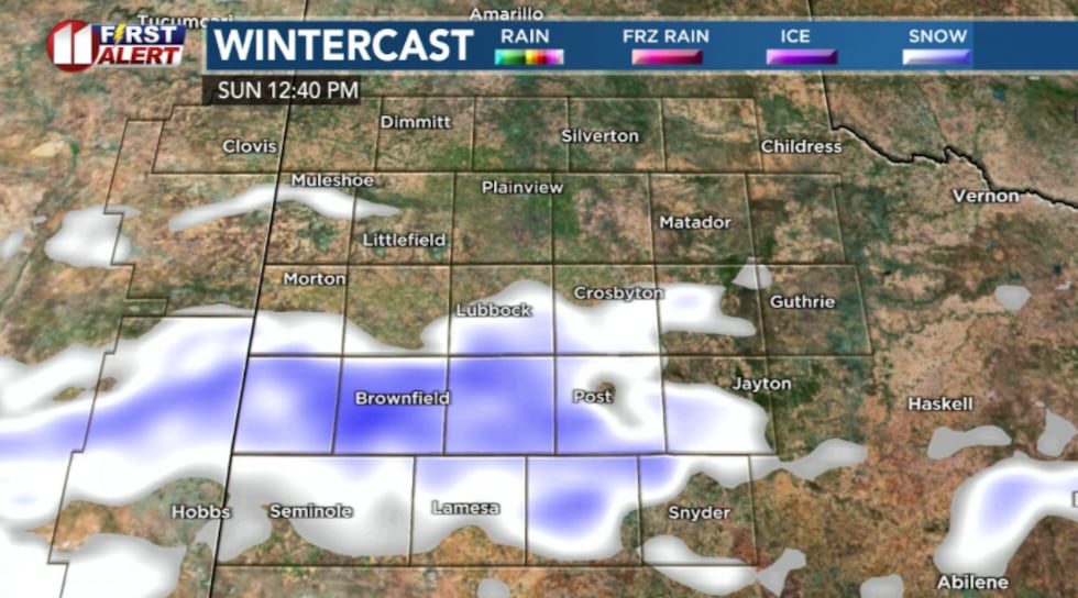 Sunday could see some hit or miss precipitation in the morning to early afternoon(KCBD)
That cold increases the risk of exposure if any travel problems occur.
The Extreme Cold Threat
Very cold temperatures are expected this weekend with wind chills as low as 15 below zero today through Sunday morning.
Conditions will worsen further on Monday morning, when wind chills could drop as low as 20 degrees below zero. An Extreme Cold Warning is in effect for the entire area through Monday morning.
At these dangerous wind chill levels, frostbite and hypothermia are serious threats. Reduce time outdoors, and take the proper precautions to avoid frostbite and hypothermia if you do need to be outside.
What You Should Do Now
Avoid unnecessary travel, especially overnight Saturday into Sunday morning when snow will be heaviest and roads will be most dangerous. If you must be outside, limit your time and wear multiple layers of warm clothing, including a hat, gloves, and face protection to prevent frostbite. Bring pets indoors and ensure livestock have adequate shelter and water. The combination of heavy snow and life-threatening wind chills makes this a serious weather event.
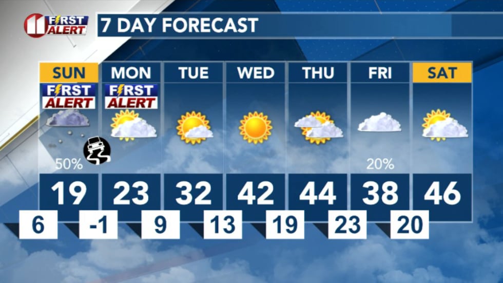 7 Day Forecast(KCBD)
Copyright 2026 KCBD. All rights reserved.