

Current watches and warnings|Submit your weather photos and videos |Closings and delays|TXDOT driving conditions|Lubbock Airport Flights|City of Lubbock updated links
LUBBOCK, Texas (KCBD) – Today and tomorrow are First Alert Weather Days because of how cold it will stay. Our crews driving around Lubbock have reported roads are snowy and slick, but driveable. If you do need to head out, please give yourself plenty of extra time. And give extra space to first responders and crews treating the roads. Safest approach is to stay home today.
Snowfall reports
We’ll get more reports in through today. The radar estimate shows heavier snow fell across the northwestern part of our area.
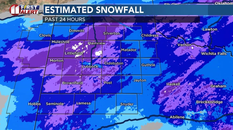 Snowfall estimate based on radar data(KCBD)
According to the National Weather Service, 4″ of snow has fallen at the Lubbock International Airport. 2.4″ of snow/sleet has been measured at the NWS office off the South Loop.
Other reports thus far include 3″ at Wolfforth, 4.3″ at Plainview, 5.5″ at Silverton, little more than 4″ at Turkey.
We also had a viewer send us a video measuring 6″ of snow at Earth, Texas, in Lamb County. There were a few other reports on Facebook of more than 10″ snow in Swisher County.
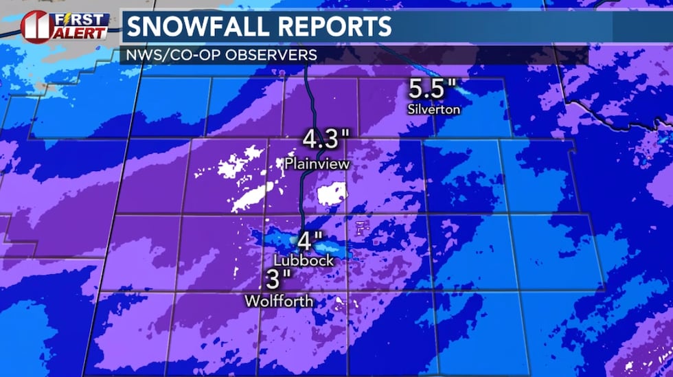 Snowfall reports as of Sunday morning(KCBD)Snow shower timing
There will be a little bit more snow moving across the area through this morning, showers moving from west to east. These should be fairly light, but could add another 1/2″ of snow in some spots.
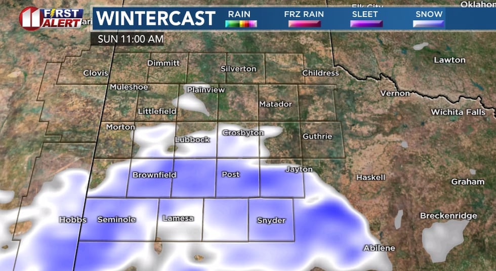 Computer model projection late Sunday morning(KCBD)
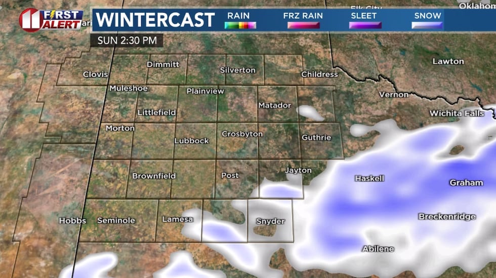 Computer model projection Sunday afternoon(KCBD)
Showers will end from west to east mid-day into early afternoon.
Very cold
While we should see some sun today, it won’t warm much. High today in the upper teens to low 20s.
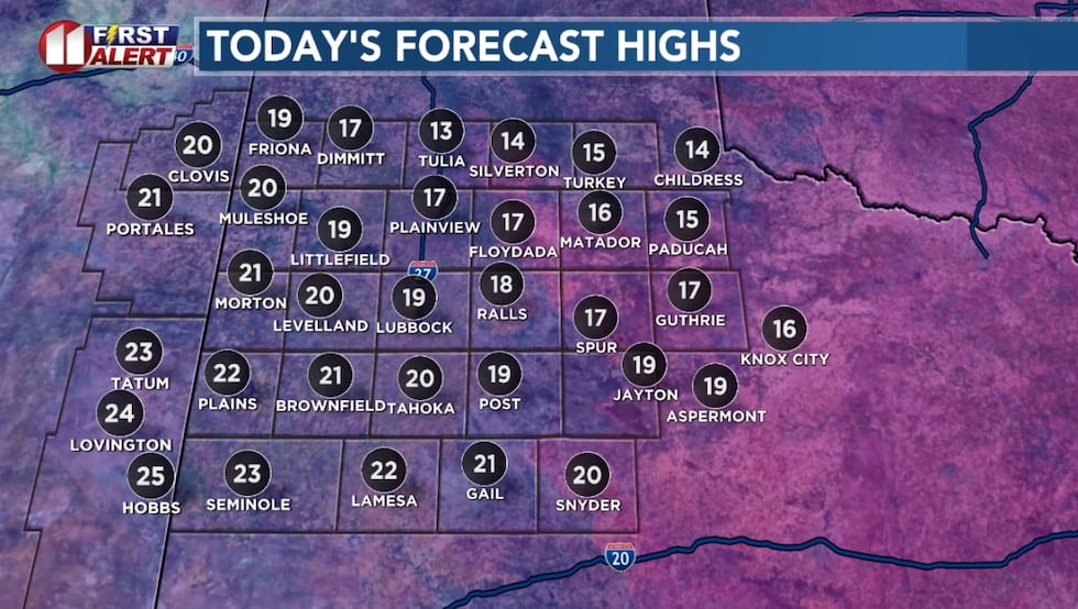 Forecast highs today(KCBD)
Tonight it will drop to around zero area-wide. We’re forecasting a couple degrees below zero in Lubbock. Where the heavier snow fell it will likely be even colder compared to the rest of the area, and that localized effect should continue into tomorrow.
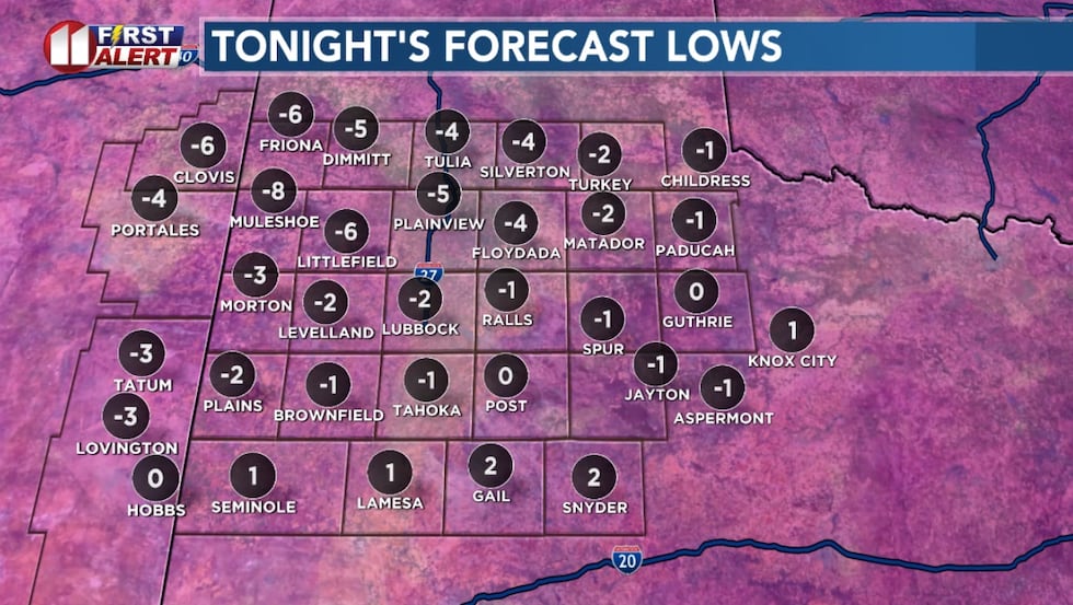 Forecast lows tonight(KCBD)
When you factor in a steading northerly wind, it will feel even colder. The wind chill will be in the single digits to low teens this aftenroon.
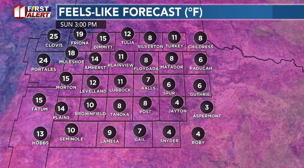 Sunday afternoon(KCBD)
Then tonight those numbers will go even lower. We have a First Alert Weather Day for tomorrow morning, because the wind chill will be around -5 to -15 to start the day.
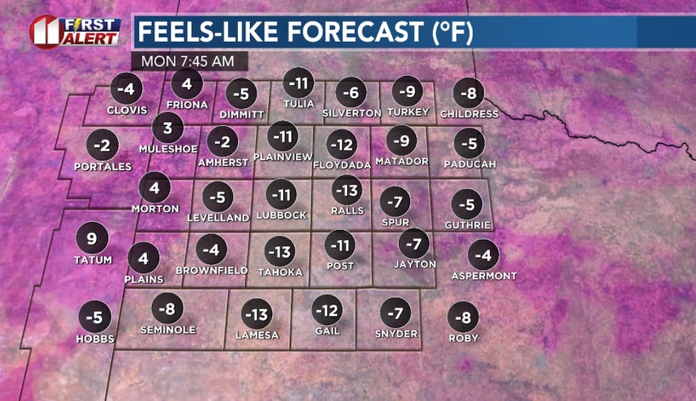 Monday morning(KCBD)
Tomorrow it will be sunny, high in the 20s. Single digit low again Tuesday morning, then we should finally climb above freezing Tuesday afternoon.
Still cold through this week.
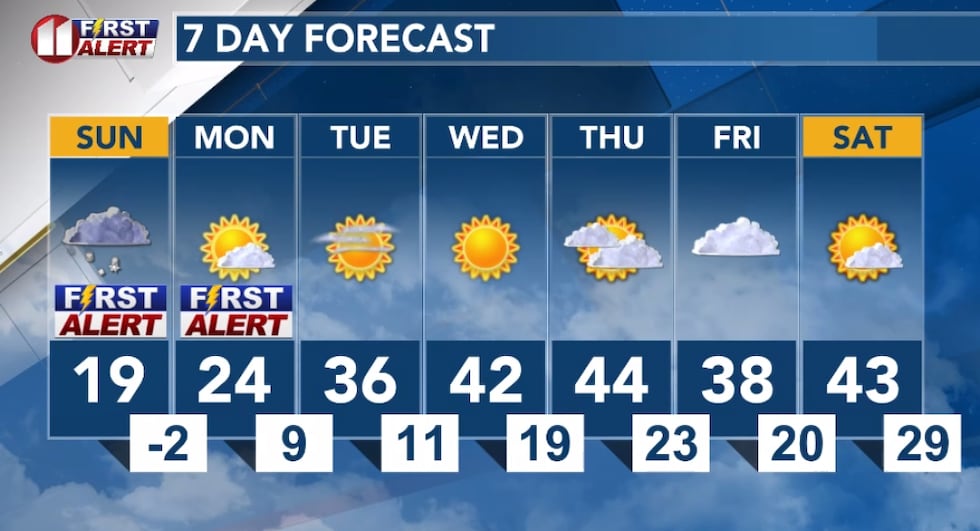 Lubbock 7-day forecast(KCBD)
Copyright 2026 KCBD. All rights reserved.