
Current watches and warnings | Submit your weather photos and videos | Closings and delays | TXDOT driving conditions | Lubbock Airport Flights | City of Lubbock updated links
LUBBOCK, Texas (KCBD) – Record snowfall for Lubbock and lows below zero expected over the South Plains.
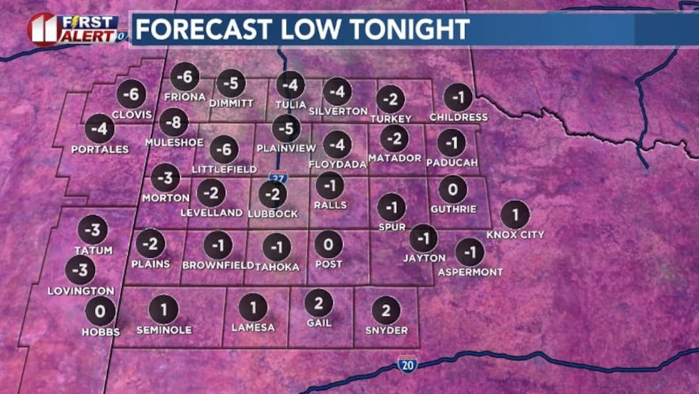
Low Sunday night will drop to below zero in Lubbock and over a large number of communities in the region. While winds will not be strong, there will be extremely low wind chill temperatures to start the week.
 Record snowfall for Lubbock and lows below zero expected over the South Plains.(John Robison | KCBD Graphic)
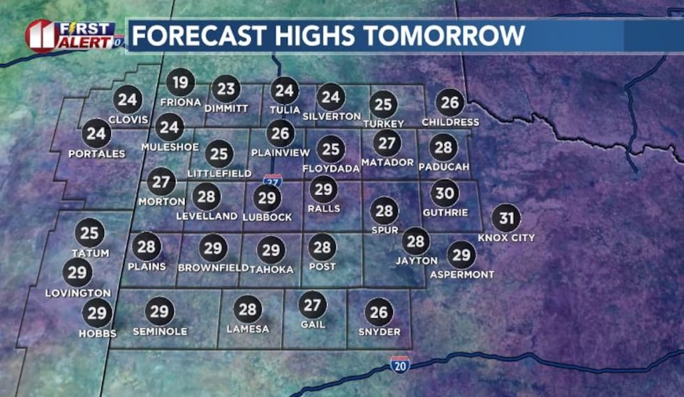
Afternoon highs will be well below normal on Monday, but still in the teens northwest to the 20s over the remainder of the region.
 Record snowfall for Lubbock and lows below zero expected over the South Plains.(John Robison | KCBD Graphic)
Following a morning low of 9 degrees on Sunday, there was just enough sunshine late afternoon for the afternoon temperature to climb to 20 degrees in Lubbock.
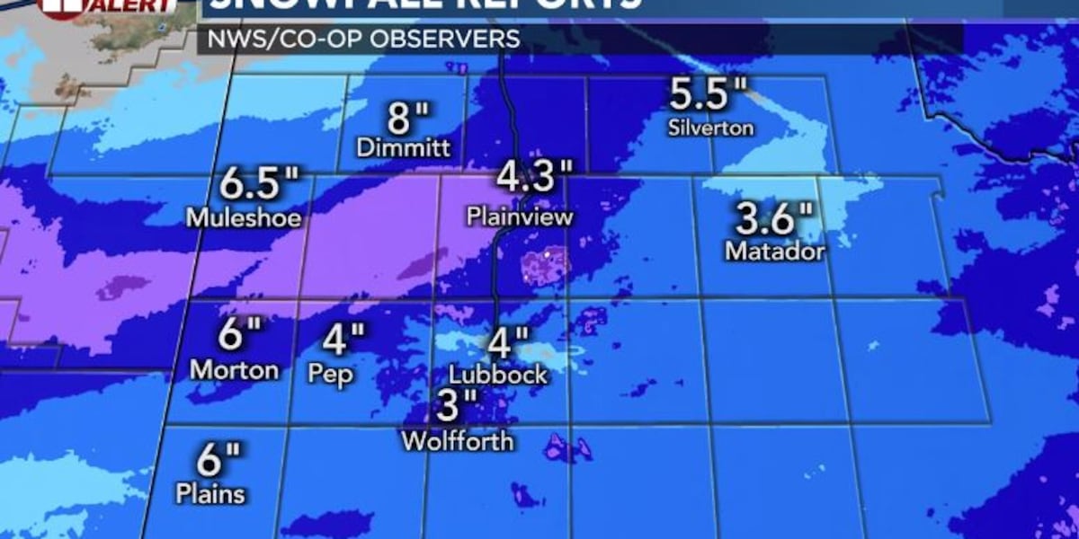
Snowfall included 4.4 inches reported by the Lubbock National Weather service for a new daily record amount.
 Record snowfall for Lubbock and lows below zero expected over the South Plains.(John Robison | KCBD Graphic)
Heaviest snow was in the northwest, with lower amounts to the south and southwest.
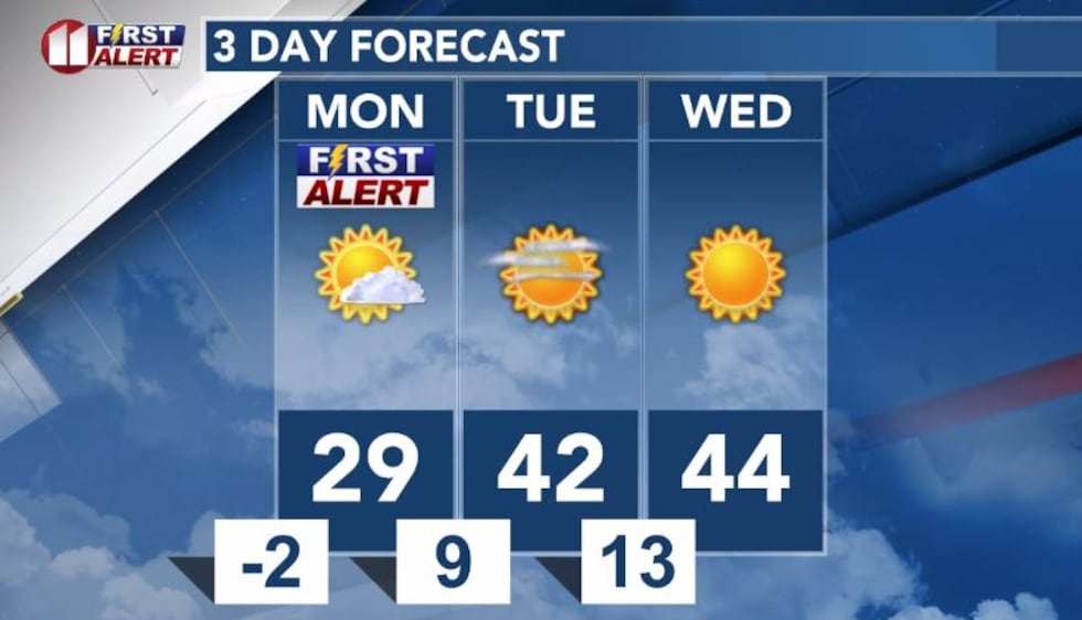
Looking ahead, freezing fog will be possible Monday morning, along with hazardous ice and snow-covered roadways and sidewalks.
With below zero low temperatures, even with sunshine, the roads will be slow to recover and will remain slick over much of the region through the day.
Limit travel if possible and remember that wind chill temperatures could be near or below zero through the morning.
Copyright 2026 KCBD. All rights reserved.