

 article
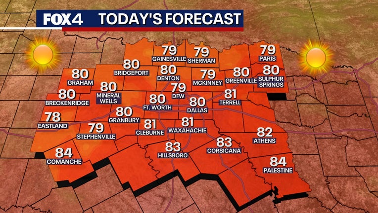
DALLAS – North Texas enters fall with a brief period of warm weather before shifting to more seasonal conditions this weekend.
Tuesday Forecast 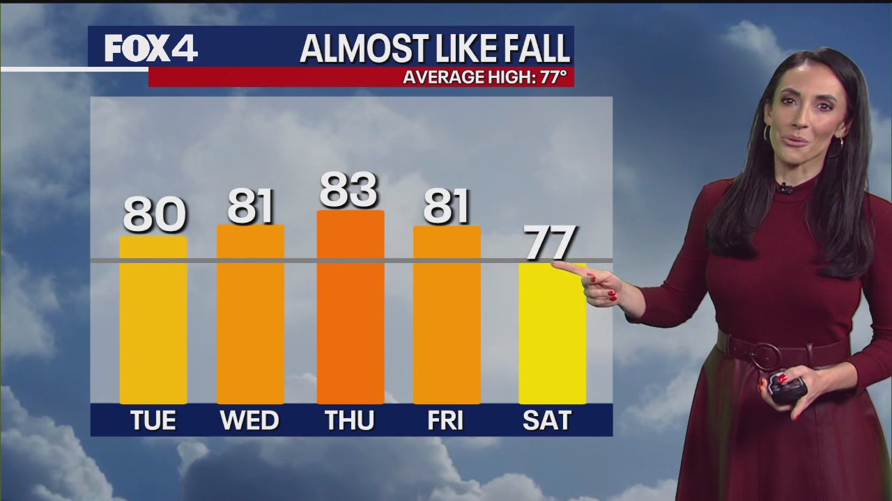
Morning storms are possible Tuesday morning, but expected to leave DFW drier this afternoon. Following the morning rain, warm and humid conditions will return. Tuesday night will be the coolest of the week, with lows in the 50s for the city and 40s in outlying areas.
Strong northerly winds behind our cold front keep temperatures about ten degrees cooler than yesterday. Those winds also keep the fire threat elevated Tuesday.
 Wednesday Forecast
Wednesday’s forecast is expected to be the most pleasant day of the week, with mostly sunny skies, dry air, and light winds. High temperatures will be near 80 degrees, slightly warm for late October.
7-Day Forecast: Weekend Storm Threat 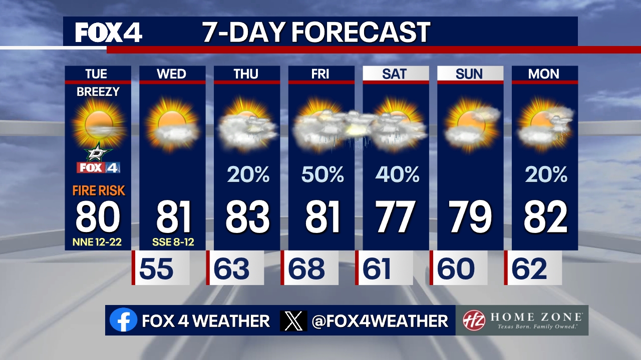
Thursday and Friday will see lots of humidity. Gusty south winds are expected Thursday with mostly cloudy skies. While a passing shower or isolated thunder is possible, widespread coverage is low. High temperatures will reach the low 80s.
Humid air continues to increase on Friday, bringing a chance for showers and storms, particularly in the afternoon and evening. The main threat is currently heavy rain with the potential for flooding, though a low-end risk for severe wind (up to 55-60 mph) and quarter-sized hail remains possible in the strongest storms.
Saturday will feel like fall with mostly cloudy skies and storms possible throughout the day.
The first significant cold front is forecast to cross overnight Saturday, bringing very dry air for Sunday. Sunday will be sunny and pleasant, with highs in the upper 70s to near 80 degrees, near the seasonal average.
After a cool night, the next weather system approaches Monday. Very dry air will remain in place, preventing rain, but strong southwest winds (30+ mph) will increase, quickly pushing temperatures back up to 90 degrees under sunny skies.
The Source: Information in this article comes from the National Weather Service.