
SAN ANTONIO – Changes are on the horizon this week as a Pacific storm system approaches, bringing the best rain chances the area has seen in nearly a month.
While dry, warm weather has dominated recently, rain chances increase Friday, especially Friday night, with the potential for 1–2+ inches of rainfall in some areas.
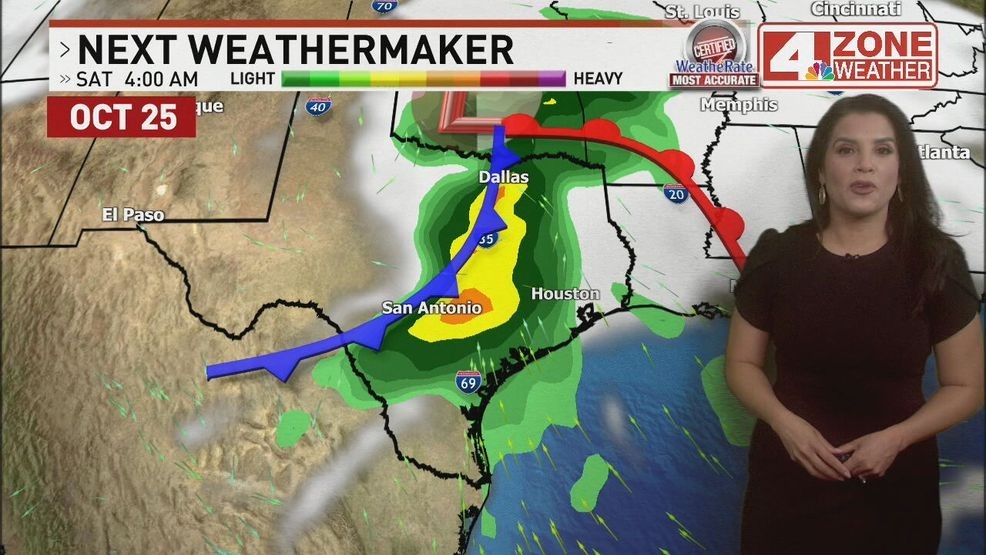
Currently, the storm system is off the coast of California but is expected to move across the desert southwest and into the South Central Plains. This system will drag a cold front through the region, which will first bring drier, more comfortable air today. Skies will be mostly cloudy in the morning, with possible patchy fog early, but sunshine will return in the afternoon as humidity drops.
CLICK HERE for interactive radar
Highs today will reach the upper 80s, slightly cooler than yesterday.
Thursday will see continued warm temperatures near 90 degrees, with increasing humidity ahead of the approaching front. A few isolated showers may develop along the coast or farther south, but most areas will remain dry.
Friday marks the real change: Scattered showers are possible during the day, but the main rain event arrives Friday night, accompanied by thunderstorms in some locations. Rain chances linger into early Saturday, tapering off by midday.
Cooler, drier conditions follow on Saturday and Sunday, with highs returning to the upper 80s and lows in the mid-60s.
Residents should plan for wet conditions late Friday into Saturday, particularly in the Hill Country and western zones, where rain could be heavier. After that, the weekend looks mostly dry and more comfortable.