
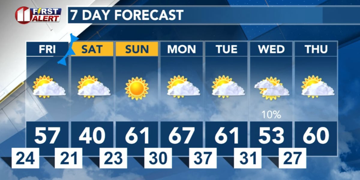
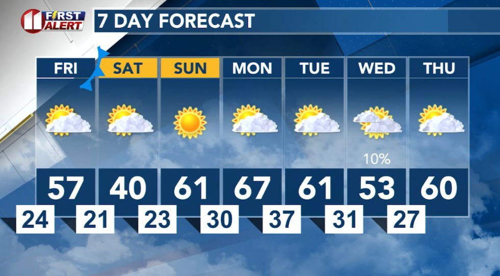
LUBBOCK, Texas (KCBD) – Mild weather will create pleasant conditions Friday afternoon across the KCBD/FOX34 viewing area. Don’t get comfortable just yet, a cold front will bring a significant temperature drop to the South Plains Friday night and Saturday morning.
Colder Tonight
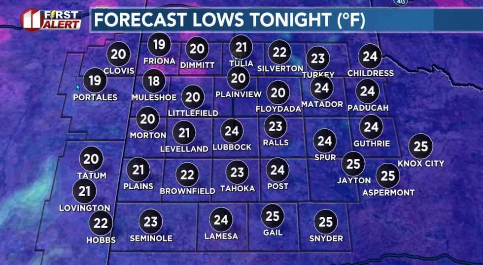
With just a few clouds, and a light northerly wind, tonight will get a little colder. Of course, it could go without saying, with temperatures below freezing any remaining moisture is likely to freeze overnight.
 Colder tonight!(KCBD First Alert)
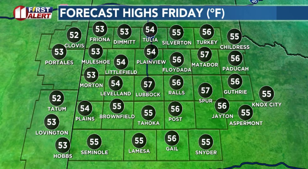
Friday begins quite cold and mostly cloudy.
Mild Afternoon
By Friday afternoon our weather will be pleasant.
 A cold morning but a pleasant afternoon.(KCBD First Alert)
A mostly sunny sky, a light wind, and highs again in the 50s. It should be a nice time to be outside.
Cold Returns
The next cold front arrives Friday night. Behind the front winds will shift to the north and become quite gusty. Temperatures will plummet into the teens and 20s — well below freezing. Wind chills in the single digits are possible.
Skies will become cloudy overnight Friday. As the clouds fill in there may be some very light freezing drizzle and/or a few flurries. At this time, I don’t expect any accumulating snow or ice on area roads. It will not be a repeat of last weekend!
 There is a very slight chance of very light freezing drizzle and flurries early Saturday.(KCBD First Alert)
It is, however, a good idea to keep up with our latest forecasts.
The clouds are anticipated to begin breaking up Saturday afternoon. If they do, some of us may get just above 40 degrees. If they don’t, then highs won’t get out of the 30s.
Reminders
– Shelter pets and livestock Friday night
– Protect sensitive plants (if they’ve survived this far!)
– Dress in layers if you will be outside Saturday morning
– Check on your elderly neighbors
Looking Ahead
The cold snap is short-lived. By Sunday, temperatures rebound into the mid-50s to near 60 degrees under a sunny sky.
 Much milder temperatures ahead, except for Saturday!(KCBD First Alert)
The warming trend continues early next week with highs climbing into the 60s Monday.
Next Cool Down
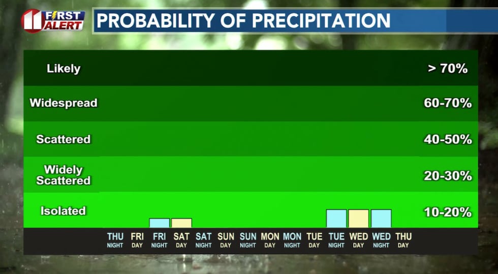
We have a slight chance of showers late Tuesday night into Wednesday, but the chance at this time is slight. Temperatures will cool slightly Tuesday and then a little more Wednesday as the next weather system moves through.
On This Date
On this date in 1999, an intense winter storm severely impacted the northwestern South Plains. Over a foot of snow fell across parts of Parmer and Bailey Counties, where drifts were as deep as 6 feet and major highways were closed for hours. Five to seven inches of snow fell in Castro, Swisher, Lamb, and Cochran Counties.
Some of these same areas received significant accumulations of freezing rain. The combined weight of ice and snow snapped numerous trees, tree limbs, and utility poles, causing many thousands of power outages (some for more than two days). In Swisher County alone, approximately 700 power poles were snapped or brought down due to the weight of the ice and snow.
(Source: National Weather Service, Lubbock)
Copyright 2026 KCBD. All rights reserved.