
SAN ANTONIO – After more than 40 days with no significant rain in our region, the opportunity to finally see welcome rain is trending nicely for much of our area.
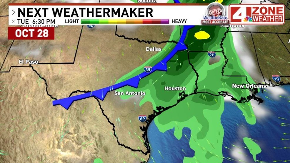
Big upper low off the coast of California is ready to eject east around a ridge of high pressure and take a track across Texas. This upper level trough will have good dynamics to provide lift for showers and storms combined with healthy moisture levels pumping into our region.
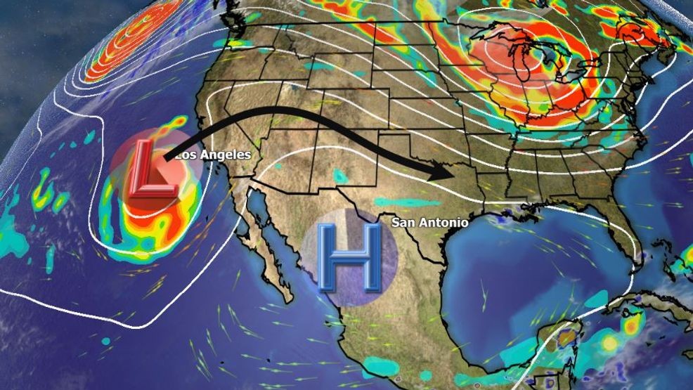
500mb flow pattern.{ } Big upper low off California is our “Next Weathermaker”
There will also be some instability building ahead of the system which could support a few strong storms in our viewing area as well. At this time, the Storm Prediction Center does not have a severe storm outlook in our area but that could change in future updates. I wouldn’t be surprised to eventually see a “marginal” severe storm outlook in our area.
During the day Friday, there will only be an isolated 20% chance of a shower or storm in humid flow off the Gulf. Our eastern zone counties will have a scattered 30% chance of showers or a thunderstorm.
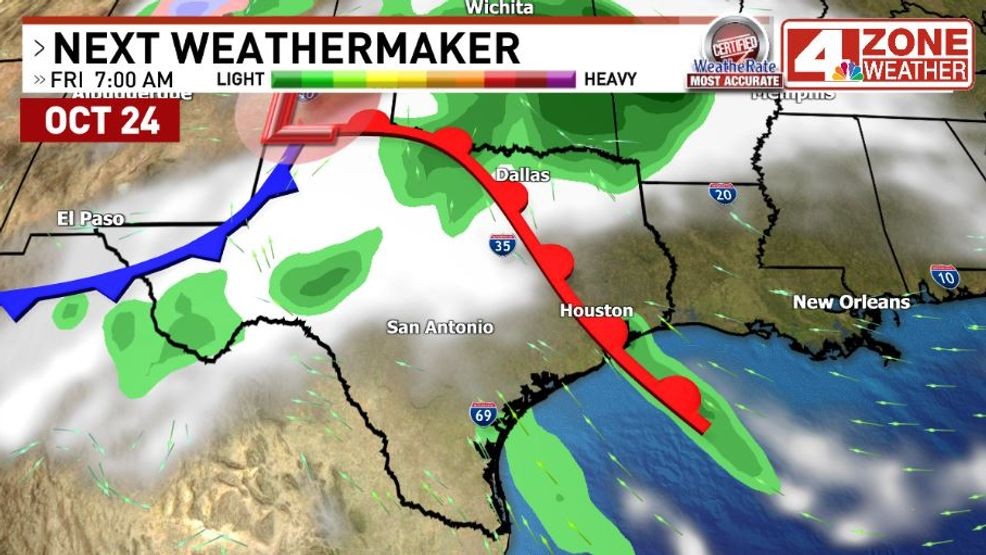
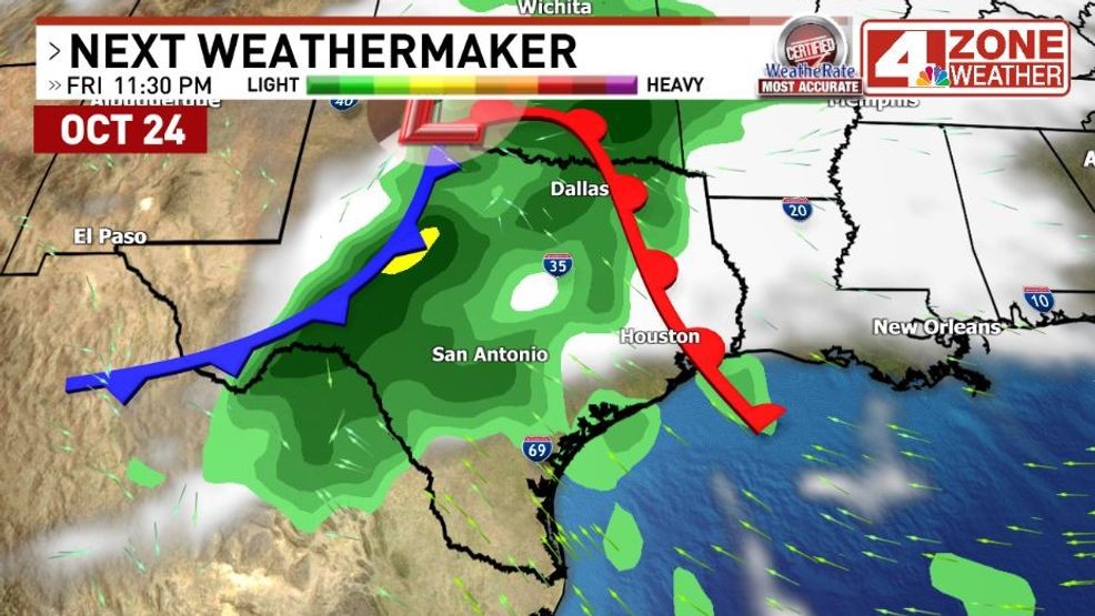
Future radar Friday morning
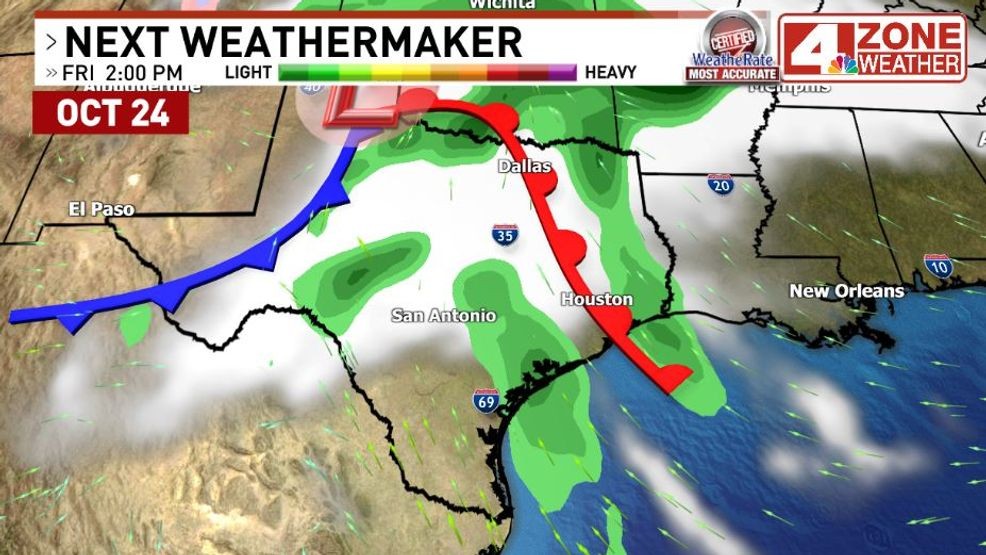
Future radar Friday afternoon
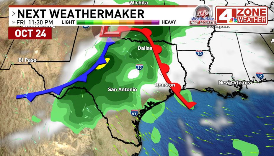
By Friday evening, we’ll start to see showers and thunderstorms develop out west closer to the stronger dynamics starting to move in. As this upper level trough slowly moves east, it will drag this region of showers and storms with it into the I-35 corridor from San Antonio to Dallas. A fairly widespread rain with storms is likely in this scenario.
Future radar Friday late evening
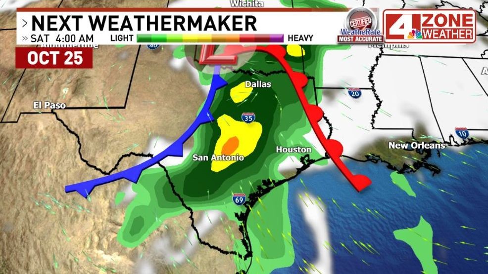
Future radar Friday night to early Saturday
It is worth pointing out, the further south you are in our viewing area, the lower the rain chance will be. Chances really drop off if you’re south of the San Antonio viewing area from Laredo to Brownsville.
As for the weekend, we’ll start cloudy with some patches of rain still in the area including thunder. The highest rain chance in the afternoon will be in the eastern half of our area while areas of sunshine pop out in the western half of the area. San Antonio will be in the transition area with some late afternoon breaks of sun possible and a lower 20% rain chance later in the afternoon.
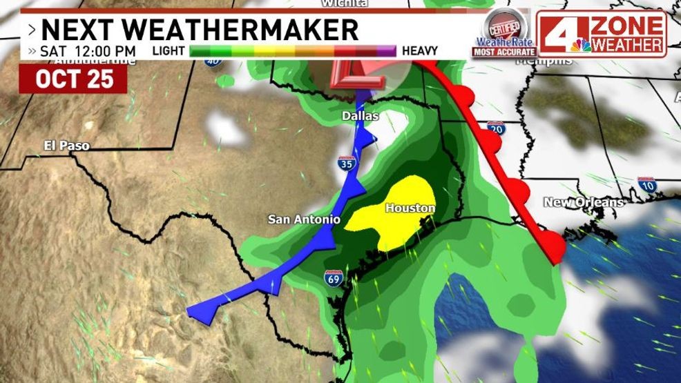
Future radar Saturday early afternoon
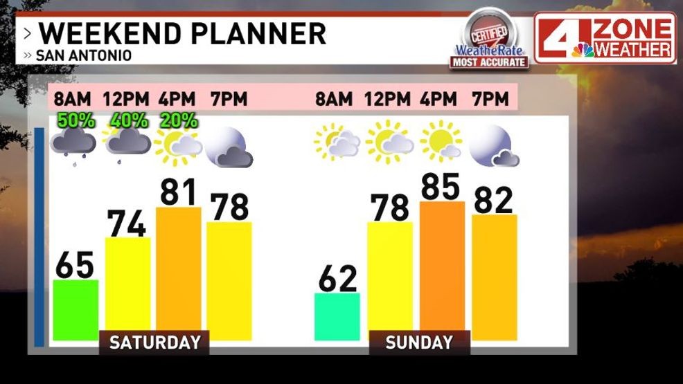
Weekend planner
Rainfall amounts many days out, a general .50″ – 1.50″+ is my expectation. This is pretty close to NOAA’s Weather Prediction Center (WPC) too. A comparison of the two global models show a wide range with the GFS suggesting localized flooding issues. It’s worth noting and keeping an eye on those trends but for now, I prefer a more conservative forecast range.
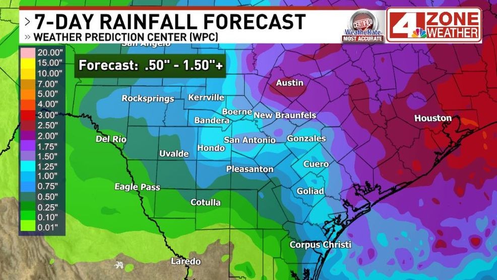
Rainfall forecast from NOAA’s WPC.{ } I expect .50″ – 1.50″+ rainfall range
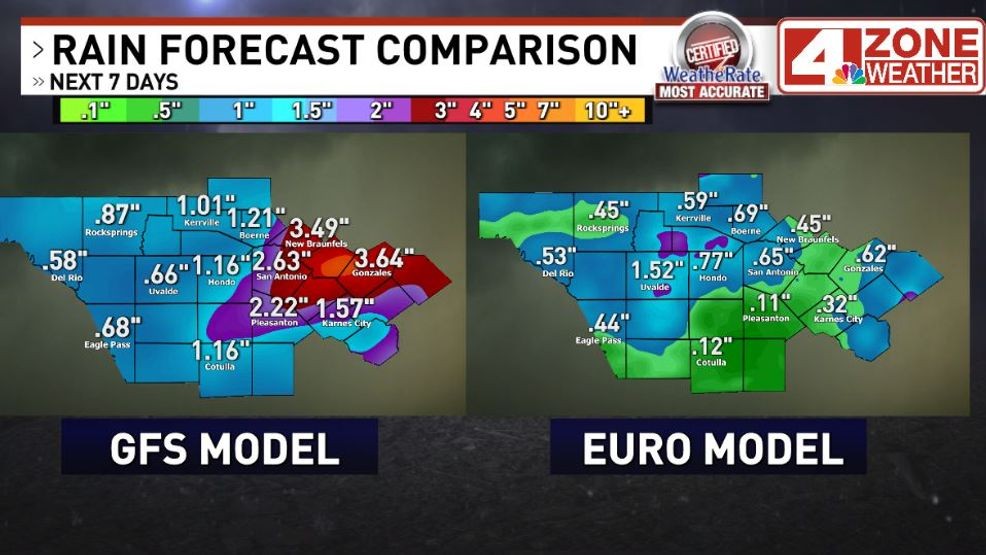
Global model rainfall comparison
Last but not least, the first strong cold front of the season is ahead next week. Not a front that will bring our first freeze to the region but a light jacket in the morning to short sleeves afternoon kind of air mass.
Cold front moving in later next Tuesday
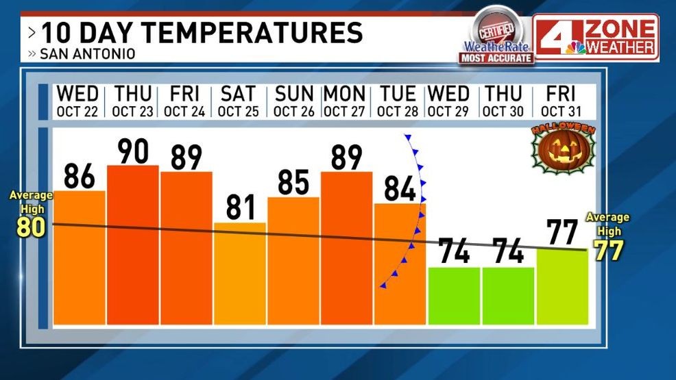
10-day Temperature forecast compared to average