
Consider the abundant sunshine Thursday across Southeast Texas and the Houston metro area as Mother Nature’s way of celebrating National Weatherperson’s Day on Feb. 5.
Whether you’re a degree-holding meteorologist or just enjoy geeking out over weather, Thursday is the day to celebrate the weather nerd in your life. Aside from a morning chill, the big weather headline through the upcoming weekend focuses on rising temperatures and the eventual return of storms.
Warming up after Thursday
Thursday morning’s lows in the 30s to lower 40s will be Southeast Texas’s coolest start for at least the next seven to 10 days.
TEXAS WINTER: While Houston has had some cold weeks lately, the winter as a whole is running warm. What role does La Niña play?
Despite the cool start, the afternoon should see temperatures peak somewhere between 63 and 66 degrees, which is right around to slightly below normal. Thursday’s cooler weather is courtesy of a light northwesterly wind.
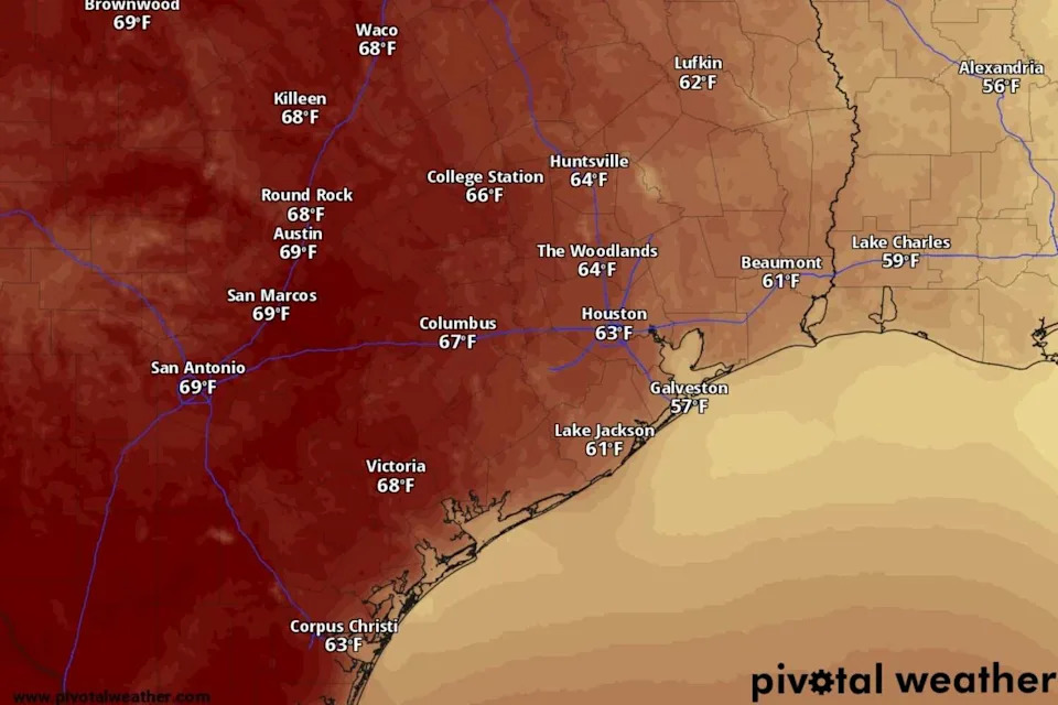
Temperatures in Southeast Texas should reach into the mid-60s Thursday, according to the National Blend of Models, a composite weather forecast model. (National Blend of Models/Pivotal Weather)
After Thursday, the focus shifts back to warm and dry weather. We’ll see daytime temps reaching the 70s Friday, with afternoon temperatures likely to peak in the upper 70s through early next week.
What about mornings? Temperatures each day should start near 50 degrees, eventually warming towards 60 degrees.
Storms return next week
Plenty of details have yet to be worked out between now and next week’s unsettled weather pattern, but a more active storm forecast looks likely.
For now, the early part of next week could bring only isolated chances of a shower or storm Tuesday into Wednesday. A cold front late in the week could bring higher chances of rain and storms to the Houston area.
{ “__type”: “devHubFreeformEmbed”, “__id”: “Datawrapper”, “__fallbackImage”: “https://datawrapper.dwcdn.net/2Yvyj/mobile.png”, “__data”: { “datawrapper_id”: “2Yvyj” } }
This time of year, as we witnessed Tuesday afternoon, can still produce a few strong storms. We could see similar activity next week, especially after Wednesday. The exact timing and potential hazards remain unknown, so just make a mental note that spring-like storms could return next week.
How Feb. 5 became National Weatherperson’s Day
The observance of National Weatherperson’s Day recognizes nearly 10,000 people nationwide who work around the clock to monitor the atmosphere and warn the public of hazardous weather.
The date marks the birthday of John Jeffries, born in 1744, who was one of America’s earliest weather observers. Jeffries began taking daily weather measurements in Boston in 1774 and later conducted the first known balloon-based weather observations, which helped lay the groundwork for modern meteorology.
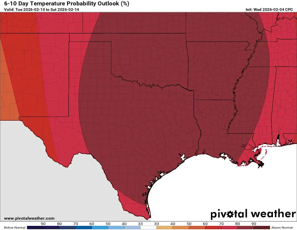
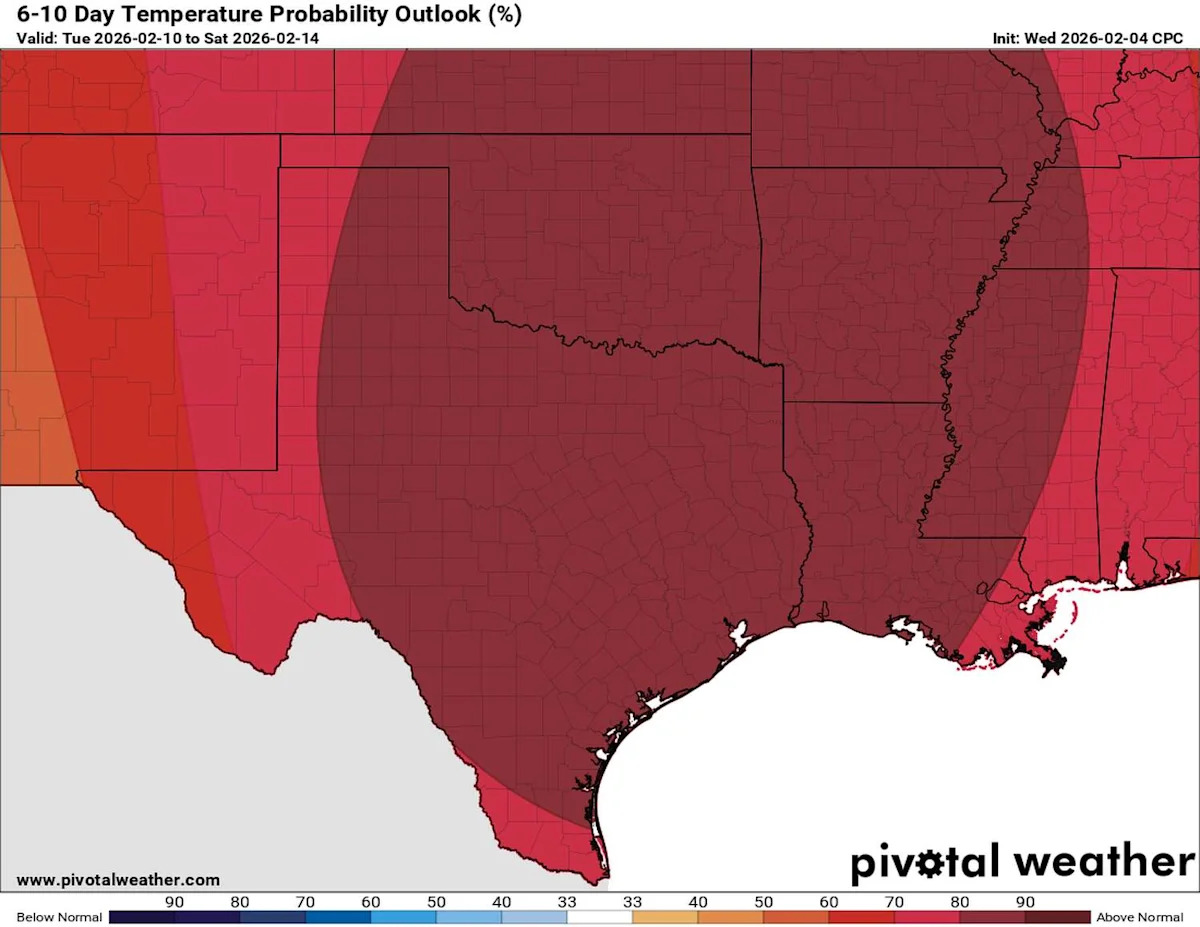
This map of Texas shows where the Climate Prediction Center expects above-normal warmth to be found through Feb. 14. (Climate Prediction Center / Pivotal Weather)
Today’s forecasts may be instantly available on phones and televisions, but they are the result of continuous work by meteorologists, hydrologists, technicians and weather broadcasters. The National Weather Service leads that effort, supported by volunteer observers, trained storm spotters, commercial weather companies and television meteorologists.
National Weatherperson’s Day is a reminder that every forecast reflects a coordinated effort focused on keeping communities informed and safe.
This article originally published at Sunshine, warming Houston weather this week. What’s happening to winter in February?.