
October’s nearly over, but it has yet to really feel like fall so far. This month in Houston is nearly tied for the most 90-degree days ever recorded in October, a record set just last year, when city temperatures hit at least 90 degrees on 18 days.
However, a weak cold front is approaching Southeast Texas on Tuesday, promising a slightly cooler weather pattern by Wednesday.
OCTOBER HEAT EXPLAINED: Why has October been so warm in Texas? Blame the omega block for keeping Houston sweating.
Before that cooler air arrives, though, we still have one more round of above-normal heat to get through.
Tuesday: Heat ahead of cold front
You likely didn’t notice a cold front was nearby when you stepped outside Tuesday morning. The day’s temperatures started near 70 degrees, which is nearly 15 degrees above normal for mornings in late October, and much warmer than the lower 60s we enjoyed Monday morning.
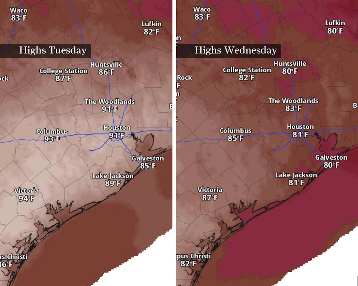
Stout southeasterly winds ahead of Tuesday’s cold front will help bump afternoon temperatures toward the lower 90s near and south of Interstate 10. Temperatures north of I-10 could stay just below 90 degrees, with the mildest temperatures near Huntsville, where highs may only reach the mid-80s.
Tuesday’s cold front arrives late Tuesday, likely after sunset in Houston and Galveston. It might spur a brief shower or downpour as it passes by, with the highest chance likely near and south of I-10. Any storm that does form could put down briefly heavy rain and the occasional rumble of thunder.
Wednesday: Briefly cooler
Behind Tuesday’s front, temperatures will certainly feel as fall-appropriate as they’ve felt since October started three weeks ago.
Dry air likely won’t reach Houston until Wednesday afternoon. This means the morning hours might still have residual mugginess as temperatures start in the middle and upper 60s. Northerly winds will finally shove drier air into the region by Wednesday afternoon, sending humidity tumbling. Temps will top out only into the lower 80s.
TEXAS HEAT TRACKER: How hot is this week’s forecast where you live? Find out with the Chronicle’s interactive tracker.
Late week: Heat, showers return
More relief from above-normal heat could come late in the week as clouds and showers return. The tradeoff to this, however, is higher levels of humidity.
{ “__type”: “devHubFreeformEmbed”, “__id”: “Datawrapper”, “__fallbackImage”: “https://datawrapper.dwcdn.net/aR3vg/mobile.png”, “__data”: { “datawrapper_id”: “aR3vg” } }
Houston’s rain odds come from yet another weak cold front that could take its own sweet time getting here. Winds from the Gulf of Mexico will bring at least isolated rain chances to Southeast Texas by Friday, with a 30% to 40% chance of storms into the weekend. A potentially more active pattern later this week could bring beneficial rain, something that hasn’t been October’s calling card so far.
Stay tuned to future Houston Chronicle forecasts as we get closer to the weekend for details on rainfall timing and amounts.
This article originally published at Another cold front arrives in Houston on Tuesday. Here’s how far temperatures could drop.