Multiple Pacific systems will bring rain chances across Texas this week. Significant rains may miss Austin.
AUSTIN, Texas — Despite a few cold spells and a touch of wintry precipitation this winter, Central Texas has been quite dry and warm. This week’s forecast keeps above-average temperatures intact, but brings rain chances back to the region.
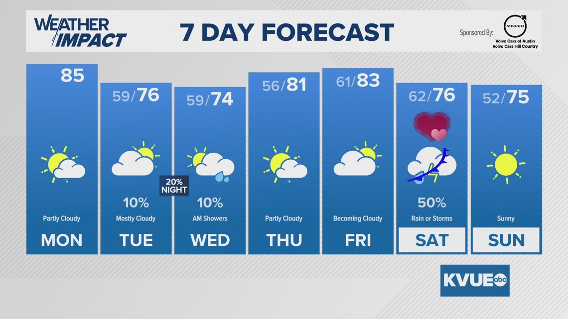
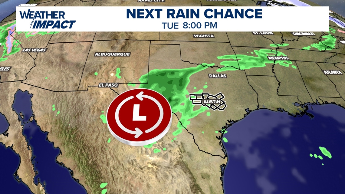
Our first chance for rainfall comes Tuesday into Wednesday. The majority of Austinites will not see significant, or even noticeable, rainfall from the early-week event.

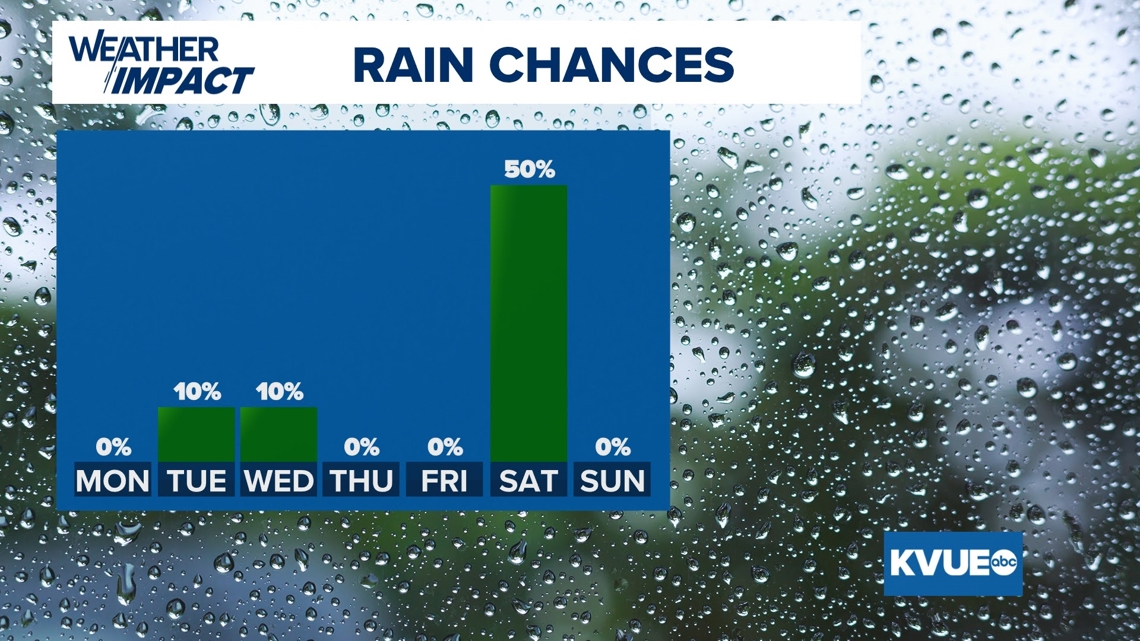
A Pacific low will inch into southwest Texas on Tuesday evening and pass over Central Texas on Tuesday night through early Wednesday. This will bring widespread cloud cover over Austin, with a 10-20% chance for light shower activity also. Rainfall totals will be minuscule at best, between .01-.10 of an inch.
The clouds and light shower possibilities will block a lot of daytime heating on Tuesday and Wednesday, so expect high temperatures to stay in the 70s and overnight lows to track towards the upper 50s and lower 60s.

As that system lifts east on Wednesday evening, sunshine and heat will return for Thursday and Friday, with highs in the 80s. However, this will be short-lived as another Pacific low works in from the desert Southwest for Saturday.
As of Monday afternoon, the time frame for our second rainfall event looks like it will last from Saturday morning through Saturday evening and push into the Gulf by Sunday. This front will offer up more moisture, leading to another 10th- to half-inch of rain possible for Central Texas.

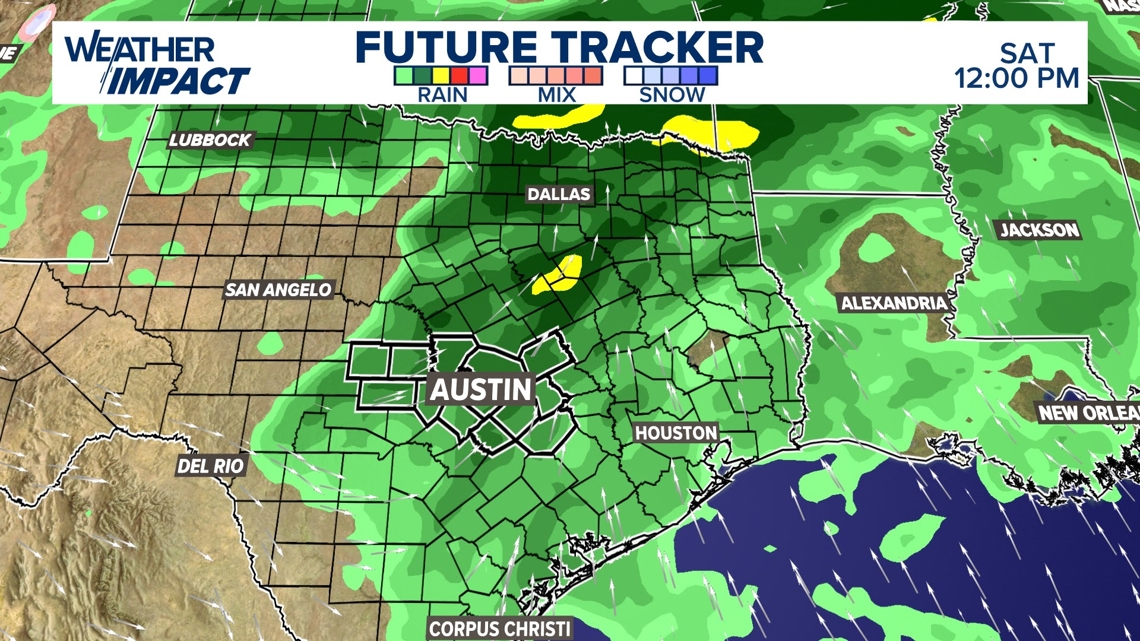
This setup could also offer up the possibility of stronger storms, but severe weather forecasting five days out is not reliable. More details on flooding, wind and hail risks will be available towards the end of the workweek. Take note, Saturday is Valentine’s Day, so if you have outdoor plans in the works, make sure you are planning your date night or date day accordingly.
This will be a lopsided rain for Texas, with most of the moisture favoring regions from the Panhandle down through Dallas and Houston.

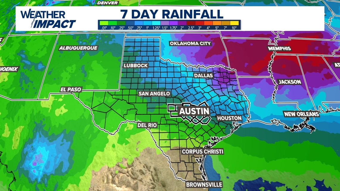
Zooming into Central Texas, our northeastern counties could see isolated totals up to an inch this week, but the majority of neighborhoods will record less than a quarter inch. While this won’t be drought-busting rain, it will benefit our soils and waterways as we move through February.


Below is the current seven-day forecast: